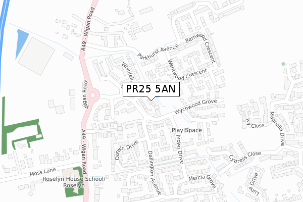
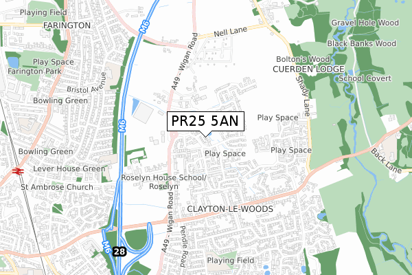
PR25 5AN is located in the Clayton West & Cuerden electoral ward, within the local authority district of Chorley and the English Parliamentary constituency of Chorley. The Sub Integrated Care Board (ICB) Location is NHS Lancashire and South Cumbria ICB - 00X and the police force is Lancashire. This postcode has been in use since November 2017.


GetTheData
Source: OS Open Zoomstack (Ordnance Survey)
Licence: Open Government Licence (requires attribution)
Attribution: Contains OS data © Crown copyright and database right 2025
Source: Open Postcode Geo
Licence: Open Government Licence (requires attribution)
Attribution: Contains OS data © Crown copyright and database right 2025; Contains Royal Mail data © Royal Mail copyright and database right 2025; Source: Office for National Statistics licensed under the Open Government Licence v.3.0
| Easting | 355882 |
| Northing | 422932 |
| Latitude | 53.700963 |
| Longitude | -2.669726 |
GetTheData
Source: Open Postcode Geo
Licence: Open Government Licence
| Country | England |
| Postcode District | PR25 |
➜ See where PR25 is on a map ➜ Where is Leyland? | |
GetTheData
Source: Land Registry Price Paid Data
Licence: Open Government Licence
| Ward | Clayton West & Cuerden |
| Constituency | Chorley |
GetTheData
Source: ONS Postcode Database
Licence: Open Government Licence
2021 12 FEB £295,000 |
14, GISBURN COURT, LEYLAND, PR25 5AN 2018 4 MAY £324,995 |
13, GISBURN COURT, LEYLAND, PR25 5AN 2018 27 APR £345,895 |
5, GISBURN COURT, LEYLAND, PR25 5AN 2018 6 APR £362,895 |
6, GISBURN COURT, LEYLAND, PR25 5AN 2018 23 FEB £315,995 |
7, GISBURN COURT, LEYLAND, PR25 5AN 2017 18 DEC £315,995 |
12, GISBURN COURT, LEYLAND, PR25 5AN 2017 15 DEC £321,895 |
10, GISBURN COURT, LEYLAND, PR25 5AN 2017 15 DEC £295,895 |
2017 15 DEC £289,995 |
8, GISBURN COURT, LEYLAND, PR25 5AN 2017 8 DEC £252,995 |
GetTheData
Source: HM Land Registry Price Paid Data
Licence: Contains HM Land Registry data © Crown copyright and database right 2025. This data is licensed under the Open Government Licence v3.0.
| Wychwood Grove (Wigan Road) | Clayton-le-woods | 221m |
| Wychwood Grove (Wigan Road) | Clayton-le-woods | 232m |
| Green Bank Farm (Wigan Road) | Clayton-le-woods | 316m |
| Green Bank Farm (Wigan Road) | Clayton-le-woods | 333m |
| Woodsman (Wigan Road) | Clayton-le-woods | 452m |
| Leyland Station | 1.2km |
| Lostock Hall Station | 2.8km |
| Bamber Bridge Station | 2.9km |
GetTheData
Source: NaPTAN
Licence: Open Government Licence
| Percentage of properties with Next Generation Access | 100.0% |
| Percentage of properties with Superfast Broadband | 100.0% |
| Percentage of properties with Ultrafast Broadband | 100.0% |
| Percentage of properties with Full Fibre Broadband | 100.0% |
Superfast Broadband is between 30Mbps and 300Mbps
Ultrafast Broadband is > 300Mbps
| Median download speed | 75.0Mbps |
| Average download speed | 141.5Mbps |
| Maximum download speed | 350.00Mbps |
| Median upload speed | 1.0Mbps |
| Average upload speed | 0.9Mbps |
| Maximum upload speed | 1.00Mbps |
| Percentage of properties unable to receive 2Mbps | 0.0% |
| Percentage of properties unable to receive 5Mbps | 0.0% |
| Percentage of properties unable to receive 10Mbps | 0.0% |
| Percentage of properties unable to receive 30Mbps | 0.0% |
GetTheData
Source: Ofcom
Licence: Ofcom Terms of Use (requires attribution)
GetTheData
Source: ONS Postcode Database
Licence: Open Government Licence


➜ Get more ratings from the Food Standards Agency
GetTheData
Source: Food Standards Agency
Licence: FSA terms & conditions
| Last Collection | |||
|---|---|---|---|
| Location | Mon-Fri | Sat | Distance |
| Lancaster Lane | 17:30 | 12:30 | 484m |
| 43 Stanfield Lane, Farington | 17:00 | 11:30 | 978m |
| 2 Stanley Road, Farington | 17:15 | 11:30 | 1,071m |
GetTheData
Source: Dracos
Licence: Creative Commons Attribution-ShareAlike
The below table lists the International Territorial Level (ITL) codes (formerly Nomenclature of Territorial Units for Statistics (NUTS) codes) and Local Administrative Units (LAU) codes for PR25 5AN:
| ITL 1 Code | Name |
|---|---|
| TLD | North West (England) |
| ITL 2 Code | Name |
| TLD4 | Lancashire |
| ITL 3 Code | Name |
| TLD47 | Chorley and West Lancashire |
| LAU 1 Code | Name |
| E07000118 | Chorley |
GetTheData
Source: ONS Postcode Directory
Licence: Open Government Licence
The below table lists the Census Output Area (OA), Lower Layer Super Output Area (LSOA), and Middle Layer Super Output Area (MSOA) for PR25 5AN:
| Code | Name | |
|---|---|---|
| OA | E00126673 | |
| LSOA | E01024957 | Chorley 003E |
| MSOA | E02005191 | Chorley 003 |
GetTheData
Source: ONS Postcode Directory
Licence: Open Government Licence
| PR25 5AB | Kielder Gardens | 121m |
| PR25 5AL | Whinfell Close | 153m |
| PR25 5AJ | Mortimer Place | 164m |
| PR25 5AP | Darwin Drive | 191m |
| PR25 5AG | Dallington Avenue | 199m |
| PR25 5AH | Dallington Avenue | 200m |
| PR25 5SB | Wigan Road | 323m |
| PR25 5SG | Ivy Close | 326m |
| PR25 5PF | Parkhurst Avenue | 329m |
| PR25 5TY | Cypress Close | 333m |
GetTheData
Source: Open Postcode Geo; Land Registry Price Paid Data
Licence: Open Government Licence