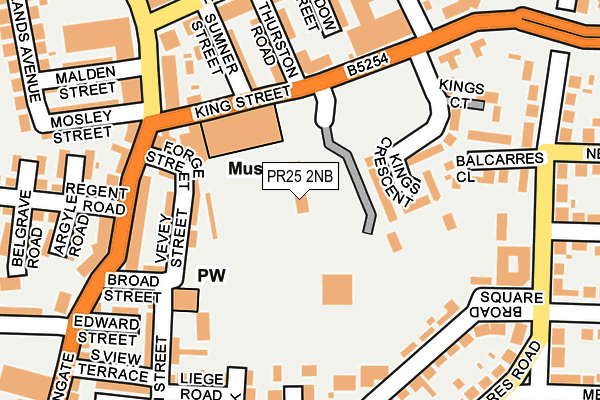
PR25 2NB is located in the Leyland Central electoral ward, within the local authority district of South Ribble and the English Parliamentary constituency of South Ribble. The Sub Integrated Care Board (ICB) Location is NHS Lancashire and South Cumbria ICB - 00X and the police force is Lancashire. This postcode has been in use since March 2009.


GetTheData
Source: OS OpenMap – Local (Ordnance Survey)
Source: OS VectorMap District (Ordnance Survey)
Licence: Open Government Licence (requires attribution)
| Easting | 354323 |
| Northing | 421973 |
| Latitude | 53.692210 |
| Longitude | -2.693197 |
GetTheData
Source: Open Postcode Geo
Licence: Open Government Licence
| Country | England |
| Postcode District | PR25 |
➜ See where PR25 is on a map ➜ Where is Leyland? | |
GetTheData
Source: Land Registry Price Paid Data
Licence: Open Government Licence
Elevation or altitude of PR25 2NB as distance above sea level:
| Metres | Feet | |
|---|---|---|
| Elevation | 40m | 131ft |
Elevation is measured from the approximate centre of the postcode, to the nearest point on an OS contour line from OS Terrain 50, which has contour spacing of ten vertical metres.
➜ How high above sea level am I? Find the elevation of your current position using your device's GPS.
GetTheData
Source: Open Postcode Elevation
Licence: Open Government Licence
| Ward | Leyland Central |
| Constituency | South Ribble |
GetTheData
Source: ONS Postcode Database
Licence: Open Government Licence
| King Street (Towngate) | Leyland Town Centre | 271m |
| Tesco (St Andrews Way) | Towngate | 274m |
| Job Centre (Towngate) | Towngate | 284m |
| Job Centre (Towngate) | Towngate | 294m |
| Tesco (St Andrews Way) | Towngate | 296m |
| Leyland Station | 0.8km |
| Buckshaw Parkway Station | 3km |
| Lostock Hall Station | 3.6km |
GetTheData
Source: NaPTAN
Licence: Open Government Licence
GetTheData
Source: ONS Postcode Database
Licence: Open Government Licence


➜ Get more ratings from the Food Standards Agency
GetTheData
Source: Food Standards Agency
Licence: FSA terms & conditions
| Last Collection | |||
|---|---|---|---|
| Location | Mon-Fri | Sat | Distance |
| 74 Balcarres Road | 17:30 | 12:30 | 210m |
| Hough Lane (Kwik Save) | 17:30 | 12:30 | 338m |
| Leyland Post Office | 18:00 | 12:30 | 355m |
GetTheData
Source: Dracos
Licence: Creative Commons Attribution-ShareAlike
The below table lists the International Territorial Level (ITL) codes (formerly Nomenclature of Territorial Units for Statistics (NUTS) codes) and Local Administrative Units (LAU) codes for PR25 2NB:
| ITL 1 Code | Name |
|---|---|
| TLD | North West (England) |
| ITL 2 Code | Name |
| TLD4 | Lancashire |
| ITL 3 Code | Name |
| TLD45 | Mid Lancashire |
| LAU 1 Code | Name |
| E07000126 | South Ribble |
GetTheData
Source: ONS Postcode Directory
Licence: Open Government Licence
The below table lists the Census Output Area (OA), Lower Layer Super Output Area (LSOA), and Middle Layer Super Output Area (MSOA) for PR25 2NB:
| Code | Name | |
|---|---|---|
| OA | E00129064 | |
| LSOA | E01025430 | South Ribble 016A |
| MSOA | E02005302 | South Ribble 016 |
GetTheData
Source: ONS Postcode Directory
Licence: Open Government Licence
| PR25 2EE | Sandy Lane | 121m |
| PR25 2EH | Pembroke Place | 137m |
| PR25 2SG | Kings Crescent | 146m |
| PR25 2EA | Broad Square | 152m |
| PR25 2ES | Liege Road | 156m |
| PR25 2ED | Sandy Lane | 156m |
| PR25 2FE | Sandy Place | 161m |
| PR25 2FS | Haydock Avenue | 167m |
| PR25 2EJ | Balcarres Road | 175m |
| PR25 2EU | Vevey Street | 185m |
GetTheData
Source: Open Postcode Geo; Land Registry Price Paid Data
Licence: Open Government Licence