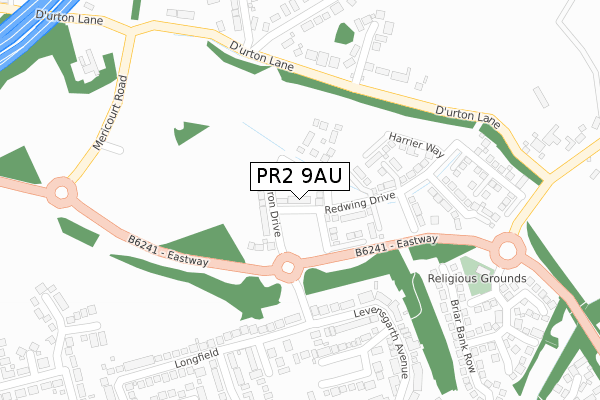
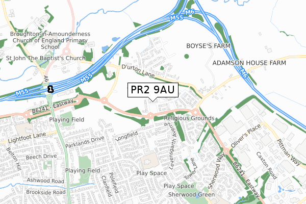
PR2 9AU is located in the Preston Rural East electoral ward, within the local authority district of Preston and the English Parliamentary constituency of Wyre and Preston North. The Sub Integrated Care Board (ICB) Location is NHS Lancashire and South Cumbria ICB - 01E and the police force is Lancashire. This postcode has been in use since December 2019.


GetTheData
Source: OS Open Zoomstack (Ordnance Survey)
Licence: Open Government Licence (requires attribution)
Attribution: Contains OS data © Crown copyright and database right 2025
Source: Open Postcode Geo
Licence: Open Government Licence (requires attribution)
Attribution: Contains OS data © Crown copyright and database right 2025; Contains Royal Mail data © Royal Mail copyright and database right 2025; Source: Office for National Statistics licensed under the Open Government Licence v.3.0
| Easting | 353820 |
| Northing | 434098 |
| Latitude | 53.801136 |
| Longitude | -2.702631 |
GetTheData
Source: Open Postcode Geo
Licence: Open Government Licence
| Country | England |
| Postcode District | PR2 |
➜ See where PR2 is on a map ➜ Where is Broughton? | |
GetTheData
Source: Land Registry Price Paid Data
Licence: Open Government Licence
| Ward | Preston Rural East |
| Constituency | Wyre And Preston North |
GetTheData
Source: ONS Postcode Database
Licence: Open Government Licence
52, HARRIER WAY, FULWOOD, PRESTON, PR2 9AU 2022 1 APR £506,995 |
50, HARRIER WAY, FULWOOD, PRESTON, PR2 9AU 2022 31 MAR £444,995 |
48, HARRIER WAY, FULWOOD, PRESTON, PR2 9AU 2022 25 FEB £412,995 |
46, HARRIER WAY, FULWOOD, PRESTON, PR2 9AU 2022 18 FEB £467,995 |
42, HARRIER WAY, FULWOOD, PRESTON, PR2 9AU 2022 28 JAN £505,995 |
44, HARRIER WAY, FULWOOD, PRESTON, PR2 9AU 2022 28 JAN £399,995 |
40, HARRIER WAY, FULWOOD, PRESTON, PR2 9AU 2021 16 DEC £499,995 |
38, HARRIER WAY, FULWOOD, PRESTON, PR2 9AU 2021 16 DEC £514,995 |
36, HARRIER WAY, FULWOOD, PRESTON, PR2 9AU 2021 16 DEC £463,995 |
32, HARRIER WAY, FULWOOD, PRESTON, PR2 9AU 2021 19 NOV £424,995 |
GetTheData
Source: HM Land Registry Price Paid Data
Licence: Contains HM Land Registry data © Crown copyright and database right 2025. This data is licensed under the Open Government Licence v3.0.
| Ashness Close (Levensgarth Avenue) | Sherwood | 427m |
| Ashness Close (Levensgarth Avenue) | Sherwood | 459m |
| Moorfield Avenue (Broadwood Drive) | Sharoe Green | 717m |
| Hellifield (Broadwood Drive) | Sharoe Green | 728m |
| Broadwood Drive | Sharoe Green | 730m |
| Preston Station | 4.9km |
GetTheData
Source: NaPTAN
Licence: Open Government Licence
GetTheData
Source: ONS Postcode Database
Licence: Open Government Licence


➜ Get more ratings from the Food Standards Agency
GetTheData
Source: Food Standards Agency
Licence: FSA terms & conditions
| Last Collection | |||
|---|---|---|---|
| Location | Mon-Fri | Sat | Distance |
| Durton Lane, Warwick House | 17:00 | 10:00 | 205m |
| Levensgarth Avenue | 17:30 | 11:30 | 321m |
| Olivers Place | 18:15 | 11:30 | 815m |
GetTheData
Source: Dracos
Licence: Creative Commons Attribution-ShareAlike
The below table lists the International Territorial Level (ITL) codes (formerly Nomenclature of Territorial Units for Statistics (NUTS) codes) and Local Administrative Units (LAU) codes for PR2 9AU:
| ITL 1 Code | Name |
|---|---|
| TLD | North West (England) |
| ITL 2 Code | Name |
| TLD4 | Lancashire |
| ITL 3 Code | Name |
| TLD45 | Mid Lancashire |
| LAU 1 Code | Name |
| E07000123 | Preston |
GetTheData
Source: ONS Postcode Directory
Licence: Open Government Licence
The below table lists the Census Output Area (OA), Lower Layer Super Output Area (LSOA), and Middle Layer Super Output Area (MSOA) for PR2 9AU:
| Code | Name | |
|---|---|---|
| OA | E00128290 | |
| LSOA | E01025277 | Preston 002B |
| MSOA | E02005254 | Preston 002 |
GetTheData
Source: ONS Postcode Directory
Licence: Open Government Licence
| PR3 5LE | Durton Lane | 118m |
| PR3 5LG | St Johns Court | 148m |
| PR3 5LJ | Highrigg Drive | 221m |
| PR2 9FP | Levensgarth Avenue | 327m |
| PR2 9FE | Langport Close | 363m |
| PR2 9FU | Longfield | 375m |
| PR2 9PJ | Haywood Close | 387m |
| PR2 9PF | Briar Bank Row | 401m |
| PR2 9FN | Langfield Close | 428m |
| PR2 9PH | Broughton Tower Way | 445m |
GetTheData
Source: Open Postcode Geo; Land Registry Price Paid Data
Licence: Open Government Licence