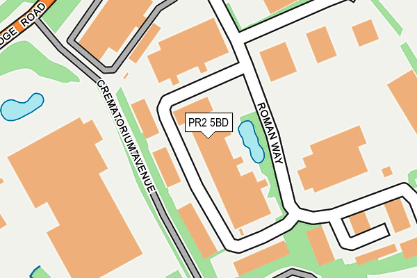
PR2 5BD is located in the Ribbleton electoral ward, within the local authority district of Preston and the English Parliamentary constituency of Preston. The Sub Integrated Care Board (ICB) Location is NHS Lancashire and South Cumbria ICB - 01E and the police force is Lancashire. This postcode has been in use since June 1981.


GetTheData
Source: OS OpenMap – Local (Ordnance Survey)
Source: OS VectorMap District (Ordnance Survey)
Licence: Open Government Licence (requires attribution)
| Easting | 358105 |
| Northing | 432565 |
| Latitude | 53.787722 |
| Longitude | -2.637368 |
GetTheData
Source: Open Postcode Geo
Licence: Open Government Licence
| Country | England |
| Postcode District | PR2 |
➜ See where PR2 is on a map ➜ Where is Preston? | |
GetTheData
Source: Land Registry Price Paid Data
Licence: Open Government Licence
Elevation or altitude of PR2 5BD as distance above sea level:
| Metres | Feet | |
|---|---|---|
| Elevation | 60m | 197ft |
Elevation is measured from the approximate centre of the postcode, to the nearest point on an OS contour line from OS Terrain 50, which has contour spacing of ten vertical metres.
➜ How high above sea level am I? Find the elevation of your current position using your device's GPS.
GetTheData
Source: Open Postcode Elevation
Licence: Open Government Licence
| Ward | Ribbleton |
| Constituency | Preston |
GetTheData
Source: ONS Postcode Database
Licence: Open Government Licence
| Crematorium (Longridge Road) | Red Scar | 304m |
| Crematorium (Longridge Road) | Red Scar | 323m |
| Roman Way (Longridge Road) | Red Scar | 407m |
| Roman Way (Longridge Road) | Red Scar | 455m |
| Roman Way Ind Est (Longridge Road) | Red Scar | 506m |
| Preston Station | 5.8km |
GetTheData
Source: NaPTAN
Licence: Open Government Licence
| Median download speed | 49.3Mbps |
| Average download speed | 47.5Mbps |
| Maximum download speed | 75.12Mbps |
| Median upload speed | 9.6Mbps |
| Average upload speed | 8.7Mbps |
| Maximum upload speed | 12.98Mbps |
GetTheData
Source: Ofcom
Licence: Ofcom Terms of Use (requires attribution)
Estimated total energy consumption in PR2 5BD by fuel type, 2015.
| Consumption (kWh) | 135,834 |
|---|---|
| Meter count | 11 |
| Mean (kWh/meter) | 12,349 |
| Median (kWh/meter) | 6,963 |
GetTheData
Source: Postcode level gas estimates: 2015 (experimental)
Source: Postcode level electricity estimates: 2015 (experimental)
Licence: Open Government Licence
GetTheData
Source: ONS Postcode Database
Licence: Open Government Licence


➜ Get more ratings from the Food Standards Agency
GetTheData
Source: Food Standards Agency
Licence: FSA terms & conditions
| Last Collection | |||
|---|---|---|---|
| Location | Mon-Fri | Sat | Distance |
| Grimsargh Post Office | 18:30 | 12:30 | 1,961m |
| Village Drive | 17:15 | 11:30 | 2,156m |
| Blackpool Road Post Office | 17:30 | 11:30 | 2,323m |
GetTheData
Source: Dracos
Licence: Creative Commons Attribution-ShareAlike
The below table lists the International Territorial Level (ITL) codes (formerly Nomenclature of Territorial Units for Statistics (NUTS) codes) and Local Administrative Units (LAU) codes for PR2 5BD:
| ITL 1 Code | Name |
|---|---|
| TLD | North West (England) |
| ITL 2 Code | Name |
| TLD4 | Lancashire |
| ITL 3 Code | Name |
| TLD45 | Mid Lancashire |
| LAU 1 Code | Name |
| E07000123 | Preston |
GetTheData
Source: ONS Postcode Directory
Licence: Open Government Licence
The below table lists the Census Output Area (OA), Lower Layer Super Output Area (LSOA), and Middle Layer Super Output Area (MSOA) for PR2 5BD:
| Code | Name | |
|---|---|---|
| OA | E00128346 | |
| LSOA | E01025286 | Preston 009E |
| MSOA | E02005261 | Preston 009 |
GetTheData
Source: ONS Postcode Directory
Licence: Open Government Licence
| PR2 5BB | Roman Way | 324m |
| PR2 5BE | Roman Way Industrial Estate | 324m |
| PR2 5AR | Rough Hey Road | 565m |
| PR2 5NN | Longridge Road | 639m |
| PR2 5BS | Jeffrey Hill Close | 711m |
| PR2 5AQ | Longridge Road | 720m |
| PR2 5BU | Peacock Hill Close | 744m |
| PR2 5BG | Pendle Hill Close | 782m |
| PR2 5BF | The Hills | 785m |
| PR2 5BJ | Winter Hill Close | 800m |
GetTheData
Source: Open Postcode Geo; Land Registry Price Paid Data
Licence: Open Government Licence