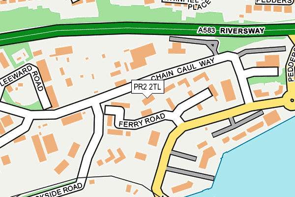
PR2 2TL is located in the Ashton electoral ward, within the local authority district of Preston and the English Parliamentary constituency of Preston. The Sub Integrated Care Board (ICB) Location is NHS Lancashire and South Cumbria ICB - 01E and the police force is Lancashire. This postcode has been in use since December 2013.


GetTheData
Source: OS OpenMap – Local (Ordnance Survey)
Source: OS VectorMap District (Ordnance Survey)
Licence: Open Government Licence (requires attribution)
| Easting | 350942 |
| Northing | 429715 |
| Latitude | 53.761466 |
| Longitude | -2.745627 |
GetTheData
Source: Open Postcode Geo
Licence: Open Government Licence
| Country | England |
| Postcode District | PR2 |
➜ See where PR2 is on a map ➜ Where is Preston? | |
GetTheData
Source: Land Registry Price Paid Data
Licence: Open Government Licence
Elevation or altitude of PR2 2TL as distance above sea level:
| Metres | Feet | |
|---|---|---|
| Elevation | 10m | 33ft |
Elevation is measured from the approximate centre of the postcode, to the nearest point on an OS contour line from OS Terrain 50, which has contour spacing of ten vertical metres.
➜ How high above sea level am I? Find the elevation of your current position using your device's GPS.
GetTheData
Source: Open Postcode Elevation
Licence: Open Government Licence
| Ward | Ashton |
| Constituency | Preston |
GetTheData
Source: ONS Postcode Database
Licence: Open Government Licence
| Chain Caul Way | Riversway | 116m |
| Chain Caul Way | Riversway | 122m |
| Business Village (Navigation Way) | Riversway | 130m |
| Business Village (Navigation Way) | Riversway | 174m |
| Leeward Road (Chaion Caul Way) | Riversway | 279m |
| Preston Station | 2.5km |
| Salwick Station | 5.2km |
| Lostock Hall Station | 5.6km |
GetTheData
Source: NaPTAN
Licence: Open Government Licence
GetTheData
Source: ONS Postcode Database
Licence: Open Government Licence


➜ Get more ratings from the Food Standards Agency
GetTheData
Source: Food Standards Agency
Licence: FSA terms & conditions
| Last Collection | |||
|---|---|---|---|
| Location | Mon-Fri | Sat | Distance |
| Navigation Way, Ashton | 17:30 | 11:30 | 111m |
| Victoria Mansions | 17:00 | 11:00 | 353m |
| Morrisons | 16:30 | 11:00 | 653m |
GetTheData
Source: Dracos
Licence: Creative Commons Attribution-ShareAlike
| Risk of PR2 2TL flooding from rivers and sea | Low |
| ➜ PR2 2TL flood map | |
GetTheData
Source: Open Flood Risk by Postcode
Licence: Open Government Licence
The below table lists the International Territorial Level (ITL) codes (formerly Nomenclature of Territorial Units for Statistics (NUTS) codes) and Local Administrative Units (LAU) codes for PR2 2TL:
| ITL 1 Code | Name |
|---|---|
| TLD | North West (England) |
| ITL 2 Code | Name |
| TLD4 | Lancashire |
| ITL 3 Code | Name |
| TLD45 | Mid Lancashire |
| LAU 1 Code | Name |
| E07000123 | Preston |
GetTheData
Source: ONS Postcode Directory
Licence: Open Government Licence
The below table lists the Census Output Area (OA), Lower Layer Super Output Area (LSOA), and Middle Layer Super Output Area (MSOA) for PR2 2TL:
| Code | Name | |
|---|---|---|
| OA | E00128368 | |
| LSOA | E01025288 | Preston 010D |
| MSOA | E02005262 | Preston 010 |
GetTheData
Source: ONS Postcode Directory
Licence: Open Government Licence
| PR2 2YP | Navigation Way | 105m |
| PR2 2YS | Lockside Office Park | 131m |
| PR2 1NR | Whinfield Place | 205m |
| PR2 1NQ | Whinfield Lane | 250m |
| PR2 2HT | Maritime Way | 313m |
| PR2 1NS | Pedders Grove | 314m |
| PR2 2GB | Princes Reach | 341m |
| PR2 1NN | Marton Road | 358m |
| PR2 1NL | Staining Avenue | 362m |
| PR2 2YL | Chain Caul Way | 390m |
GetTheData
Source: Open Postcode Geo; Land Registry Price Paid Data
Licence: Open Government Licence