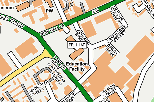
PR11 1AT is located in the Fishwick & Frenchwood electoral ward, within the local authority district of Preston and the English Parliamentary constituency of Preston. The Sub Integrated Care Board (ICB) Location is NHS Lancashire and South Cumbria ICB - 01E and the police force is Lancashire. This postcode has been in use since December 2000.


GetTheData
Source: OS OpenMap – Local (Ordnance Survey)
Source: OS VectorMap District (Ordnance Survey)
Licence: Open Government Licence (requires attribution)
| Easting | 354945 |
| Northing | 429486 |
| Latitude | 53.759770 |
| Longitude | -2.684878 |
GetTheData
Source: Open Postcode Geo
Licence: Open Government Licence
| Country | England |
| Postcode District | PR11 |
➜ Where is Preston? | |
GetTheData
Source: Land Registry Price Paid Data
Licence: Open Government Licence
Elevation or altitude of PR11 1AT as distance above sea level:
| Metres | Feet | |
|---|---|---|
| Elevation | 40m | 131ft |
Elevation is measured from the approximate centre of the postcode, to the nearest point on an OS contour line from OS Terrain 50, which has contour spacing of ten vertical metres.
➜ How high above sea level am I? Find the elevation of your current position using your device's GPS.
GetTheData
Source: Open Postcode Elevation
Licence: Open Government Licence
| Ward | Fishwick & Frenchwood |
| Constituency | Preston |
GetTheData
Source: ONS Postcode Database
Licence: Open Government Licence
| Queen Street (London Road) | Frenchwood | 74m |
| Queen Street (London Road) | Frenchwood | 105m |
| St Mary's Street (New Hall Lane) | Fishwick | 108m |
| London Road (New Hall Lane) | Fishwick | 136m |
| Centenary Mill (New Hall Lane) | Fishwick | 187m |
| Preston Station | 1.6km |
| Lostock Hall Station | 4km |
| Bamber Bridge Station | 4km |
GetTheData
Source: NaPTAN
Licence: Open Government Licence
GetTheData
Source: ONS Postcode Database
Licence: Open Government Licence


➜ Get more ratings from the Food Standards Agency
GetTheData
Source: Food Standards Agency
Licence: FSA terms & conditions
| Last Collection | |||
|---|---|---|---|
| Location | Mon-Fri | Sat | Distance |
| 1 Derby Street | 17:30 | 11:30 | 593m |
| Manchester Road | 17:30 | 11:30 | 679m |
| New Hall Lane Post Office | 17:30 | 11:30 | 704m |
GetTheData
Source: Dracos
Licence: Creative Commons Attribution-ShareAlike
The below table lists the International Territorial Level (ITL) codes (formerly Nomenclature of Territorial Units for Statistics (NUTS) codes) and Local Administrative Units (LAU) codes for PR11 1AT:
| ITL 1 Code | Name |
|---|---|
| TLD | North West (England) |
| ITL 2 Code | Name |
| TLD4 | Lancashire |
| ITL 3 Code | Name |
| TLD45 | Mid Lancashire |
| LAU 1 Code | Name |
| E07000123 | Preston |
GetTheData
Source: ONS Postcode Directory
Licence: Open Government Licence
The below table lists the Census Output Area (OA), Lower Layer Super Output Area (LSOA), and Middle Layer Super Output Area (MSOA) for PR11 1AT:
| Code | Name | |
|---|---|---|
| OA | E00128435 | |
| LSOA | E01025305 | Preston 016F |
| MSOA | E02005268 | Preston 016 |
GetTheData
Source: ONS Postcode Directory
Licence: Open Government Licence
| PR1 4DU | 103m | |
| PR1 4JH | Grosvenor Street | 115m |
| PR1 5NX | New Hall Lane | 134m |
| PR1 5NU | New Hall Lane | 137m |
| PR1 4DT | 149m | |
| PR1 4DP | New Hall Lane | 164m |
| PR1 4LQ | Mercer Street | 184m |
| PR1 4HY | 195m | |
| PR1 4JB | Ashworth Street | 213m |
| PR1 4HT | Albyn Street East | 214m |
GetTheData
Source: Open Postcode Geo; Land Registry Price Paid Data
Licence: Open Government Licence