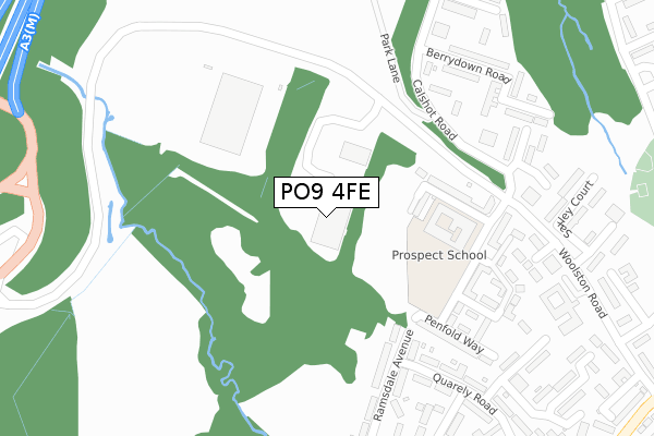
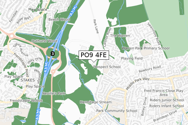
PO9 4FE is located in the Barncroft electoral ward, within the local authority district of Havant and the English Parliamentary constituency of Havant. The Sub Integrated Care Board (ICB) Location is NHS Hampshire and Isle of Wight ICB - D9Y0V and the police force is Hampshire. This postcode has been in use since October 2018.


GetTheData
Source: OS Open Zoomstack (Ordnance Survey)
Licence: Open Government Licence (requires attribution)
Attribution: Contains OS data © Crown copyright and database right 2025
Source: Open Postcode Geo
Licence: Open Government Licence (requires attribution)
Attribution: Contains OS data © Crown copyright and database right 2025; Contains Royal Mail data © Royal Mail copyright and database right 2025; Source: Office for National Statistics licensed under the Open Government Licence v.3.0
| Easting | 470119 |
| Northing | 108963 |
| Latitude | 50.875910 |
| Longitude | -1.004750 |
GetTheData
Source: Open Postcode Geo
Licence: Open Government Licence
| Country | England |
| Postcode District | PO9 |
➜ See where PO9 is on a map | |
GetTheData
Source: Land Registry Price Paid Data
Licence: Open Government Licence
| Ward | Barncroft |
| Constituency | Havant |
GetTheData
Source: ONS Postcode Database
Licence: Open Government Licence
| Larkwhistle Walk (Calshot Road) | Leigh Park | 203m |
| Southfield Walk (Calshot Road) | Leigh Park | 239m |
| Malmesbury House (Woolston Road) | Leigh Park | 454m |
| Strouden Court (Off St Clares Avenue) | Leigh Park | 491m |
| Quarely Road (Park House Farm Way) | Leigh Park | 522m |
| Bedhampton Station | 2.5km |
| Havant Station | 2.9km |
| Warblington Station | 3.6km |
GetTheData
Source: NaPTAN
Licence: Open Government Licence
GetTheData
Source: ONS Postcode Database
Licence: Open Government Licence


➜ Get more ratings from the Food Standards Agency
GetTheData
Source: Food Standards Agency
Licence: FSA terms & conditions
| Last Collection | |||
|---|---|---|---|
| Location | Mon-Fri | Sat | Distance |
| Calshott Road | 17:30 | 12:00 | 263m |
| The Warren Post Office | 17:30 | 12:00 | 512m |
| Parkhouse Farm Way | 17:50 | 12:00 | 520m |
GetTheData
Source: Dracos
Licence: Creative Commons Attribution-ShareAlike
The below table lists the International Territorial Level (ITL) codes (formerly Nomenclature of Territorial Units for Statistics (NUTS) codes) and Local Administrative Units (LAU) codes for PO9 4FE:
| ITL 1 Code | Name |
|---|---|
| TLJ | South East (England) |
| ITL 2 Code | Name |
| TLJ3 | Hampshire and Isle of Wight |
| ITL 3 Code | Name |
| TLJ35 | South Hampshire |
| LAU 1 Code | Name |
| E07000090 | Havant |
GetTheData
Source: ONS Postcode Directory
Licence: Open Government Licence
The below table lists the Census Output Area (OA), Lower Layer Super Output Area (LSOA), and Middle Layer Super Output Area (MSOA) for PO9 4FE:
| Code | Name | |
|---|---|---|
| OA | E00116368 | |
| LSOA | E01022901 | Havant 006A |
| MSOA | E02004767 | Havant 006 |
GetTheData
Source: ONS Postcode Directory
Licence: Open Government Licence
| PO9 4EQ | Clover Road | 147m |
| PO9 4EF | Shepherd Way | 160m |
| PO9 4HT | Calshot Road | 169m |
| PO9 4JA | Larkwhistle Walk | 182m |
| PO9 4AQ | Freeley Road | 234m |
| PO9 4JB | Larkwhistle Walk | 258m |
| PO9 4HY | Southfield Walk | 262m |
| PO9 4AW | Dale Square | 267m |
| PO9 4HZ | Southfield Walk | 274m |
| PO9 4JH | Woolston Road | 291m |
GetTheData
Source: Open Postcode Geo; Land Registry Price Paid Data
Licence: Open Government Licence