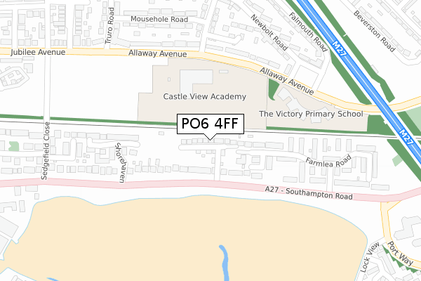
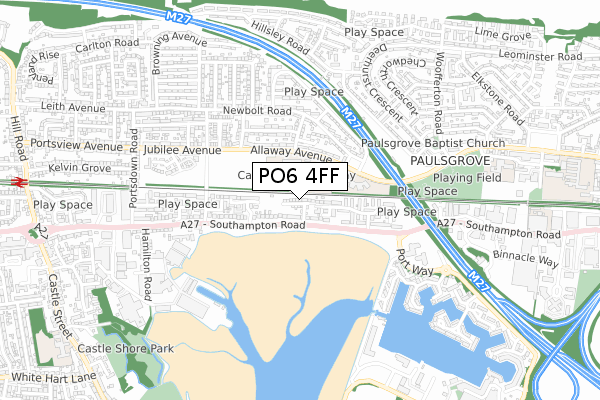
PO6 4FF is located in the Paulsgrove electoral ward, within the unitary authority of Portsmouth and the English Parliamentary constituency of Portsmouth North. The Sub Integrated Care Board (ICB) Location is NHS Hampshire and Isle of Wight ICB - 10R and the police force is Hampshire. This postcode has been in use since June 2018.


GetTheData
Source: OS Open Zoomstack (Ordnance Survey)
Licence: Open Government Licence (requires attribution)
Attribution: Contains OS data © Crown copyright and database right 2024
Source: Open Postcode Geo
Licence: Open Government Licence (requires attribution)
Attribution: Contains OS data © Crown copyright and database right 2024; Contains Royal Mail data © Royal Mail copyright and database right 2024; Source: Office for National Statistics licensed under the Open Government Licence v.3.0
| Easting | 462905 |
| Northing | 105773 |
| Latitude | 50.848056 |
| Longitude | -1.107818 |
GetTheData
Source: Open Postcode Geo
Licence: Open Government Licence
| Country | England |
| Postcode District | PO6 |
➜ See where PO6 is on a map ➜ Where is Portsmouth? | |
GetTheData
Source: Land Registry Price Paid Data
Licence: Open Government Licence
| Ward | Paulsgrove |
| Constituency | Portsmouth North |
GetTheData
Source: ONS Postcode Database
Licence: Open Government Licence
7, NAUTILUS DRIVE, PORTSMOUTH, PO6 4FF 2018 3 OCT £390,000 |
GetTheData
Source: HM Land Registry Price Paid Data
Licence: Contains HM Land Registry data © Crown copyright and database right 2024. This data is licensed under the Open Government Licence v3.0.
| Shorehaven | Paulsgrove | 99m |
| Shorehaven (Southampton Road) | Paulsgrove | 134m |
| Pendennis Road (Allaway Avenue) | Paulsgrove | 194m |
| Pendennis Road (Allaway Avenue) | Paulsgrove | 220m |
| Bodmin Road (Allaway Avenue) | Paulsgrove | 226m |
| Portchester Station | 1.2km |
| Cosham Station | 2.9km |
| Hilsea Station | 4.1km |
GetTheData
Source: NaPTAN
Licence: Open Government Licence
| Percentage of properties with Next Generation Access | 100.0% |
| Percentage of properties with Superfast Broadband | 100.0% |
| Percentage of properties with Ultrafast Broadband | 100.0% |
| Percentage of properties with Full Fibre Broadband | 100.0% |
Superfast Broadband is between 30Mbps and 300Mbps
Ultrafast Broadband is > 300Mbps
| Percentage of properties unable to receive 2Mbps | 0.0% |
| Percentage of properties unable to receive 5Mbps | 0.0% |
| Percentage of properties unable to receive 10Mbps | 0.0% |
| Percentage of properties unable to receive 30Mbps | 0.0% |
GetTheData
Source: Ofcom
Licence: Ofcom Terms of Use (requires attribution)
GetTheData
Source: ONS Postcode Database
Licence: Open Government Licence


➜ Get more ratings from the Food Standards Agency
GetTheData
Source: Food Standards Agency
Licence: FSA terms & conditions
| Last Collection | |||
|---|---|---|---|
| Location | Mon-Fri | Sat | Distance |
| Paulsgrove | 16:00 | 11:30 | 183m |
| Watersedge | 17:00 | 11:30 | 295m |
| Newbolt Road | 17:00 | 11:30 | 350m |
GetTheData
Source: Dracos
Licence: Creative Commons Attribution-ShareAlike
The below table lists the International Territorial Level (ITL) codes (formerly Nomenclature of Territorial Units for Statistics (NUTS) codes) and Local Administrative Units (LAU) codes for PO6 4FF:
| ITL 1 Code | Name |
|---|---|
| TLJ | South East (England) |
| ITL 2 Code | Name |
| TLJ3 | Hampshire and Isle of Wight |
| ITL 3 Code | Name |
| TLJ31 | Portsmouth |
| LAU 1 Code | Name |
| E06000044 | Portsmouth |
GetTheData
Source: ONS Postcode Directory
Licence: Open Government Licence
The below table lists the Census Output Area (OA), Lower Layer Super Output Area (LSOA), and Middle Layer Super Output Area (MSOA) for PO6 4FF:
| Code | Name | |
|---|---|---|
| OA | E00086451 | |
| LSOA | E01017114 | Portsmouth 004C |
| MSOA | E02003527 | Portsmouth 004 |
GetTheData
Source: ONS Postcode Directory
Licence: Open Government Licence
| PO6 4RY | Southampton Road | 91m |
| PO6 4SQ | Farmlea Road | 169m |
| PO6 4PT | Beach Drive | 191m |
| PO6 4QR | Allaway Avenue | 218m |
| PO6 4SD | Paddock Walk | 231m |
| PO6 4RU | Shorehaven | 234m |
| PO6 4QU | Bodmin Road | 252m |
| PO6 4QS | Allaway Avenue | 262m |
| PO6 4JJ | Pendennis Road | 279m |
| PO6 4SE | Watersedge Road | 281m |
GetTheData
Source: Open Postcode Geo; Land Registry Price Paid Data
Licence: Open Government Licence