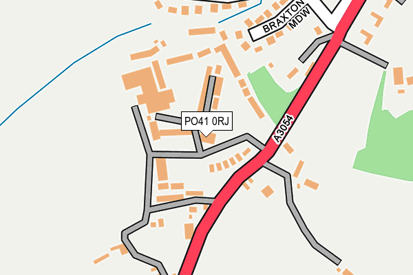
PO41 0RJ lies on Halletts Shute in Norton, Yarmouth. PO41 0RJ is located in the Freshwater North & Yarmouth electoral ward, within the unitary authority of Isle of Wight and the English Parliamentary constituency of Isle of Wight. The Sub Integrated Care Board (ICB) Location is NHS Hampshire and Isle of Wight ICB - D9Y0V and the police force is Hampshire. This postcode has been in use since June 1999.


GetTheData
Source: OS OpenMap – Local (Ordnance Survey)
Source: OS VectorMap District (Ordnance Survey)
Licence: Open Government Licence (requires attribution)
| Easting | 434286 |
| Northing | 89141 |
| Latitude | 50.700906 |
| Longitude | -1.515875 |
GetTheData
Source: Open Postcode Geo
Licence: Open Government Licence
| Street | Halletts Shute |
| Locality | Norton |
| Town/City | Yarmouth |
| Country | England |
| Postcode District | PO41 |
➜ See where PO41 is on a map ➜ Where is Norton? | |
GetTheData
Source: Land Registry Price Paid Data
Licence: Open Government Licence
Elevation or altitude of PO41 0RJ as distance above sea level:
| Metres | Feet | |
|---|---|---|
| Elevation | 10m | 33ft |
Elevation is measured from the approximate centre of the postcode, to the nearest point on an OS contour line from OS Terrain 50, which has contour spacing of ten vertical metres.
➜ How high above sea level am I? Find the elevation of your current position using your device's GPS.
GetTheData
Source: Open Postcode Elevation
Licence: Open Government Licence
| Ward | Freshwater North & Yarmouth |
| Constituency | Isle Of Wight |
GetTheData
Source: ONS Postcode Database
Licence: Open Government Licence
| Savoy (Halletts Shute) | Norton | 210m |
| Savoy (Halletts Shute) | Norton | 266m |
| Pixley Hill (Halletts Shute) | Norton | 367m |
| Pixley Hill (Hill Lane) | Norton | 403m |
| Norton Grange (Halletts Shute) | Norton | 549m |
GetTheData
Source: NaPTAN
Licence: Open Government Licence
Estimated total energy consumption in PO41 0RJ by fuel type, 2015.
| Consumption (kWh) | 75,449 |
|---|---|
| Meter count | 7 |
| Mean (kWh/meter) | 10,778 |
| Median (kWh/meter) | 10,523 |
GetTheData
Source: Postcode level gas estimates: 2015 (experimental)
Source: Postcode level electricity estimates: 2015 (experimental)
Licence: Open Government Licence
GetTheData
Source: ONS Postcode Database
Licence: Open Government Licence


➜ Get more ratings from the Food Standards Agency
GetTheData
Source: Food Standards Agency
Licence: FSA terms & conditions
| Last Collection | |||
|---|---|---|---|
| Location | Mon-Fri | Sat | Distance |
| Savoy Holiday Village | 16:45 | 11:00 | 69m |
| West Hill Lane | 16:15 | 09:00 | 380m |
| Norton | 16:15 | 11:00 | 581m |
GetTheData
Source: Dracos
Licence: Creative Commons Attribution-ShareAlike
The below table lists the International Territorial Level (ITL) codes (formerly Nomenclature of Territorial Units for Statistics (NUTS) codes) and Local Administrative Units (LAU) codes for PO41 0RJ:
| ITL 1 Code | Name |
|---|---|
| TLJ | South East (England) |
| ITL 2 Code | Name |
| TLJ3 | Hampshire and Isle of Wight |
| ITL 3 Code | Name |
| TLJ34 | Isle of Wight |
| LAU 1 Code | Name |
| E06000046 | Isle of Wight |
GetTheData
Source: ONS Postcode Directory
Licence: Open Government Licence
The below table lists the Census Output Area (OA), Lower Layer Super Output Area (LSOA), and Middle Layer Super Output Area (MSOA) for PO41 0RJ:
| Code | Name | |
|---|---|---|
| OA | E00087448 | |
| LSOA | E01033239 | Isle of Wight 012H |
| MSOA | E02003592 | Isle of Wight 012 |
GetTheData
Source: ONS Postcode Directory
Licence: Open Government Licence
| PO41 0BD | Bay Drive | 55m |
| PO41 0RH | Halletts Shute | 116m |
| PO41 0RN | Braxton Meadow | 190m |
| PO41 0RL | Linstone Drive | 246m |
| PO41 0RP | Hammond Close | 288m |
| PO41 0RW | Westhill Lane | 298m |
| PO40 9TH | Halletts Shute | 376m |
| PO41 0RT | Sconce Road | 383m |
| PO41 0RX | Graeme Road | 404m |
| PO41 0SB | Halletts Shute | 407m |
GetTheData
Source: Open Postcode Geo; Land Registry Price Paid Data
Licence: Open Government Licence