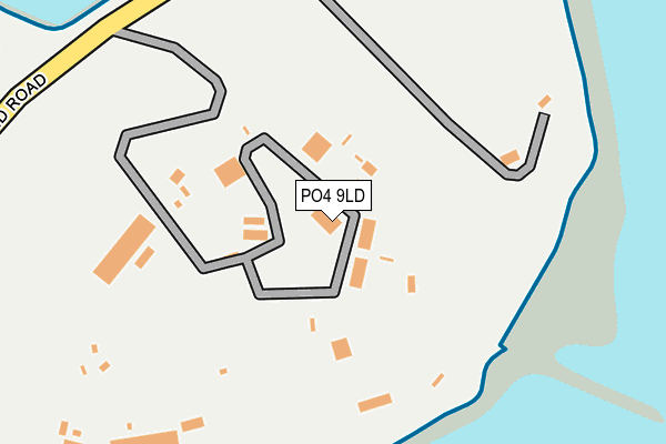
PO4 9LD is located in the Eastney and Craneswater electoral ward, within the unitary authority of Portsmouth and the English Parliamentary constituency of Portsmouth South. The Sub Integrated Care Board (ICB) Location is NHS Hampshire and Isle of Wight ICB - 10R and the police force is Hampshire. This postcode has been in use since January 1980.


GetTheData
Source: OS OpenMap – Local (Ordnance Survey)
Source: OS VectorMap District (Ordnance Survey)
Licence: Open Government Licence (requires attribution)
| Easting | 468120 |
| Northing | 99231 |
| Latitude | 50.788645 |
| Longitude | -1.034964 |
GetTheData
Source: Open Postcode Geo
Licence: Open Government Licence
| Country | England |
| Postcode District | PO4 |
➜ See where PO4 is on a map ➜ Where is Portsmouth? | |
GetTheData
Source: Land Registry Price Paid Data
Licence: Open Government Licence
Elevation or altitude of PO4 9LD as distance above sea level:
| Metres | Feet | |
|---|---|---|
| Elevation | 0m | 0ft |
Elevation is measured from the approximate centre of the postcode, to the nearest point on an OS contour line from OS Terrain 50, which has contour spacing of ten vertical metres.
➜ How high above sea level am I? Find the elevation of your current position using your device's GPS.
GetTheData
Source: Open Postcode Elevation
Licence: Open Government Licence
| Ward | Eastney And Craneswater |
| Constituency | Portsmouth South |
GetTheData
Source: ONS Postcode Database
Licence: Open Government Licence
| Fort Cumberland (Fort Cumberland Road) | Eastney | 180m |
| Lumsden Road (Ferry Road) | Eastney | 366m |
| Gibraltar Road (Fort Cumberland Road) | Eastney | 473m |
| Gibraltar Road (Ferry Road) | Eastney | 581m |
| Ferry Road (Henderson Road) | Eastney | 680m |
| Fratton Station | 2.9km |
| Portsmouth & Southsea Station | 4.1km |
| Southsea Hoverport | 4.6km |
GetTheData
Source: NaPTAN
Licence: Open Government Licence
GetTheData
Source: ONS Postcode Database
Licence: Open Government Licence


➜ Get more ratings from the Food Standards Agency
GetTheData
Source: Food Standards Agency
Licence: FSA terms & conditions
| Last Collection | |||
|---|---|---|---|
| Location | Mon-Fri | Sat | Distance |
| Lumsden Road | 16:45 | 11:30 | 311m |
| Ferry Road | 16:45 | 11:30 | 631m |
| Kingsley Road | 17:15 | 11:30 | 1,009m |
GetTheData
Source: Dracos
Licence: Creative Commons Attribution-ShareAlike
The below table lists the International Territorial Level (ITL) codes (formerly Nomenclature of Territorial Units for Statistics (NUTS) codes) and Local Administrative Units (LAU) codes for PO4 9LD:
| ITL 1 Code | Name |
|---|---|
| TLJ | South East (England) |
| ITL 2 Code | Name |
| TLJ3 | Hampshire and Isle of Wight |
| ITL 3 Code | Name |
| TLJ31 | Portsmouth |
| LAU 1 Code | Name |
| E06000044 | Portsmouth |
GetTheData
Source: ONS Postcode Directory
Licence: Open Government Licence
The below table lists the Census Output Area (OA), Lower Layer Super Output Area (LSOA), and Middle Layer Super Output Area (MSOA) for PO4 9LD:
| Code | Name | |
|---|---|---|
| OA | E00086185 | |
| LSOA | E01017074 | Portsmouth 023E |
| MSOA | E02003546 | Portsmouth 023 |
GetTheData
Source: ONS Postcode Directory
Licence: Open Government Licence
| PO4 9UQ | Solent Heights | 188m |
| PO4 9UG | Horse Sands Close | 213m |
| PO4 9UD | Ferry Road | 224m |
| PO4 9UB | Horse Sands Close | 232m |
| PO4 9UF | Langstone Marina Heights | 254m |
| PO4 9LP | Lumsden Road | 275m |
| PO4 9UA | Ferry Road | 275m |
| PO4 9UE | Eastlake Heights | 298m |
| PO4 9LR | Lumsden Road | 299m |
| PO4 9LW | Lumsden Road | 343m |
GetTheData
Source: Open Postcode Geo; Land Registry Price Paid Data
Licence: Open Government Licence