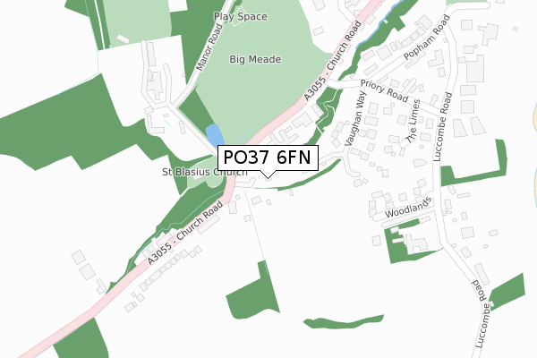
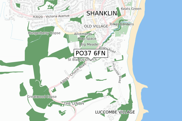
PO37 6FN is located in the Shanklin South electoral ward, within the unitary authority of Isle of Wight and the English Parliamentary constituency of Isle of Wight. The Sub Integrated Care Board (ICB) Location is NHS Hampshire and Isle of Wight ICB - D9Y0V and the police force is Hampshire. This postcode has been in use since July 2019.


GetTheData
Source: OS Open Zoomstack (Ordnance Survey)
Licence: Open Government Licence (requires attribution)
Attribution: Contains OS data © Crown copyright and database right 2025
Source: Open Postcode Geo
Licence: Open Government Licence (requires attribution)
Attribution: Contains OS data © Crown copyright and database right 2025; Contains Royal Mail data © Royal Mail copyright and database right 2025; Source: Office for National Statistics licensed under the Open Government Licence v.3.0
| Easting | 457978 |
| Northing | 80545 |
| Latitude | 50.621725 |
| Longitude | -1.181760 |
GetTheData
Source: Open Postcode Geo
Licence: Open Government Licence
| Country | England |
| Postcode District | PO37 |
➜ See where PO37 is on a map ➜ Where is Shanklin? | |
GetTheData
Source: Land Registry Price Paid Data
Licence: Open Government Licence
| Ward | Shanklin South |
| Constituency | Isle Of Wight |
GetTheData
Source: ONS Postcode Database
Licence: Open Government Licence
THE RETREAT, OLD CHURCH LANE, SHANKLIN, PO37 6FN 2020 8 SEP £150,000 |
GetTheData
Source: HM Land Registry Price Paid Data
Licence: Contains HM Land Registry data © Crown copyright and database right 2025. This data is licensed under the Open Government Licence v3.0.
| Priory Road (Church Road) | Shanklin | 188m |
| Priory Road (Church Road) | Shanklin | 251m |
| De-restriction Sign (Church Road) | Shanklin | 268m |
| De-restriction Sign (Church Road) | Shanklin | 287m |
| Chine Avenue | Shanklin Esplanade | 546m |
| Shanklin Station | 1.4km |
| Lake (Isle of Wight) Station | 3km |
| Sandown Station | 4.1km |
GetTheData
Source: NaPTAN
Licence: Open Government Licence
| Percentage of properties with Next Generation Access | 100.0% |
| Percentage of properties with Superfast Broadband | 100.0% |
| Percentage of properties with Ultrafast Broadband | 0.0% |
| Percentage of properties with Full Fibre Broadband | 0.0% |
Superfast Broadband is between 30Mbps and 300Mbps
Ultrafast Broadband is > 300Mbps
| Percentage of properties unable to receive 2Mbps | 0.0% |
| Percentage of properties unable to receive 5Mbps | 0.0% |
| Percentage of properties unable to receive 10Mbps | 0.0% |
| Percentage of properties unable to receive 30Mbps | 0.0% |
GetTheData
Source: Ofcom
Licence: Ofcom Terms of Use (requires attribution)
GetTheData
Source: ONS Postcode Database
Licence: Open Government Licence


➜ Get more ratings from the Food Standards Agency
GetTheData
Source: Food Standards Agency
Licence: FSA terms & conditions
| Last Collection | |||
|---|---|---|---|
| Location | Mon-Fri | Sat | Distance |
| Church Road | 16:45 | 11:15 | 80m |
| Luccombe Road | 16:45 | 11:15 | 366m |
| Luccombe Village | 14:45 | 11:15 | 674m |
GetTheData
Source: Dracos
Licence: Creative Commons Attribution-ShareAlike
The below table lists the International Territorial Level (ITL) codes (formerly Nomenclature of Territorial Units for Statistics (NUTS) codes) and Local Administrative Units (LAU) codes for PO37 6FN:
| ITL 1 Code | Name |
|---|---|
| TLJ | South East (England) |
| ITL 2 Code | Name |
| TLJ3 | Hampshire and Isle of Wight |
| ITL 3 Code | Name |
| TLJ34 | Isle of Wight |
| LAU 1 Code | Name |
| E06000046 | Isle of Wight |
GetTheData
Source: ONS Postcode Directory
Licence: Open Government Licence
The below table lists the Census Output Area (OA), Lower Layer Super Output Area (LSOA), and Middle Layer Super Output Area (MSOA) for PO37 6FN:
| Code | Name | |
|---|---|---|
| OA | E00087674 | |
| LSOA | E01017359 | Isle of Wight 016E |
| MSOA | E02003596 | Isle of Wight 016 |
GetTheData
Source: ONS Postcode Directory
Licence: Open Government Licence
| PO37 6QR | Church Road | 85m |
| PO37 6SD | Vaughan Way | 144m |
| PO37 6QY | Church Road | 156m |
| PO37 6EQ | Chine Mews | 157m |
| PO37 6SA | Priory Road | 221m |
| PO37 6SB | The Limes | 232m |
| PO37 6QS | Manor Road | 279m |
| PO37 6RE | Priory Road | 314m |
| PO37 6RF | Popham Road | 367m |
| PO37 6RN | Luccombe Road | 374m |
GetTheData
Source: Open Postcode Geo; Land Registry Price Paid Data
Licence: Open Government Licence