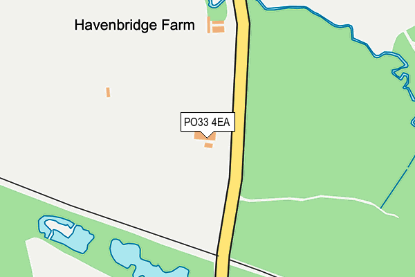
PO33 4EA is located in the Newchurch, Havenstreet & Ashey electoral ward, within the unitary authority of Isle of Wight and the English Parliamentary constituency of Isle of Wight. The Sub Integrated Care Board (ICB) Location is NHS Hampshire and Isle of Wight ICB - D9Y0V and the police force is Hampshire. This postcode has been in use since June 1981.


GetTheData
Source: OS OpenMap – Local (Ordnance Survey)
Source: OS VectorMap District (Ordnance Survey)
Licence: Open Government Licence (requires attribution)
| Easting | 456470 |
| Northing | 89576 |
| Latitude | 50.703090 |
| Longitude | -1.201710 |
GetTheData
Source: Open Postcode Geo
Licence: Open Government Licence
| Country | England |
| Postcode District | PO33 |
➜ See where PO33 is on a map | |
GetTheData
Source: Land Registry Price Paid Data
Licence: Open Government Licence
Elevation or altitude of PO33 4EA as distance above sea level:
| Metres | Feet | |
|---|---|---|
| Elevation | 20m | 66ft |
Elevation is measured from the approximate centre of the postcode, to the nearest point on an OS contour line from OS Terrain 50, which has contour spacing of ten vertical metres.
➜ How high above sea level am I? Find the elevation of your current position using your device's GPS.
GetTheData
Source: Open Postcode Elevation
Licence: Open Government Licence
| Ward | Newchurch, Havenstreet & Ashey |
| Constituency | Isle Of Wight |
GetTheData
Source: ONS Postcode Database
Licence: Open Government Licence
| Stroudwood Road (Stroud Wood Road) | Upton | 1,220m |
| Rowlands Lane (Newnham Road) | Havenstreet | 1,341m |
| Stroud Farm (Stroud Wood Road) | Upton | 1,422m |
| Havenstreet (Isle Of Wight Steam Railway) | Havenstreet | 973m |
| Ashey (Isle Of Wight Steam Railway) | Ashey | 1,516m |
| Smallbrook Junction Station | 3.5km |
| Ryde St Johns Road Station | 4km |
| Ryde Esplanade Station | 4.4km |
GetTheData
Source: NaPTAN
Licence: Open Government Licence
GetTheData
Source: ONS Postcode Database
Licence: Open Government Licence


➜ Get more ratings from the Food Standards Agency
GetTheData
Source: Food Standards Agency
Licence: FSA terms & conditions
| Last Collection | |||
|---|---|---|---|
| Location | Mon-Fri | Sat | Distance |
| Havenstreet Village | 16:30 | 11:00 | 848m |
| Havenstreet Main Road | 16:30 | 11:00 | 1,120m |
| Upton Cross | 16:45 | 09:15 | 1,807m |
GetTheData
Source: Dracos
Licence: Creative Commons Attribution-ShareAlike
The below table lists the International Territorial Level (ITL) codes (formerly Nomenclature of Territorial Units for Statistics (NUTS) codes) and Local Administrative Units (LAU) codes for PO33 4EA:
| ITL 1 Code | Name |
|---|---|
| TLJ | South East (England) |
| ITL 2 Code | Name |
| TLJ3 | Hampshire and Isle of Wight |
| ITL 3 Code | Name |
| TLJ34 | Isle of Wight |
| LAU 1 Code | Name |
| E06000046 | Isle of Wight |
GetTheData
Source: ONS Postcode Directory
Licence: Open Government Licence
The below table lists the Census Output Area (OA), Lower Layer Super Output Area (LSOA), and Middle Layer Super Output Area (MSOA) for PO33 4EA:
| Code | Name | |
|---|---|---|
| OA | E00087279 | |
| LSOA | E01017283 | Isle of Wight 006B |
| MSOA | E02003586 | Isle of Wight 006 |
GetTheData
Source: ONS Postcode Directory
Licence: Open Government Licence
| PO33 4DD | Pondcast Lane | 652m |
| PO33 4DG | Church Road | 755m |
| PO33 4DN | Church Road | 782m |
| PO33 4DW | Church Road | 810m |
| PO33 4DU | Elizabeth Gardens | 837m |
| PO33 4DR | Main Road | 842m |
| PO33 4DX | Main Road | 851m |
| PO33 4AD | St Peters Court | 858m |
| PO33 4DP | Main Road | 878m |
| PO33 4DQ | Church Road | 904m |
GetTheData
Source: Open Postcode Geo; Land Registry Price Paid Data
Licence: Open Government Licence