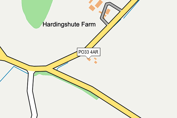
PO33 4AR lies on Harding Shute in Ryde. PO33 4AR is located in the Brading & St Helens electoral ward, within the unitary authority of Isle of Wight and the English Parliamentary constituency of Isle of Wight. The Sub Integrated Care Board (ICB) Location is NHS Hampshire and Isle of Wight ICB - D9Y0V and the police force is Hampshire. This postcode has been in use since January 1980.


GetTheData
Source: OS OpenMap – Local (Ordnance Survey)
Source: OS VectorMap District (Ordnance Survey)
Licence: Open Government Licence (requires attribution)
| Easting | 459427 |
| Northing | 88317 |
| Latitude | 50.691464 |
| Longitude | -1.160034 |
GetTheData
Source: Open Postcode Geo
Licence: Open Government Licence
| Street | Harding Shute |
| Town/City | Ryde |
| Country | England |
| Postcode District | PO33 |
➜ See where PO33 is on a map | |
GetTheData
Source: Land Registry Price Paid Data
Licence: Open Government Licence
Elevation or altitude of PO33 4AR as distance above sea level:
| Metres | Feet | |
|---|---|---|
| Elevation | 30m | 98ft |
Elevation is measured from the approximate centre of the postcode, to the nearest point on an OS contour line from OS Terrain 50, which has contour spacing of ten vertical metres.
➜ How high above sea level am I? Find the elevation of your current position using your device's GPS.
GetTheData
Source: Open Postcode Elevation
Licence: Open Government Licence
| Ward | Brading & St Helens |
| Constituency | Isle Of Wight |
GetTheData
Source: ONS Postcode Database
Licence: Open Government Licence
| Rowborough Corner (Beaper Shute) | Carpenters Road | 1,101m |
| Rowborough Corner (Beaper Shute) | Carpenters Road | 1,125m |
| Cricket Club (Rowborough Lane) | Brading | 1,229m |
| Cricket Club (Rowborough Lane) | Brading | 1,252m |
| Whitefield Campsite (Beaper Shute) | Beaper Farm | 1,371m |
| Brading Station | 2.1km |
| Smallbrook Junction Station | 2.2km |
| Ryde St Johns Road Station | 3.7km |
GetTheData
Source: NaPTAN
Licence: Open Government Licence
GetTheData
Source: ONS Postcode Database
Licence: Open Government Licence

➜ Get more ratings from the Food Standards Agency
GetTheData
Source: Food Standards Agency
Licence: FSA terms & conditions
| Last Collection | |||
|---|---|---|---|
| Location | Mon-Fri | Sat | Distance |
| Deacons Lane | 16:45 | 08:30 | 1,199m |
| Park Road | 16:30 | 10:45 | 1,334m |
| Brading Post Office | 16:30 | 11:00 | 1,717m |
GetTheData
Source: Dracos
Licence: Creative Commons Attribution-ShareAlike
The below table lists the International Territorial Level (ITL) codes (formerly Nomenclature of Territorial Units for Statistics (NUTS) codes) and Local Administrative Units (LAU) codes for PO33 4AR:
| ITL 1 Code | Name |
|---|---|
| TLJ | South East (England) |
| ITL 2 Code | Name |
| TLJ3 | Hampshire and Isle of Wight |
| ITL 3 Code | Name |
| TLJ34 | Isle of Wight |
| LAU 1 Code | Name |
| E06000046 | Isle of Wight |
GetTheData
Source: ONS Postcode Directory
Licence: Open Government Licence
The below table lists the Census Output Area (OA), Lower Layer Super Output Area (LSOA), and Middle Layer Super Output Area (MSOA) for PO33 4AR:
| Code | Name | |
|---|---|---|
| OA | E00087319 | |
| LSOA | E01017289 | Isle of Wight 014A |
| MSOA | E02003594 | Isle of Wight 014 |
GetTheData
Source: ONS Postcode Directory
Licence: Open Government Licence
| PO33 4AS | East Ashey Lane | 804m |
| PO33 4AP | Harding Shute | 975m |
| PO33 4AZ | Green Lane | 982m |
| PO36 0AZ | 1017m | |
| PO33 4BA | Ashey Road | 1146m |
| PO33 4AY | Ashey Road | 1157m |
| PO36 0JF | Kyngs Close | 1218m |
| PO33 4AU | Ashey Road | 1255m |
| PO36 0JE | Coach Lane | 1270m |
| PO36 0JB | Queens Drive | 1285m |
GetTheData
Source: Open Postcode Geo; Land Registry Price Paid Data
Licence: Open Government Licence