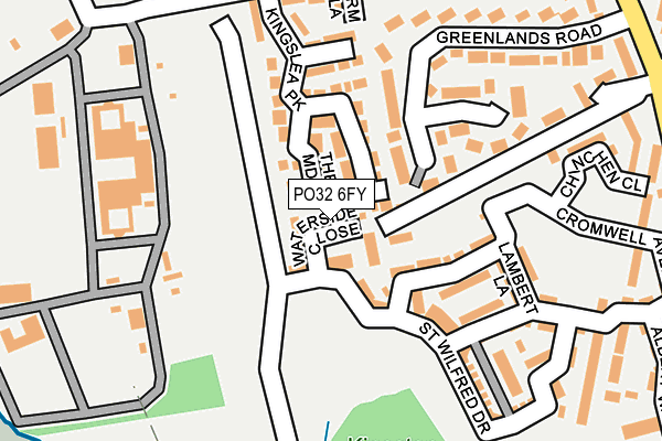
PO32 6FY is located in the Fairlee & Whippingham electoral ward, within the unitary authority of Isle of Wight and the English Parliamentary constituency of Isle of Wight. The Sub Integrated Care Board (ICB) Location is NHS Hampshire and Isle of Wight ICB - D9Y0V and the police force is Hampshire. This postcode has been in use since March 2017.


GetTheData
Source: OS OpenMap – Local (Ordnance Survey)
Source: OS VectorMap District (Ordnance Survey)
Licence: Open Government Licence (requires attribution)
| Easting | 451540 |
| Northing | 93868 |
| Latitude | 50.742130 |
| Longitude | -1.270908 |
GetTheData
Source: Open Postcode Geo
Licence: Open Government Licence
| Country | England |
| Postcode District | PO32 |
➜ See where PO32 is on a map ➜ Where is Whippingham? | |
GetTheData
Source: Land Registry Price Paid Data
Licence: Open Government Licence
| Ward | Fairlee & Whippingham |
| Constituency | Isle Of Wight |
GetTheData
Source: ONS Postcode Database
Licence: Open Government Licence
| Barton Lodge | Osborne House | 139m |
| Barton Lodge | Osborne House | 221m |
| Whippingham Heights | Whippingham | 257m |
| Campfield Road (A3021 Whippingham Road) | Whippingham | 316m |
| The Forge (Whippingham Road) | Whippingham | 460m |
GetTheData
Source: NaPTAN
Licence: Open Government Licence
GetTheData
Source: ONS Postcode Database
Licence: Open Government Licence


➜ Get more ratings from the Food Standards Agency
GetTheData
Source: Food Standards Agency
Licence: FSA terms & conditions
| Last Collection | |||
|---|---|---|---|
| Location | Mon-Fri | Sat | Distance |
| Whippingham Heights | 16:30 | 08:00 | 204m |
| Rectory | 16:30 | 08:00 | 449m |
| Whippingham Post Office | 16:30 | 08:45 | 620m |
GetTheData
Source: Dracos
Licence: Creative Commons Attribution-ShareAlike
The below table lists the International Territorial Level (ITL) codes (formerly Nomenclature of Territorial Units for Statistics (NUTS) codes) and Local Administrative Units (LAU) codes for PO32 6FY:
| ITL 1 Code | Name |
|---|---|
| TLJ | South East (England) |
| ITL 2 Code | Name |
| TLJ3 | Hampshire and Isle of Wight |
| ITL 3 Code | Name |
| TLJ34 | Isle of Wight |
| LAU 1 Code | Name |
| E06000046 | Isle of Wight |
GetTheData
Source: ONS Postcode Directory
Licence: Open Government Licence
The below table lists the Census Output Area (OA), Lower Layer Super Output Area (LSOA), and Middle Layer Super Output Area (MSOA) for PO32 6FY:
| Code | Name | |
|---|---|---|
| OA | E00087519 | |
| LSOA | E01033229 | Isle of Wight 003D |
| MSOA | E02003583 | Isle of Wight 003 |
GetTheData
Source: ONS Postcode Directory
Licence: Open Government Licence
| PO32 6LU | River View | 212m |
| PO32 6LH | Whippingham Road | 230m |
| PO32 6LS | Barton Close | 325m |
| PO32 6LT | Campfield Road | 357m |
| PO32 6LP | Beatrice Avenue | 434m |
| PO32 6LW | Beatrice Avenue | 493m |
| PO32 6LY | Folly Lane | 522m |
| PO32 6GL | Haven Close | 597m |
| PO32 6GN | Monks Walk | 603m |
| PO32 6GF | Abbey Walk | 608m |
GetTheData
Source: Open Postcode Geo; Land Registry Price Paid Data
Licence: Open Government Licence