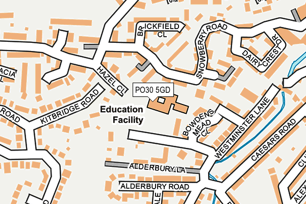
PO30 5GD is located in the Newport West electoral ward, within the unitary authority of Isle of Wight and the English Parliamentary constituency of Isle of Wight. The Sub Integrated Care Board (ICB) Location is NHS Hampshire and Isle of Wight ICB - D9Y0V and the police force is Hampshire. This postcode has been in use since February 1990.


GetTheData
Source: OS OpenMap – Local (Ordnance Survey)
Source: OS VectorMap District (Ordnance Survey)
Licence: Open Government Licence (requires attribution)
| Easting | 449237 |
| Northing | 89058 |
| Latitude | 50.699077 |
| Longitude | -1.304186 |
GetTheData
Source: Open Postcode Geo
Licence: Open Government Licence
| Country | England |
| Postcode District | PO30 |
➜ See where PO30 is on a map ➜ Where is Newport? | |
GetTheData
Source: Land Registry Price Paid Data
Licence: Open Government Licence
Elevation or altitude of PO30 5GD as distance above sea level:
| Metres | Feet | |
|---|---|---|
| Elevation | 10m | 33ft |
Elevation is measured from the approximate centre of the postcode, to the nearest point on an OS contour line from OS Terrain 50, which has contour spacing of ten vertical metres.
➜ How high above sea level am I? Find the elevation of your current position using your device's GPS.
GetTheData
Source: Open Postcode Elevation
Licence: Open Government Licence
| Ward | Newport West |
| Constituency | Isle Of Wight |
GetTheData
Source: ONS Postcode Database
Licence: Open Government Licence
| Aspen Close (Sylvan Drive) | Newport | 293m |
| Westmill Road | Newport | 296m |
| Birch Gardens (Sylvan Drive) | Newport | 308m |
| Wolfe Close (Hinton Road) | Newport | 326m |
| Simeon Monument (Carisbrooke) | Newport | 374m |
GetTheData
Source: NaPTAN
Licence: Open Government Licence
GetTheData
Source: ONS Postcode Database
Licence: Open Government Licence


➜ Get more ratings from the Food Standards Agency
GetTheData
Source: Food Standards Agency
Licence: FSA terms & conditions
| Last Collection | |||
|---|---|---|---|
| Location | Mon-Fri | Sat | Distance |
| The Mall | 17:45 | 12:15 | 318m |
| Hinton Road | 17:45 | 12:15 | 380m |
| Castle Road | 17:00 | 12:00 | 418m |
GetTheData
Source: Dracos
Licence: Creative Commons Attribution-ShareAlike
The below table lists the International Territorial Level (ITL) codes (formerly Nomenclature of Territorial Units for Statistics (NUTS) codes) and Local Administrative Units (LAU) codes for PO30 5GD:
| ITL 1 Code | Name |
|---|---|
| TLJ | South East (England) |
| ITL 2 Code | Name |
| TLJ3 | Hampshire and Isle of Wight |
| ITL 3 Code | Name |
| TLJ34 | Isle of Wight |
| LAU 1 Code | Name |
| E06000046 | Isle of Wight |
GetTheData
Source: ONS Postcode Directory
Licence: Open Government Licence
The below table lists the Census Output Area (OA), Lower Layer Super Output Area (LSOA), and Middle Layer Super Output Area (MSOA) for PO30 5GD:
| Code | Name | |
|---|---|---|
| OA | E00087342 | |
| LSOA | E01017292 | Isle of Wight 011A |
| MSOA | E02003591 | Isle of Wight 011 |
GetTheData
Source: ONS Postcode Directory
Licence: Open Government Licence
| PO30 5GZ | Bowdens Mead Close | 68m |
| PO30 5DP | Westminster Lane | 79m |
| PO30 5ZG | Westminster Lane | 99m |
| PO30 5ZQ | Charnwood Close | 107m |
| PO30 5DR | Alderbury Road | 121m |
| PO30 5EZ | Snowberry Road | 121m |
| PO30 5GN | Snowberry Road | 121m |
| PO30 5ZF | Westminster Lane | 133m |
| PO30 5ZH | Westminster Lane | 144m |
| PO30 5FG | Hazel Close | 159m |
GetTheData
Source: Open Postcode Geo; Land Registry Price Paid Data
Licence: Open Government Licence