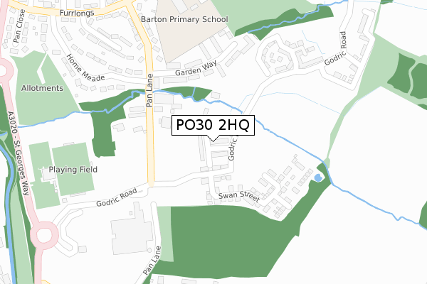
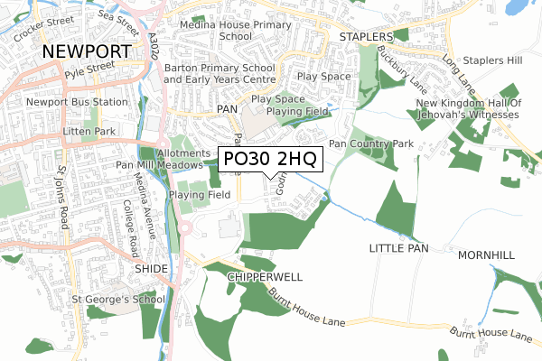
PO30 2HQ is located in the Pan & Barton electoral ward, within the unitary authority of Isle of Wight and the English Parliamentary constituency of Isle of Wight. The Sub Integrated Care Board (ICB) Location is NHS Hampshire and Isle of Wight ICB - D9Y0V and the police force is Hampshire. This postcode has been in use since May 2019.


GetTheData
Source: OS Open Zoomstack (Ordnance Survey)
Licence: Open Government Licence (requires attribution)
Attribution: Contains OS data © Crown copyright and database right 2025
Source: Open Postcode Geo
Licence: Open Government Licence (requires attribution)
Attribution: Contains OS data © Crown copyright and database right 2025; Contains Royal Mail data © Royal Mail copyright and database right 2025; Source: Office for National Statistics licensed under the Open Government Licence v.3.0
| Easting | 450837 |
| Northing | 88594 |
| Latitude | 50.694767 |
| Longitude | -1.281596 |
GetTheData
Source: Open Postcode Geo
Licence: Open Government Licence
| Country | England |
| Postcode District | PO30 |
➜ See where PO30 is on a map ➜ Where is Newport? | |
GetTheData
Source: Land Registry Price Paid Data
Licence: Open Government Licence
| Ward | Pan & Barton |
| Constituency | Isle Of Wight |
GetTheData
Source: ONS Postcode Database
Licence: Open Government Licence
28, DORMOUSE DRIVE, NEWPORT, PO30 2HQ 2019 6 DEC £247,500 |
GetTheData
Source: HM Land Registry Price Paid Data
Licence: Contains HM Land Registry data © Crown copyright and database right 2025. This data is licensed under the Open Government Licence v3.0.
| Pan Lane (Furrlongs) | Pan | 392m |
| Downside Middle (Furrlongs) | Pan | 401m |
| Downside Middle School (Furrlongs) | Pan | 423m |
| Manor Crescent (Furrlongs) | Pan | 433m |
| St Georges Park (St.georges Way) | Newport | 453m |
GetTheData
Source: NaPTAN
Licence: Open Government Licence
GetTheData
Source: ONS Postcode Database
Licence: Open Government Licence


➜ Get more ratings from the Food Standards Agency
GetTheData
Source: Food Standards Agency
Licence: FSA terms & conditions
| Last Collection | |||
|---|---|---|---|
| Location | Mon-Fri | Sat | Distance |
| Pan Post Office | 17:30 | 12:00 | 424m |
| Robinhood Street | 17:30 | 12:30 | 467m |
| Shide Post Office | 17:15 | 12:00 | 603m |
GetTheData
Source: Dracos
Licence: Creative Commons Attribution-ShareAlike
The below table lists the International Territorial Level (ITL) codes (formerly Nomenclature of Territorial Units for Statistics (NUTS) codes) and Local Administrative Units (LAU) codes for PO30 2HQ:
| ITL 1 Code | Name |
|---|---|
| TLJ | South East (England) |
| ITL 2 Code | Name |
| TLJ3 | Hampshire and Isle of Wight |
| ITL 3 Code | Name |
| TLJ34 | Isle of Wight |
| LAU 1 Code | Name |
| E06000046 | Isle of Wight |
GetTheData
Source: ONS Postcode Directory
Licence: Open Government Licence
The below table lists the Census Output Area (OA), Lower Layer Super Output Area (LSOA), and Middle Layer Super Output Area (MSOA) for PO30 2HQ:
| Code | Name | |
|---|---|---|
| OA | E00087529 | |
| LSOA | E01017331 | Isle of Wight 008C |
| MSOA | E02003588 | Isle of Wight 008 |
GetTheData
Source: ONS Postcode Directory
Licence: Open Government Licence
| PO30 2PH | Pan Lane | 181m |
| PO30 2BN | Garden Way | 195m |
| PO30 2BP | Pan Lane | 199m |
| PO30 2BW | Garden Way | 254m |
| PO30 2AS | Pan Lane | 303m |
| PO30 2FR | Godric Road | 305m |
| PO30 2AT | Downs View Road | 340m |
| PO30 2AR | Home Mead | 362m |
| PO30 2AX | Furrlongs | 381m |
| PO30 2AP | Furrlongs | 396m |
GetTheData
Source: Open Postcode Geo; Land Registry Price Paid Data
Licence: Open Government Licence