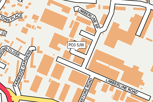
PO3 5JW is located in the Hilsea electoral ward, within the unitary authority of Portsmouth and the English Parliamentary constituency of Portsmouth North. The Sub Integrated Care Board (ICB) Location is NHS Hampshire and Isle of Wight ICB - 10R and the police force is Hampshire. This postcode has been in use since December 2016.


GetTheData
Source: OS OpenMap – Local (Ordnance Survey)
Source: OS VectorMap District (Ordnance Survey)
Licence: Open Government Licence (requires attribution)
| Easting | 466122 |
| Northing | 104012 |
| Latitude | 50.831865 |
| Longitude | -1.062445 |
GetTheData
Source: Open Postcode Geo
Licence: Open Government Licence
| Country | England |
| Postcode District | PO3 |
➜ See where PO3 is on a map ➜ Where is Portsmouth? | |
GetTheData
Source: Land Registry Price Paid Data
Licence: Open Government Licence
Elevation or altitude of PO3 5JW as distance above sea level:
| Metres | Feet | |
|---|---|---|
| Elevation | 10m | 33ft |
Elevation is measured from the approximate centre of the postcode, to the nearest point on an OS contour line from OS Terrain 50, which has contour spacing of ten vertical metres.
➜ How high above sea level am I? Find the elevation of your current position using your device's GPS.
GetTheData
Source: Open Postcode Elevation
Licence: Open Government Licence
| Ward | Hilsea |
| Constituency | Portsmouth North |
GetTheData
Source: ONS Postcode Database
Licence: Open Government Licence
| Copnor Road (Norway Road) | Hilsea | 283m |
| Norway Road | Hilsea | 291m |
| Norway Road | Hilsea | 305m |
| Green Farm Gardens (Copnor Road) | Hilsea | 378m |
| Copnor Road (Old London Road) | Hilsea | 389m |
| Hilsea Station | 0.5km |
| Cosham Station | 1.2km |
| Fratton Station | 4km |
GetTheData
Source: NaPTAN
Licence: Open Government Licence
| Median download speed | 6.2Mbps |
| Average download speed | 39.3Mbps |
| Maximum download speed | 80.00Mbps |
| Median upload speed | 1.1Mbps |
| Average upload speed | 9.7Mbps |
| Maximum upload speed | 20.00Mbps |
GetTheData
Source: Ofcom
Licence: Ofcom Terms of Use (requires attribution)
GetTheData
Source: ONS Postcode Database
Licence: Open Government Licence


➜ Get more ratings from the Food Standards Agency
GetTheData
Source: Food Standards Agency
Licence: FSA terms & conditions
| Last Collection | |||
|---|---|---|---|
| Location | Mon-Fri | Sat | Distance |
| Limberline Spur | 16:30 | 11:30 | 83m |
| Norway Road | 18:30 | 11:30 | 294m |
| Perronne Road | 16:45 | 12:00 | 358m |
GetTheData
Source: Dracos
Licence: Creative Commons Attribution-ShareAlike
| Risk of PO3 5JW flooding from rivers and sea | Medium |
| ➜ PO3 5JW flood map | |
GetTheData
Source: Open Flood Risk by Postcode
Licence: Open Government Licence
The below table lists the International Territorial Level (ITL) codes (formerly Nomenclature of Territorial Units for Statistics (NUTS) codes) and Local Administrative Units (LAU) codes for PO3 5JW:
| ITL 1 Code | Name |
|---|---|
| TLJ | South East (England) |
| ITL 2 Code | Name |
| TLJ3 | Hampshire and Isle of Wight |
| ITL 3 Code | Name |
| TLJ31 | Portsmouth |
| LAU 1 Code | Name |
| E06000044 | Portsmouth |
GetTheData
Source: ONS Postcode Directory
Licence: Open Government Licence
The below table lists the Census Output Area (OA), Lower Layer Super Output Area (LSOA), and Middle Layer Super Output Area (MSOA) for PO3 5JW:
| Code | Name | |
|---|---|---|
| OA | E00086297 | |
| LSOA | E01017090 | Portsmouth 007C |
| MSOA | E02003530 | Portsmouth 007 |
GetTheData
Source: ONS Postcode Directory
Licence: Open Government Licence
| PO3 5HT | Norway Road | 181m |
| PO3 5JF | Limberline Road | 228m |
| PO3 5QZ | Hobby Close | 279m |
| PO3 5JA | Farmside Gardens | 282m |
| PO3 5JP | Shawcross Industrial Park | 293m |
| PO3 5XE | Kingfisher Court | 297m |
| PO3 5JD | Green Farm Gardens | 307m |
| PO3 5LU | Feltons Place | 308m |
| PO3 5LX | Carronade Walk | 312m |
| PO3 5JB | Mark Close | 313m |
GetTheData
Source: Open Postcode Geo; Land Registry Price Paid Data
Licence: Open Government Licence