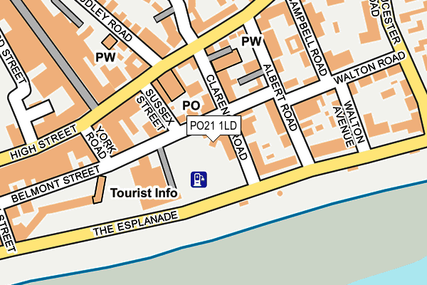
PO21 1LD is located in the Hotham electoral ward, within the local authority district of Arun and the English Parliamentary constituency of Bognor Regis and Littlehampton. The Sub Integrated Care Board (ICB) Location is NHS Sussex ICB - 70F and the police force is Sussex. This postcode has been in use since January 1980.


GetTheData
Source: OS OpenMap – Local (Ordnance Survey)
Source: OS VectorMap District (Ordnance Survey)
Licence: Open Government Licence (requires attribution)
| Easting | 493831 |
| Northing | 99020 |
| Latitude | 50.783173 |
| Longitude | -0.670373 |
GetTheData
Source: Open Postcode Geo
Licence: Open Government Licence
| Country | England |
| Postcode District | PO21 |
➜ See where PO21 is on a map ➜ Where is Bognor Regis? | |
GetTheData
Source: Land Registry Price Paid Data
Licence: Open Government Licence
Elevation or altitude of PO21 1LD as distance above sea level:
| Metres | Feet | |
|---|---|---|
| Elevation | 0m | 0ft |
Elevation is measured from the approximate centre of the postcode, to the nearest point on an OS contour line from OS Terrain 50, which has contour spacing of ten vertical metres.
➜ How high above sea level am I? Find the elevation of your current position using your device's GPS.
GetTheData
Source: Open Postcode Elevation
Licence: Open Government Licence
| Ward | Hotham |
| Constituency | Bognor Regis And Littlehampton |
GetTheData
Source: ONS Postcode Database
Licence: Open Government Licence
| Town Hall (Clarence Road) | Bognor Regis | 26m |
| Post Office (High Street) | Bognor Regis | 127m |
| York Road (Belmont Street) | Bognor Regis | 139m |
| Lyon Street Shops (Lyon Street) | Bognor Regis | 175m |
| High Street | Bognor Regis | 181m |
| Bognor Regis Station | 0.6km |
GetTheData
Source: NaPTAN
Licence: Open Government Licence
GetTheData
Source: ONS Postcode Database
Licence: Open Government Licence


➜ Get more ratings from the Food Standards Agency
GetTheData
Source: Food Standards Agency
Licence: FSA terms & conditions
| Last Collection | |||
|---|---|---|---|
| Location | Mon-Fri | Sat | Distance |
| Bognor Regis Delivery Office | 18:35 | 12:00 | 121m |
| High Street | 18:25 | 11:30 | 244m |
| High Street | 17:30 | 11:30 | 244m |
GetTheData
Source: Dracos
Licence: Creative Commons Attribution-ShareAlike
The below table lists the International Territorial Level (ITL) codes (formerly Nomenclature of Territorial Units for Statistics (NUTS) codes) and Local Administrative Units (LAU) codes for PO21 1LD:
| ITL 1 Code | Name |
|---|---|
| TLJ | South East (England) |
| ITL 2 Code | Name |
| TLJ2 | Surrey, East and West Sussex |
| ITL 3 Code | Name |
| TLJ27 | West Sussex (South West) |
| LAU 1 Code | Name |
| E07000224 | Arun |
GetTheData
Source: ONS Postcode Directory
Licence: Open Government Licence
The below table lists the Census Output Area (OA), Lower Layer Super Output Area (LSOA), and Middle Layer Super Output Area (MSOA) for PO21 1LD:
| Code | Name | |
|---|---|---|
| OA | E00172133 | |
| LSOA | E01031431 | Arun 017A |
| MSOA | E02006558 | Arun 017 |
GetTheData
Source: ONS Postcode Directory
Licence: Open Government Licence
| PO21 1LA | Alexandra Terrace | 46m |
| PO21 1XT | Alexandra Terrace | 53m |
| PO21 1LE | Belmont Street | 58m |
| PO21 1JU | Clarence Road | 64m |
| PO21 1LX | The Esplanade | 76m |
| PO21 1SF | Sussex Street | 91m |
| PO21 1NH | Albert Road | 95m |
| PO21 1NR | Albert Road | 95m |
| PO21 1RQ | High Street | 115m |
| PO21 1SQ | High Street | 117m |
GetTheData
Source: Open Postcode Geo; Land Registry Price Paid Data
Licence: Open Government Licence