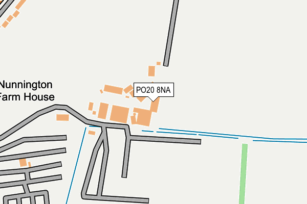
PO20 8NA is located in the The Witterings electoral ward, within the local authority district of Chichester and the English Parliamentary constituency of Chichester. The Sub Integrated Care Board (ICB) Location is NHS Sussex ICB - 70F and the police force is Sussex. This postcode has been in use since January 1980.


GetTheData
Source: OS OpenMap – Local (Ordnance Survey)
Source: OS VectorMap District (Ordnance Survey)
Licence: Open Government Licence (requires attribution)
| Easting | 478697 |
| Northing | 98811 |
| Latitude | 50.783532 |
| Longitude | -0.885028 |
GetTheData
Source: Open Postcode Geo
Licence: Open Government Licence
| Country | England |
| Postcode District | PO20 |
➜ See where PO20 is on a map | |
GetTheData
Source: Land Registry Price Paid Data
Licence: Open Government Licence
Elevation or altitude of PO20 8NA as distance above sea level:
| Metres | Feet | |
|---|---|---|
| Elevation | 0m | 0ft |
Elevation is measured from the approximate centre of the postcode, to the nearest point on an OS contour line from OS Terrain 50, which has contour spacing of ten vertical metres.
➜ How high above sea level am I? Find the elevation of your current position using your device's GPS.
GetTheData
Source: Open Postcode Elevation
Licence: Open Government Licence
| Ward | The Witterings |
| Constituency | Chichester |
GetTheData
Source: ONS Postcode Database
Licence: Open Government Licence
| Malthouse Cottages (Rookwood Road) | West Wittering | 335m |
| Malthouse Cottages (B2179) | West Wittering | 361m |
| Post Office (Rockwood Road) | West Wittering | 487m |
| Emmery Cotages (B2179) | West Wittering | 516m |
| Emmery Cotages (B2179) | West Wittering | 522m |
GetTheData
Source: NaPTAN
Licence: Open Government Licence
GetTheData
Source: ONS Postcode Database
Licence: Open Government Licence


➜ Get more ratings from the Food Standards Agency
GetTheData
Source: Food Standards Agency
Licence: FSA terms & conditions
| Last Collection | |||
|---|---|---|---|
| Location | Mon-Fri | Sat | Distance |
| Old House Farm | 16:00 | 08:00 | 2,128m |
| Bracklesham Post Office | 17:30 | 11:45 | 2,974m |
| The Bell Inn | 16:30 | 08:00 | 3,073m |
GetTheData
Source: Dracos
Licence: Creative Commons Attribution-ShareAlike
The below table lists the International Territorial Level (ITL) codes (formerly Nomenclature of Territorial Units for Statistics (NUTS) codes) and Local Administrative Units (LAU) codes for PO20 8NA:
| ITL 1 Code | Name |
|---|---|
| TLJ | South East (England) |
| ITL 2 Code | Name |
| TLJ2 | Surrey, East and West Sussex |
| ITL 3 Code | Name |
| TLJ27 | West Sussex (South West) |
| LAU 1 Code | Name |
| E07000225 | Chichester |
GetTheData
Source: ONS Postcode Directory
Licence: Open Government Licence
The below table lists the Census Output Area (OA), Lower Layer Super Output Area (LSOA), and Middle Layer Super Output Area (MSOA) for PO20 8NA:
| Code | Name | |
|---|---|---|
| OA | E00166593 | |
| LSOA | E01031540 | Chichester 013E |
| MSOA | E02006573 | Chichester 013 |
GetTheData
Source: ONS Postcode Directory
Licence: Open Government Licence
| PO20 8LZ | Rookwood Road | 69m |
| PO20 8QJ | Rookwood Road | 309m |
| PO20 8LR | Meadow Lane | 336m |
| PO20 8LS | Elms Way | 359m |
| PO20 8QL | Rookwood Road | 430m |
| PO20 8LD | Rookwood Road | 439m |
| PO20 8NQ | Elmstead Park Road | 443m |
| PO20 8LW | Elms Lane | 476m |
| PO20 8NG | Elmstead Gardens | 561m |
| PO20 8LT | Rookwood Road | 586m |
GetTheData
Source: Open Postcode Geo; Land Registry Price Paid Data
Licence: Open Government Licence