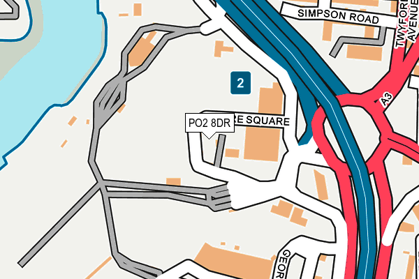
PO2 8DR is located in the Nelson electoral ward, within the unitary authority of Portsmouth and the English Parliamentary constituency of Portsmouth North. The Sub Integrated Care Board (ICB) Location is NHS Hampshire and Isle of Wight ICB - 10R and the police force is Hampshire. This postcode has been in use since January 1980.


GetTheData
Source: OS OpenMap – Local (Ordnance Survey)
Source: OS VectorMap District (Ordnance Survey)
Licence: Open Government Licence (requires attribution)
| Easting | 464305 |
| Northing | 101945 |
| Latitude | 50.813483 |
| Longitude | -1.088605 |
GetTheData
Source: Open Postcode Geo
Licence: Open Government Licence
| Country | England |
| Postcode District | PO2 |
➜ See where PO2 is on a map ➜ Where is Portsmouth? | |
GetTheData
Source: Land Registry Price Paid Data
Licence: Open Government Licence
Elevation or altitude of PO2 8DR as distance above sea level:
| Metres | Feet | |
|---|---|---|
| Elevation | 10m | 33ft |
Elevation is measured from the approximate centre of the postcode, to the nearest point on an OS contour line from OS Terrain 50, which has contour spacing of ten vertical metres.
➜ How high above sea level am I? Find the elevation of your current position using your device's GPS.
GetTheData
Source: Open Postcode Elevation
Licence: Open Government Licence
| Ward | Nelson |
| Constituency | Portsmouth North |
GetTheData
Source: ONS Postcode Database
Licence: Open Government Licence
| International Port (Wharf Road) | Stamshaw | 180m |
| Rudmore Roundabout (Mile End Road) | Mile End | 245m |
| Rudmore Roundabout (Silverlock Gardens) | Stamshaw | 267m |
| Seagrove Road (Stamshaw Road) | Stamshaw | 293m |
| Stanley Road (Twyford Avenue) | Stamshaw | 326m |
| Portsmouth & Southsea Station | 1.7km |
| Fratton Station | 2.2km |
| Portsmouth Harbour Station | 2.3km |
GetTheData
Source: NaPTAN
Licence: Open Government Licence
GetTheData
Source: ONS Postcode Database
Licence: Open Government Licence


➜ Get more ratings from the Food Standards Agency
GetTheData
Source: Food Standards Agency
Licence: FSA terms & conditions
| Last Collection | |||
|---|---|---|---|
| Location | Mon-Fri | Sat | Distance |
| Continental Ferry Port | 17:00 | 12:00 | 182m |
| Stanley Road | 16:15 | 11:30 | 383m |
| Haversham Road | 16:45 | 11:30 | 497m |
GetTheData
Source: Dracos
Licence: Creative Commons Attribution-ShareAlike
| Risk of PO2 8DR flooding from rivers and sea | Medium |
| ➜ PO2 8DR flood map | |
GetTheData
Source: Open Flood Risk by Postcode
Licence: Open Government Licence
The below table lists the International Territorial Level (ITL) codes (formerly Nomenclature of Territorial Units for Statistics (NUTS) codes) and Local Administrative Units (LAU) codes for PO2 8DR:
| ITL 1 Code | Name |
|---|---|
| TLJ | South East (England) |
| ITL 2 Code | Name |
| TLJ3 | Hampshire and Isle of Wight |
| ITL 3 Code | Name |
| TLJ31 | Portsmouth |
| LAU 1 Code | Name |
| E06000044 | Portsmouth |
GetTheData
Source: ONS Postcode Directory
Licence: Open Government Licence
The below table lists the Census Output Area (OA), Lower Layer Super Output Area (LSOA), and Middle Layer Super Output Area (MSOA) for PO2 8DR:
| Code | Name | |
|---|---|---|
| OA | E00086396 | |
| LSOA | E01017108 | Portsmouth 010C |
| MSOA | E02003533 | Portsmouth 010 |
GetTheData
Source: ONS Postcode Directory
Licence: Open Government Licence
| PO2 8EH | Simpson Road | 235m |
| PO2 8SS | Simpson Road | 235m |
| PO2 8EL | Stanley Road | 266m |
| PO2 8EW | Whale Island Way | 268m |
| PO2 7AN | Mile End Road | 274m |
| PO2 8EN | Stanley Road | 280m |
| PO2 8DD | Twyford Avenue | 302m |
| PO2 8EP | Island View Terrace | 313m |
| PO2 8DF | Twyford Avenue | 319m |
| PO2 8EY | Lower Derby Road | 331m |
GetTheData
Source: Open Postcode Geo; Land Registry Price Paid Data
Licence: Open Government Licence