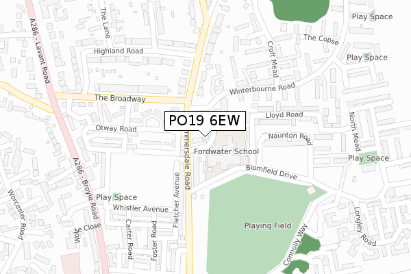
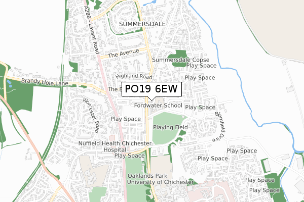
PO19 6EW is located in the Chichester North electoral ward, within the local authority district of Chichester and the English Parliamentary constituency of Chichester. The Sub Integrated Care Board (ICB) Location is NHS Sussex ICB - 70F and the police force is Sussex. This postcode has been in use since January 2019.


GetTheData
Source: OS Open Zoomstack (Ordnance Survey)
Licence: Open Government Licence (requires attribution)
Attribution: Contains OS data © Crown copyright and database right 2024
Source: Open Postcode Geo
Licence: Open Government Licence (requires attribution)
Attribution: Contains OS data © Crown copyright and database right 2024; Contains Royal Mail data © Royal Mail copyright and database right 2024; Source: Office for National Statistics licensed under the Open Government Licence v.3.0
| Easting | 486258 |
| Northing | 106510 |
| Latitude | 50.851677 |
| Longitude | -0.775990 |
GetTheData
Source: Open Postcode Geo
Licence: Open Government Licence
| Country | England |
| Postcode District | PO19 |
➜ See where PO19 is on a map ➜ Where is Chichester? | |
GetTheData
Source: Land Registry Price Paid Data
Licence: Open Government Licence
| Ward | Chichester North |
| Constituency | Chichester |
GetTheData
Source: ONS Postcode Database
Licence: Open Government Licence
| Ambulance Station (Summersdale Road) | Chichester | 105m |
| Ambulance Station (Summersdale Road) | Chichester | 111m |
| Summersdale Road (Winterbourne Road) | Chichester | 139m |
| Naunton Road (Blomfield Drive) | Chichester | 160m |
| Naunton Road (Blomfield Drive) | Chichester | 167m |
| Chichester Station | 2.2km |
| Fishbourne Station | 3.1km |
GetTheData
Source: NaPTAN
Licence: Open Government Licence
GetTheData
Source: ONS Postcode Database
Licence: Open Government Licence


➜ Get more ratings from the Food Standards Agency
GetTheData
Source: Food Standards Agency
Licence: FSA terms & conditions
| Last Collection | |||
|---|---|---|---|
| Location | Mon-Fri | Sat | Distance |
| The Barracks | 17:15 | 12:30 | 300m |
| Summersdale Post Office | 18:30 | 12:30 | 355m |
| Norwich Road | 17:30 | 12:00 | 631m |
GetTheData
Source: Dracos
Licence: Creative Commons Attribution-ShareAlike
The below table lists the International Territorial Level (ITL) codes (formerly Nomenclature of Territorial Units for Statistics (NUTS) codes) and Local Administrative Units (LAU) codes for PO19 6EW:
| ITL 1 Code | Name |
|---|---|
| TLJ | South East (England) |
| ITL 2 Code | Name |
| TLJ2 | Surrey, East and West Sussex |
| ITL 3 Code | Name |
| TLJ27 | West Sussex (South West) |
| LAU 1 Code | Name |
| E07000225 | Chichester |
GetTheData
Source: ONS Postcode Directory
Licence: Open Government Licence
The below table lists the Census Output Area (OA), Lower Layer Super Output Area (LSOA), and Middle Layer Super Output Area (MSOA) for PO19 6EW:
| Code | Name | |
|---|---|---|
| OA | E00160568 | |
| LSOA | E01031487 | Chichester 006C |
| MSOA | E02006566 | Chichester 006 |
GetTheData
Source: ONS Postcode Directory
Licence: Open Government Licence
| PO19 6PL | Summersdale Road | 72m |
| PO19 6AB | Blomfield Drive | 145m |
| PO19 6PA | Winterbourne Road | 163m |
| PO19 6PW | Summersdale Road | 166m |
| PO19 6DG | Fletcher Avenue | 187m |
| PO19 6BP | Otway Road | 188m |
| PO19 6BU | Richmond Avenue | 207m |
| PO19 6PN | Summersdale Road | 211m |
| PO19 6QR | The Broadway | 214m |
| PO19 6AZ | Lloyd Road | 216m |
GetTheData
Source: Open Postcode Geo; Land Registry Price Paid Data
Licence: Open Government Licence