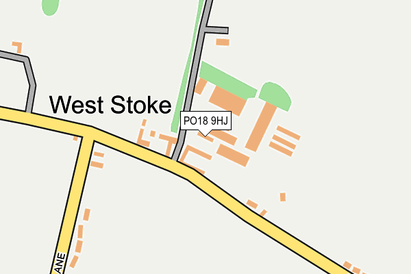
PO18 9HJ is located in the Lavant electoral ward, within the local authority district of Chichester and the English Parliamentary constituency of Chichester. The Sub Integrated Care Board (ICB) Location is NHS Sussex ICB - 70F and the police force is Sussex. This postcode has been in use since December 1994.


GetTheData
Source: OS OpenMap – Local (Ordnance Survey)
Source: OS VectorMap District (Ordnance Survey)
Licence: Open Government Licence (requires attribution)
| Easting | 483064 |
| Northing | 108584 |
| Latitude | 50.870799 |
| Longitude | -0.820902 |
GetTheData
Source: Open Postcode Geo
Licence: Open Government Licence
| Country | England |
| Postcode District | PO18 |
➜ See where PO18 is on a map ➜ Where is West Stoke? | |
GetTheData
Source: Land Registry Price Paid Data
Licence: Open Government Licence
Elevation or altitude of PO18 9HJ as distance above sea level:
| Metres | Feet | |
|---|---|---|
| Elevation | 50m | 164ft |
Elevation is measured from the approximate centre of the postcode, to the nearest point on an OS contour line from OS Terrain 50, which has contour spacing of ten vertical metres.
➜ How high above sea level am I? Find the elevation of your current position using your device's GPS.
GetTheData
Source: Open Postcode Elevation
Licence: Open Government Licence
| Ward | Lavant |
| Constituency | Chichester |
GetTheData
Source: ONS Postcode Database
Licence: Open Government Licence
| Horse & Groom (B2178) | East Ashling | 1,294m |
| Horse & Groom (B2178) | East Ashling | 1,298m |
| Fishbourne Station | 3.6km |
| Bosham Station | 3.6km |
| Chichester Station | 5.1km |
GetTheData
Source: NaPTAN
Licence: Open Government Licence
| Median download speed | 15.9Mbps |
| Average download speed | 13.4Mbps |
| Maximum download speed | 20.00Mbps |
| Median upload speed | 5.2Mbps |
| Average upload speed | 4.1Mbps |
| Maximum upload speed | 5.60Mbps |
GetTheData
Source: Ofcom
Licence: Ofcom Terms of Use (requires attribution)
GetTheData
Source: ONS Postcode Database
Licence: Open Government Licence


➜ Get more ratings from the Food Standards Agency
GetTheData
Source: Food Standards Agency
Licence: FSA terms & conditions
| Last Collection | |||
|---|---|---|---|
| Location | Mon-Fri | Sat | Distance |
| Downs Road West Stoke | 16:15 | 10:30 | 117m |
| East Ashling | 16:20 | 08:00 | 1,320m |
| West Lavant | 16:20 | 07:15 | 1,910m |
GetTheData
Source: Dracos
Licence: Creative Commons Attribution-ShareAlike
The below table lists the International Territorial Level (ITL) codes (formerly Nomenclature of Territorial Units for Statistics (NUTS) codes) and Local Administrative Units (LAU) codes for PO18 9HJ:
| ITL 1 Code | Name |
|---|---|
| TLJ | South East (England) |
| ITL 2 Code | Name |
| TLJ2 | Surrey, East and West Sussex |
| ITL 3 Code | Name |
| TLJ27 | West Sussex (South West) |
| LAU 1 Code | Name |
| E07000225 | Chichester |
GetTheData
Source: ONS Postcode Directory
Licence: Open Government Licence
The below table lists the Census Output Area (OA), Lower Layer Super Output Area (LSOA), and Middle Layer Super Output Area (MSOA) for PO18 9HJ:
| Code | Name | |
|---|---|---|
| OA | E00160678 | |
| LSOA | E01031507 | Chichester 007B |
| MSOA | E02006567 | Chichester 007 |
GetTheData
Source: ONS Postcode Directory
Licence: Open Government Licence
| PO18 9BQ | Downs Road | 62m |
| PO18 9BH | Downs Road | 105m |
| PO18 9BG | Lye Lane | 168m |
| PO18 9BD | Lye Lane | 232m |
| PO18 9BL | Downs Road | 295m |
| PO18 9BN | Downs Road | 406m |
| PO18 9BB | Lye Lane | 693m |
| PO18 9BX | 956m | |
| PO18 9BP | Downs Road | 1060m |
| PO18 9AY | 1190m |
GetTheData
Source: Open Postcode Geo; Land Registry Price Paid Data
Licence: Open Government Licence