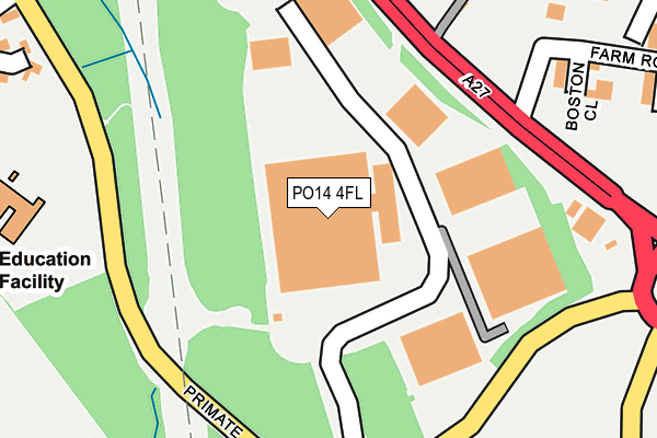
PO14 4FL is located in the Titchfield Common electoral ward, within the local authority district of Fareham and the English Parliamentary constituency of Fareham. The Sub Integrated Care Board (ICB) Location is NHS Hampshire and Isle of Wight ICB - D9Y0V and the police force is Hampshire. This postcode has been in use since March 2005.


GetTheData
Source: OS OpenMap – Local (Ordnance Survey)
Source: OS VectorMap District (Ordnance Survey)
Licence: Open Government Licence (requires attribution)
| Easting | 452983 |
| Northing | 106526 |
| Latitude | 50.855829 |
| Longitude | -1.248647 |
GetTheData
Source: Open Postcode Geo
Licence: Open Government Licence
| Country | England |
| Postcode District | PO14 |
➜ See where PO14 is on a map ➜ Where is Titchfield Park? | |
GetTheData
Source: Land Registry Price Paid Data
Licence: Open Government Licence
Elevation or altitude of PO14 4FL as distance above sea level:
| Metres | Feet | |
|---|---|---|
| Elevation | 30m | 98ft |
Elevation is measured from the approximate centre of the postcode, to the nearest point on an OS contour line from OS Terrain 50, which has contour spacing of ten vertical metres.
➜ How high above sea level am I? Find the elevation of your current position using your device's GPS.
GetTheData
Source: Open Postcode Elevation
Licence: Open Government Licence
| Ward | Titchfield Common |
| Constituency | Fareham |
GetTheData
Source: ONS Postcode Database
Licence: Open Government Licence
| Warsash Road | Titchfield Common | 242m |
| Warsash Road | Titchfield Common | 252m |
| Primate Road (Warsash Road) | Titchfield Common | 317m |
| Primate Road (Warsash Road) | Titchfield Common | 359m |
| The Hurdles (Primate Road) | Titchfield Common | 367m |
| Swanwick Station | 2.5km |
| Fareham Station | 4km |
| Bursledon Station | 5km |
GetTheData
Source: NaPTAN
Licence: Open Government Licence
GetTheData
Source: ONS Postcode Database
Licence: Open Government Licence


➜ Get more ratings from the Food Standards Agency
GetTheData
Source: Food Standards Agency
Licence: FSA terms & conditions
| Last Collection | |||
|---|---|---|---|
| Location | Mon-Fri | Sat | Distance |
| Prelate Way | 17:00 | 09:00 | 481m |
| Netley Road | 17:00 | 09:00 | 529m |
| Priory/Southampton Hill | 17:00 | 09:15 | 539m |
GetTheData
Source: Dracos
Licence: Creative Commons Attribution-ShareAlike
The below table lists the International Territorial Level (ITL) codes (formerly Nomenclature of Territorial Units for Statistics (NUTS) codes) and Local Administrative Units (LAU) codes for PO14 4FL:
| ITL 1 Code | Name |
|---|---|
| TLJ | South East (England) |
| ITL 2 Code | Name |
| TLJ3 | Hampshire and Isle of Wight |
| ITL 3 Code | Name |
| TLJ35 | South Hampshire |
| LAU 1 Code | Name |
| E07000087 | Fareham |
GetTheData
Source: ONS Postcode Directory
Licence: Open Government Licence
The below table lists the Census Output Area (OA), Lower Layer Super Output Area (LSOA), and Middle Layer Super Output Area (MSOA) for PO14 4FL:
| Code | Name | |
|---|---|---|
| OA | E00168113 | |
| LSOA | E01022786 | Fareham 007D |
| MSOA | E02004733 | Fareham 007 |
GetTheData
Source: ONS Postcode Directory
Licence: Open Government Licence
| PO14 4AW | Stable Close | 305m |
| PO14 4PD | Hunts Pond Road | 379m |
| PO14 4AN | The Hurdles | 386m |
| PO14 4BL | St Margarets Lane | 402m |
| PO14 4DP | The Gallops | 411m |
| PO14 4FW | Alpine Crescent | 411m |
| PO15 5RU | Stephenson Road | 445m |
| PO14 4BG | St Margarets Lane | 458m |
| PO14 4PS | Southampton Road | 476m |
| PO14 4FX | Camino Court | 489m |
GetTheData
Source: Open Postcode Geo; Land Registry Price Paid Data
Licence: Open Government Licence