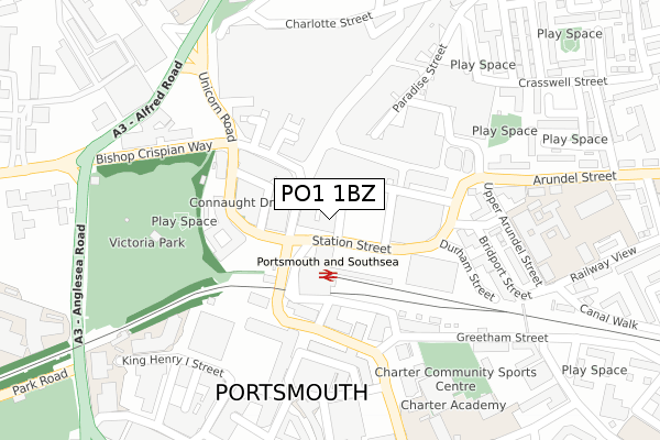
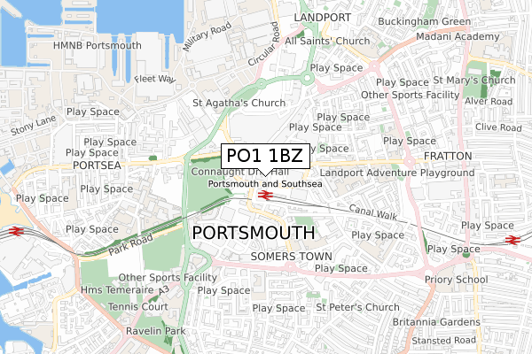
PO1 1BZ is located in the Charles Dickens electoral ward, within the unitary authority of Portsmouth and the English Parliamentary constituency of Portsmouth South. The Sub Integrated Care Board (ICB) Location is NHS Hampshire and Isle of Wight ICB - 10R and the police force is Hampshire. This postcode has been in use since September 2018.


GetTheData
Source: OS Open Zoomstack (Ordnance Survey)
Licence: Open Government Licence (requires attribution)
Attribution: Contains OS data © Crown copyright and database right 2025
Source: Open Postcode Geo
Licence: Open Government Licence (requires attribution)
Attribution: Contains OS data © Crown copyright and database right 2025; Contains Royal Mail data © Royal Mail copyright and database right 2025; Source: Office for National Statistics licensed under the Open Government Licence v.3.0
| Easting | 464206 |
| Northing | 100353 |
| Latitude | 50.799179 |
| Longitude | -1.090288 |
GetTheData
Source: Open Postcode Geo
Licence: Open Government Licence
| Country | England |
| Postcode District | PO1 |
➜ See where PO1 is on a map ➜ Where is Portsmouth? | |
GetTheData
Source: Land Registry Price Paid Data
Licence: Open Government Licence
| Ward | Charles Dickens |
| Constituency | Portsmouth South |
GetTheData
Source: ONS Postcode Database
Licence: Open Government Licence
| Station Street | Guildhall | 49m |
| City Centre South (Commercial Road South) | Guildhall | 50m |
| City Centre South (Commercial Road South) | Guildhall | 61m |
| Station Street | Guildhall | 67m |
| City Centre South (Commercial Road South) | Guildhall | 68m |
| Portsmouth & Southsea Station | 0.1km |
| Fratton Station | 1.2km |
| Portsmouth Harbour Station | 1.3km |
GetTheData
Source: NaPTAN
Licence: Open Government Licence
| Percentage of properties with Next Generation Access | 0.0% |
| Percentage of properties with Superfast Broadband | 0.0% |
| Percentage of properties with Ultrafast Broadband | 0.0% |
| Percentage of properties with Full Fibre Broadband | 0.0% |
Superfast Broadband is between 30Mbps and 300Mbps
Ultrafast Broadband is > 300Mbps
| Percentage of properties unable to receive 2Mbps | 0.0% |
| Percentage of properties unable to receive 5Mbps | 0.0% |
| Percentage of properties unable to receive 10Mbps | 0.0% |
| Percentage of properties unable to receive 30Mbps | 100.0% |
GetTheData
Source: Ofcom
Licence: Ofcom Terms of Use (requires attribution)
GetTheData
Source: ONS Postcode Database
Licence: Open Government Licence


➜ Get more ratings from the Food Standards Agency
GetTheData
Source: Food Standards Agency
Licence: FSA terms & conditions
| Last Collection | |||
|---|---|---|---|
| Location | Mon-Fri | Sat | Distance |
| Portsmouth Mail Centre | 19:30 | 14:00 | 102m |
| Portsmouth Mail Centre | 19:30 | 14:00 | 103m |
| Tesco Store | 17:00 | 11:45 | 279m |
GetTheData
Source: Dracos
Licence: Creative Commons Attribution-ShareAlike
The below table lists the International Territorial Level (ITL) codes (formerly Nomenclature of Territorial Units for Statistics (NUTS) codes) and Local Administrative Units (LAU) codes for PO1 1BZ:
| ITL 1 Code | Name |
|---|---|
| TLJ | South East (England) |
| ITL 2 Code | Name |
| TLJ3 | Hampshire and Isle of Wight |
| ITL 3 Code | Name |
| TLJ31 | Portsmouth |
| LAU 1 Code | Name |
| E06000044 | Portsmouth |
GetTheData
Source: ONS Postcode Directory
Licence: Open Government Licence
The below table lists the Census Output Area (OA), Lower Layer Super Output Area (LSOA), and Middle Layer Super Output Area (MSOA) for PO1 1BZ:
| Code | Name | |
|---|---|---|
| OA | E00174445 | |
| LSOA | E01017032 | Portsmouth 016B |
| MSOA | E02003539 | Portsmouth 016 |
GetTheData
Source: ONS Postcode Directory
Licence: Open Government Licence
| PO1 1JT | Surrey Street | 33m |
| PO1 1DE | Edinburgh Road | 148m |
| PO1 1NB | 152m | |
| PO1 1BU | Commercial Road | 156m |
| PO1 1NL | Arundel Street | 159m |
| PO1 1EX | Commercial Road | 166m |
| PO1 1BE | Station Street | 175m |
| PO1 4AA | Spring Street | 180m |
| PO1 2DS | Isambard Brunel Road | 213m |
| PO1 1LA | Upper Arundel Street | 234m |
GetTheData
Source: Open Postcode Geo; Land Registry Price Paid Data
Licence: Open Government Licence