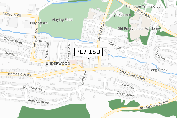
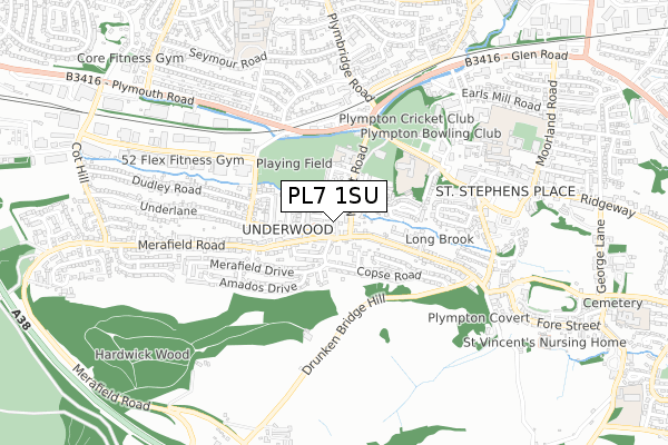
PL7 1SU is located in the Plympton Erle electoral ward, within the unitary authority of Plymouth and the English Parliamentary constituency of South West Devon. The Sub Integrated Care Board (ICB) Location is NHS Devon ICB - 15N and the police force is Devon & Cornwall. This postcode has been in use since September 2017.


GetTheData
Source: OS Open Zoomstack (Ordnance Survey)
Licence: Open Government Licence (requires attribution)
Attribution: Contains OS data © Crown copyright and database right 2025
Source: Open Postcode Geo
Licence: Open Government Licence (requires attribution)
Attribution: Contains OS data © Crown copyright and database right 2025; Contains Royal Mail data © Royal Mail copyright and database right 2025; Source: Office for National Statistics licensed under the Open Government Licence v.3.0
| Easting | 253590 |
| Northing | 56066 |
| Latitude | 50.386192 |
| Longitude | -4.060866 |
GetTheData
Source: Open Postcode Geo
Licence: Open Government Licence
| Country | England |
| Postcode District | PL7 |
➜ See where PL7 is on a map ➜ Where is Plymouth? | |
GetTheData
Source: Land Registry Price Paid Data
Licence: Open Government Licence
| Ward | Plympton Erle |
| Constituency | South West Devon |
GetTheData
Source: ONS Postcode Database
Licence: Open Government Licence
2022 4 APR £365,000 |
2017 12 DEC £265,640 |
4, HAWKMOOR CLOSE, PLYMOUTH, PL7 1SU 2017 4 OCT £285,000 |
3, HAWKMOOR CLOSE, PLYMOUTH, PL7 1SU 2017 29 SEP £275,000 |
GetTheData
Source: HM Land Registry Price Paid Data
Licence: Contains HM Land Registry data © Crown copyright and database right 2025. This data is licensed under the Open Government Licence v3.0.
| Kennel Hill Close (Kennel Hill) | Underwood | 79m |
| Kennel Hill Close (Kennel Hill) | Underwood | 91m |
| Underwood Road West (Underwood Road) | Underwood | 160m |
| Underwood Road West (Underwood Road) | Underwood | 161m |
| Merafield Drive | Underwood | 228m |
GetTheData
Source: NaPTAN
Licence: Open Government Licence
| Percentage of properties with Next Generation Access | 100.0% |
| Percentage of properties with Superfast Broadband | 100.0% |
| Percentage of properties with Ultrafast Broadband | 66.7% |
| Percentage of properties with Full Fibre Broadband | 0.0% |
Superfast Broadband is between 30Mbps and 300Mbps
Ultrafast Broadband is > 300Mbps
| Percentage of properties unable to receive 2Mbps | 0.0% |
| Percentage of properties unable to receive 5Mbps | 0.0% |
| Percentage of properties unable to receive 10Mbps | 0.0% |
| Percentage of properties unable to receive 30Mbps | 0.0% |
GetTheData
Source: Ofcom
Licence: Ofcom Terms of Use (requires attribution)
GetTheData
Source: ONS Postcode Database
Licence: Open Government Licence


➜ Get more ratings from the Food Standards Agency
GetTheData
Source: Food Standards Agency
Licence: FSA terms & conditions
| Last Collection | |||
|---|---|---|---|
| Location | Mon-Fri | Sat | Distance |
| Westfield | 17:15 | 10:45 | 1,691m |
| Hemerdon | 16:30 | 07:10 | 2,137m |
| Pike Road Post Office | 17:00 | 12:00 | 2,663m |
GetTheData
Source: Dracos
Licence: Creative Commons Attribution-ShareAlike
The below table lists the International Territorial Level (ITL) codes (formerly Nomenclature of Territorial Units for Statistics (NUTS) codes) and Local Administrative Units (LAU) codes for PL7 1SU:
| ITL 1 Code | Name |
|---|---|
| TLK | South West (England) |
| ITL 2 Code | Name |
| TLK4 | Devon |
| ITL 3 Code | Name |
| TLK41 | Plymouth |
| LAU 1 Code | Name |
| E06000026 | Plymouth |
GetTheData
Source: ONS Postcode Directory
Licence: Open Government Licence
The below table lists the Census Output Area (OA), Lower Layer Super Output Area (LSOA), and Middle Layer Super Output Area (MSOA) for PL7 1SU:
| Code | Name | |
|---|---|---|
| OA | E00076354 | |
| LSOA | E01015114 | Plymouth 019C |
| MSOA | E02003140 | Plymouth 019 |
GetTheData
Source: ONS Postcode Directory
Licence: Open Government Licence
| PL7 1SX | Underwood Road | 52m |
| PL7 1ZB | Underlane | 56m |
| PL7 1SY | Underwood Road | 73m |
| PL7 1QF | Rock Terrace | 103m |
| PL7 1QP | Potters Way | 114m |
| PL7 1QW | Market Road | 129m |
| PL7 1ZG | Lavinia Drive | 130m |
| PL7 1SZ | Underwood Road | 144m |
| PL7 1QE | Kennel Hill Close | 156m |
| PL7 1QD | Copse Close | 171m |
GetTheData
Source: Open Postcode Geo; Land Registry Price Paid Data
Licence: Open Government Licence