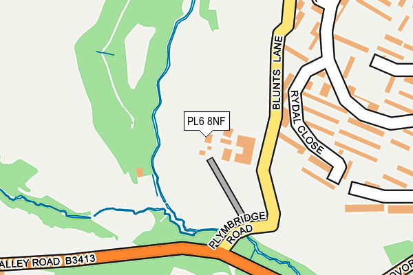
PL6 8NF is located in the Moor View electoral ward, within the unitary authority of Plymouth and the English Parliamentary constituency of Plymouth, Moor View. The Sub Integrated Care Board (ICB) Location is NHS Devon ICB - 15N and the police force is Devon & Cornwall. This postcode has been in use since January 1980.


GetTheData
Source: OS OpenMap – Local (Ordnance Survey)
Source: OS VectorMap District (Ordnance Survey)
Licence: Open Government Licence (requires attribution)
| Easting | 250389 |
| Northing | 58542 |
| Latitude | 50.407652 |
| Longitude | -4.106821 |
GetTheData
Source: Open Postcode Geo
Licence: Open Government Licence
| Country | England |
| Postcode District | PL6 |
➜ See where PL6 is on a map ➜ Where is Plymouth? | |
GetTheData
Source: Land Registry Price Paid Data
Licence: Open Government Licence
Elevation or altitude of PL6 8NF as distance above sea level:
| Metres | Feet | |
|---|---|---|
| Elevation | 30m | 98ft |
Elevation is measured from the approximate centre of the postcode, to the nearest point on an OS contour line from OS Terrain 50, which has contour spacing of ten vertical metres.
➜ How high above sea level am I? Find the elevation of your current position using your device's GPS.
GetTheData
Source: Open Postcode Elevation
Licence: Open Government Licence
| Ward | Moor View |
| Constituency | Plymouth, Moor View |
GetTheData
Source: ONS Postcode Database
Licence: Open Government Licence
| Keswick Crescent | Estover | 262m |
| Keswick Crescent | Estover | 277m |
| Childrey Gardens (Austin Crescent) | Eggbuckland | 323m |
| Dunley Walk (Austin Crescent) | Eggbuckland | 413m |
| Yewdale Gardens (Keswick Crescent) | Estover | 414m |
| Plymouth Station | 4.2km |
| Devonport Station | 5.6km |
| Dockyard (Plymouth) Station | 5.7km |
GetTheData
Source: NaPTAN
Licence: Open Government Licence
GetTheData
Source: ONS Postcode Database
Licence: Open Government Licence


➜ Get more ratings from the Food Standards Agency
GetTheData
Source: Food Standards Agency
Licence: FSA terms & conditions
| Last Collection | |||
|---|---|---|---|
| Location | Mon-Fri | Sat | Distance |
| Erlstoke Close | 17:30 | 12:30 | 375m |
| Langdale Gardens | 17:00 | 12:00 | 793m |
| Penrith Gardens | 17:15 | 12:30 | 960m |
GetTheData
Source: Dracos
Licence: Creative Commons Attribution-ShareAlike
The below table lists the International Territorial Level (ITL) codes (formerly Nomenclature of Territorial Units for Statistics (NUTS) codes) and Local Administrative Units (LAU) codes for PL6 8NF:
| ITL 1 Code | Name |
|---|---|
| TLK | South West (England) |
| ITL 2 Code | Name |
| TLK4 | Devon |
| ITL 3 Code | Name |
| TLK41 | Plymouth |
| LAU 1 Code | Name |
| E06000026 | Plymouth |
GetTheData
Source: ONS Postcode Directory
Licence: Open Government Licence
The below table lists the Census Output Area (OA), Lower Layer Super Output Area (LSOA), and Middle Layer Super Output Area (MSOA) for PL6 8NF:
| Code | Name | |
|---|---|---|
| OA | E00076259 | |
| LSOA | E01015092 | Plymouth 005C |
| MSOA | E02003126 | Plymouth 005 |
GetTheData
Source: ONS Postcode Directory
Licence: Open Government Licence
| PL6 8TR | Rydal Close | 165m |
| PL6 5QW | Baydon Close | 222m |
| PL6 5QL | Freshford Walk | 251m |
| PL6 8TS | Keswick Crescent | 262m |
| PL6 5QJ | Freshford Close | 284m |
| PL6 5QS | Austin Crescent | 295m |
| PL6 8TP | Torver Close | 311m |
| PL6 5FD | Moat Park | 322m |
| PL6 8TW | Wasdale Gardens | 336m |
| PL6 5QU | Childrey Gardens | 359m |
GetTheData
Source: Open Postcode Geo; Land Registry Price Paid Data
Licence: Open Government Licence