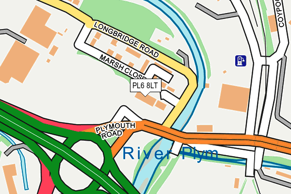
PL6 8LT is located in the Moor View electoral ward, within the unitary authority of Plymouth and the English Parliamentary constituency of Plymouth, Moor View. The Sub Integrated Care Board (ICB) Location is NHS Devon ICB - 15N and the police force is Devon & Cornwall. This postcode has been in use since January 1992.


GetTheData
Source: OS OpenMap – Local (Ordnance Survey)
Source: OS VectorMap District (Ordnance Survey)
Licence: Open Government Licence (requires attribution)
| Easting | 251890 |
| Northing | 56815 |
| Latitude | 50.392512 |
| Longitude | -4.085031 |
GetTheData
Source: Open Postcode Geo
Licence: Open Government Licence
| Country | England |
| Postcode District | PL6 |
➜ See where PL6 is on a map ➜ Where is Plymouth? | |
GetTheData
Source: Land Registry Price Paid Data
Licence: Open Government Licence
Elevation or altitude of PL6 8LT as distance above sea level:
| Metres | Feet | |
|---|---|---|
| Elevation | 10m | 33ft |
Elevation is measured from the approximate centre of the postcode, to the nearest point on an OS contour line from OS Terrain 50, which has contour spacing of ten vertical metres.
➜ How high above sea level am I? Find the elevation of your current position using your device's GPS.
GetTheData
Source: Open Postcode Elevation
Licence: Open Government Licence
| Ward | Moor View |
| Constituency | Plymouth, Moor View |
GetTheData
Source: ONS Postcode Database
Licence: Open Government Licence
| Argosy House (Longbridge Road) | Longbridge | 64m |
| Plymouth Road (Mcdonalds) | Woodford | 122m |
| Coypool P&r | Woodford | 237m |
| Marsh Mills East (Plymouth Road) | Woodford | 296m |
| Sainsbury Superstore | Crabtree | 311m |
| Plymouth Station | 4.5km |
GetTheData
Source: NaPTAN
Licence: Open Government Licence
GetTheData
Source: ONS Postcode Database
Licence: Open Government Licence


➜ Get more ratings from the Food Standards Agency
GetTheData
Source: Food Standards Agency
Licence: FSA terms & conditions
| Last Collection | |||
|---|---|---|---|
| Location | Mon-Fri | Sat | Distance |
| Pike Road Post Office | 17:00 | 12:00 | 1,062m |
| Blandford Road | 17:00 | 12:00 | 1,194m |
| Nevada Close | 17:45 | 12:00 | 1,197m |
GetTheData
Source: Dracos
Licence: Creative Commons Attribution-ShareAlike
| Risk of PL6 8LT flooding from rivers and sea | Low |
| ➜ PL6 8LT flood map | |
GetTheData
Source: Open Flood Risk by Postcode
Licence: Open Government Licence
The below table lists the International Territorial Level (ITL) codes (formerly Nomenclature of Territorial Units for Statistics (NUTS) codes) and Local Administrative Units (LAU) codes for PL6 8LT:
| ITL 1 Code | Name |
|---|---|
| TLK | South West (England) |
| ITL 2 Code | Name |
| TLK4 | Devon |
| ITL 3 Code | Name |
| TLK41 | Plymouth |
| LAU 1 Code | Name |
| E06000026 | Plymouth |
GetTheData
Source: ONS Postcode Directory
Licence: Open Government Licence
The below table lists the Census Output Area (OA), Lower Layer Super Output Area (LSOA), and Middle Layer Super Output Area (MSOA) for PL6 8LT:
| Code | Name | |
|---|---|---|
| OA | E00076267 | |
| LSOA | E01015095 | Plymouth 010D |
| MSOA | E02003131 | Plymouth 010 |
GetTheData
Source: ONS Postcode Directory
Licence: Open Government Licence
| PL6 8LB | Longbridge Avenue | 44m |
| PL6 8LN | Marsh Close | 99m |
| PL6 8LD | Longbridge Road | 261m |
| PL7 4QY | Woodford Crescent | 416m |
| PL7 4QN | Woodford Avenue | 421m |
| PL7 4RW | Triumphal Crescent | 445m |
| PL3 6PL | Crabtree Close | 452m |
| PL7 4QX | Woodford Close | 470m |
| PL3 6PG | Appleton Tor Close | 482m |
| PL7 4SE | Lynwood Avenue | 502m |
GetTheData
Source: Open Postcode Geo; Land Registry Price Paid Data
Licence: Open Government Licence