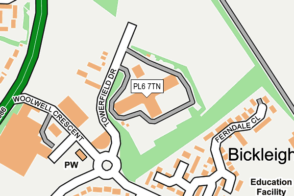
PL6 7TN is located in the Bickleigh & Cornwood electoral ward, within the local authority district of South Hams and the English Parliamentary constituency of South West Devon. The Sub Integrated Care Board (ICB) Location is NHS Devon ICB - 15N and the police force is Devon & Cornwall. This postcode has been in use since August 1993.


GetTheData
Source: OS OpenMap – Local (Ordnance Survey)
Source: OS VectorMap District (Ordnance Survey)
Licence: Open Government Licence (requires attribution)
| Easting | 250556 |
| Northing | 61709 |
| Latitude | 50.436157 |
| Longitude | -4.105735 |
GetTheData
Source: Open Postcode Geo
Licence: Open Government Licence
| Country | England |
| Postcode District | PL6 |
➜ See where PL6 is on a map ➜ Where is Plymouth? | |
GetTheData
Source: Land Registry Price Paid Data
Licence: Open Government Licence
Elevation or altitude of PL6 7TN as distance above sea level:
| Metres | Feet | |
|---|---|---|
| Elevation | 160m | 525ft |
Elevation is measured from the approximate centre of the postcode, to the nearest point on an OS contour line from OS Terrain 50, which has contour spacing of ten vertical metres.
➜ How high above sea level am I? Find the elevation of your current position using your device's GPS.
GetTheData
Source: Open Postcode Elevation
Licence: Open Government Licence
| Ward | Bickleigh & Cornwood |
| Constituency | South West Devon |
GetTheData
Source: ONS Postcode Database
Licence: Open Government Licence
| Long Park Drive (Woolwell Road) | Woolwell | 198m |
| Ferndale Close (Woolwell Road) | Woolwell | 218m |
| Roborough Footbridge | Belliver | 252m |
| Tesco Superstore Roborough | Woolwell | 283m |
| Roborough Footbridge (Tavistock Road) | Belliver | 298m |
GetTheData
Source: NaPTAN
Licence: Open Government Licence
GetTheData
Source: ONS Postcode Database
Licence: Open Government Licence


➜ Get more ratings from the Food Standards Agency
GetTheData
Source: Food Standards Agency
Licence: FSA terms & conditions
| Last Collection | |||
|---|---|---|---|
| Location | Mon-Fri | Sat | Distance |
| Tesco (Roborough) | 17:30 | 12:30 | 205m |
| Beverston Way | 17:30 | 12:30 | 533m |
| Derriford | 18:45 | 12:45 | 926m |
GetTheData
Source: Dracos
Licence: Creative Commons Attribution-ShareAlike
The below table lists the International Territorial Level (ITL) codes (formerly Nomenclature of Territorial Units for Statistics (NUTS) codes) and Local Administrative Units (LAU) codes for PL6 7TN:
| ITL 1 Code | Name |
|---|---|
| TLK | South West (England) |
| ITL 2 Code | Name |
| TLK4 | Devon |
| ITL 3 Code | Name |
| TLK43 | Devon CC |
| LAU 1 Code | Name |
| E07000044 | South Hams |
GetTheData
Source: ONS Postcode Directory
Licence: Open Government Licence
The below table lists the Census Output Area (OA), Lower Layer Super Output Area (LSOA), and Middle Layer Super Output Area (MSOA) for PL6 7TN:
| Code | Name | |
|---|---|---|
| OA | E00102014 | |
| LSOA | E01020145 | South Hams 001B |
| MSOA | E02004189 | South Hams 001 |
GetTheData
Source: ONS Postcode Directory
Licence: Open Government Licence
| PL6 7FG | Towerfield Drive | 125m |
| PL6 7HL | Hazelwood Drive | 147m |
| PL6 7HJ | Ferndale Close | 197m |
| PL6 7QN | Coppice Wood Drive | 203m |
| PL6 7HW | Blackthorn Close | 245m |
| PL6 7QA | Forresters Drive | 248m |
| PL6 7QJ | Croft Park | 258m |
| PL6 7HP | Bracken Close | 259m |
| PL6 7QB | Hawthorn Close | 297m |
| PL6 7QL | Silver Birch Close | 299m |
GetTheData
Source: Open Postcode Geo; Land Registry Price Paid Data
Licence: Open Government Licence