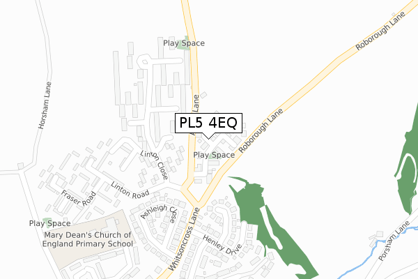
PL5 4EQ is located in the Bickleigh & Cornwood electoral ward, within the local authority district of South Hams and the English Parliamentary constituency of South West Devon. The Sub Integrated Care Board (ICB) Location is NHS Devon ICB - 15N and the police force is Devon & Cornwall. This postcode has been in use since April 2020.


GetTheData
Source: OS Open Zoomstack (Ordnance Survey)
Licence: Open Government Licence (requires attribution)
Attribution: Contains OS data © Crown copyright and database right 2025
Source: Open Postcode Geo
Licence: Open Government Licence (requires attribution)
Attribution: Contains OS data © Crown copyright and database right 2025; Contains Royal Mail data © Royal Mail copyright and database right 2025; Source: Office for National Statistics licensed under the Open Government Licence v.3.0
| Easting | 248101 |
| Northing | 62328 |
| Latitude | 50.441076 |
| Longitude | -4.140558 |
GetTheData
Source: Open Postcode Geo
Licence: Open Government Licence
| Country | England |
| Postcode District | PL5 |
➜ See where PL5 is on a map | |
GetTheData
Source: Land Registry Price Paid Data
Licence: Open Government Licence
| Ward | Bickleigh & Cornwood |
| Constituency | South West Devon |
GetTheData
Source: ONS Postcode Database
Licence: Open Government Licence
| Cunningham Road Terminus | Tamerton Foliot | 1,038m |
| Tamerton Community Centre (Cunningham Road) | Tamerton Foliot | 1,127m |
| Community Centre (Cunningham Road) | Tamerton Foliot | 1,128m |
| Henley Drive (Whitsoncross Lane) | Tamerton Foliot | 1,179m |
| Henley Drive (Whitsoncross Lane) | Tamerton Foliot | 1,189m |
| Bere Ferrers Station | 3.1km |
| St Budeaux Victoria Road Station | 5.5km |
| St Budeaux Ferry Road Station | 5.5km |
GetTheData
Source: NaPTAN
Licence: Open Government Licence
GetTheData
Source: ONS Postcode Database
Licence: Open Government Licence


➜ Get more ratings from the Food Standards Agency
GetTheData
Source: Food Standards Agency
Licence: FSA terms & conditions
| Last Collection | |||
|---|---|---|---|
| Location | Mon-Fri | Sat | Distance |
| Beverston Way | 17:30 | 12:30 | 2,017m |
| Tesco (Roborough) | 17:30 | 12:30 | 2,388m |
| Clittaford Road | 17:15 | 12:00 | 2,677m |
GetTheData
Source: Dracos
Licence: Creative Commons Attribution-ShareAlike
The below table lists the International Territorial Level (ITL) codes (formerly Nomenclature of Territorial Units for Statistics (NUTS) codes) and Local Administrative Units (LAU) codes for PL5 4EQ:
| ITL 1 Code | Name |
|---|---|
| TLK | South West (England) |
| ITL 2 Code | Name |
| TLK4 | Devon |
| ITL 3 Code | Name |
| TLK43 | Devon CC |
| LAU 1 Code | Name |
| E07000044 | South Hams |
GetTheData
Source: ONS Postcode Directory
Licence: Open Government Licence
The below table lists the Census Output Area (OA), Lower Layer Super Output Area (LSOA), and Middle Layer Super Output Area (MSOA) for PL5 4EQ:
| Code | Name | |
|---|---|---|
| OA | E00102012 | |
| LSOA | E01020145 | South Hams 001B |
| MSOA | E02004189 | South Hams 001 |
GetTheData
Source: ONS Postcode Directory
Licence: Open Government Licence
| PL5 4LZ | Porsham Lane | 603m |
| PL5 4LQ | 641m | |
| PL5 4PT | Cunningham Road | 938m |
| PL5 4LF | Coombe Lane | 1006m |
| PL5 4PS | Cunningham Road | 1020m |
| PL5 4PU | Cunningham Road | 1063m |
| PL5 4PX | Cunningham Road | 1117m |
| PL6 6JW | Winnicott Close | 1120m |
| PL5 4PP | Linton Close | 1132m |
| PL6 6NJ | Waring Road | 1150m |
GetTheData
Source: Open Postcode Geo; Land Registry Price Paid Data
Licence: Open Government Licence