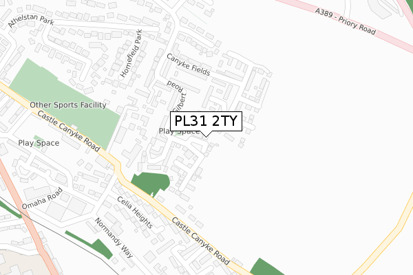
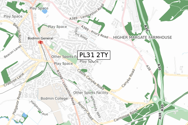
PL31 2TY is located in the Bodmin St Petroc's electoral ward, within the unitary authority of Cornwall and the English Parliamentary constituency of North Cornwall. The Sub Integrated Care Board (ICB) Location is NHS Cornwall and the Isles of Scilly ICB - 11N and the police force is Devon & Cornwall. This postcode has been in use since May 2019.


GetTheData
Source: OS Open Zoomstack (Ordnance Survey)
Licence: Open Government Licence (requires attribution)
Attribution: Contains OS data © Crown copyright and database right 2025
Source: Open Postcode Geo
Licence: Open Government Licence (requires attribution)
Attribution: Contains OS data © Crown copyright and database right 2025; Contains Royal Mail data © Royal Mail copyright and database right 2025; Source: Office for National Statistics licensed under the Open Government Licence v.3.0
| Easting | 208007 |
| Northing | 66178 |
| Latitude | 50.463913 |
| Longitude | -4.706583 |
GetTheData
Source: Open Postcode Geo
Licence: Open Government Licence
| Country | England |
| Postcode District | PL31 |
➜ See where PL31 is on a map ➜ Where is Bodmin? | |
GetTheData
Source: Land Registry Price Paid Data
Licence: Open Government Licence
| Ward | Bodmin St Petroc's |
| Constituency | North Cornwall |
GetTheData
Source: ONS Postcode Database
Licence: Open Government Licence
7, BRAY CLOSE, BODMIN, PL31 2TY 2019 17 MAY £254,950 |
GetTheData
Source: HM Land Registry Price Paid Data
Licence: Contains HM Land Registry data © Crown copyright and database right 2025. This data is licensed under the Open Government Licence v3.0.
| Roman Drive | Bodmin | 365m |
| Roman Drive | Bodmin | 371m |
| Castle Cankye Road (Castle Canyke Road) | Bodmin | 479m |
| Morrisons Main Road | Bodmin | 488m |
| Morrisons Main Road | Bodmin | 498m |
| Bodmin General (Bodmin & Wenford Railway) | Bodmin | 707m |
| Bodmin Parkway Station | 3.7km |
GetTheData
Source: NaPTAN
Licence: Open Government Licence
| Percentage of properties with Next Generation Access | 100.0% |
| Percentage of properties with Superfast Broadband | 100.0% |
| Percentage of properties with Ultrafast Broadband | 100.0% |
| Percentage of properties with Full Fibre Broadband | 100.0% |
Superfast Broadband is between 30Mbps and 300Mbps
Ultrafast Broadband is > 300Mbps
| Percentage of properties unable to receive 2Mbps | 0.0% |
| Percentage of properties unable to receive 5Mbps | 0.0% |
| Percentage of properties unable to receive 10Mbps | 0.0% |
| Percentage of properties unable to receive 30Mbps | 0.0% |
GetTheData
Source: Ofcom
Licence: Ofcom Terms of Use (requires attribution)
GetTheData
Source: ONS Postcode Database
Licence: Open Government Licence


➜ Get more ratings from the Food Standards Agency
GetTheData
Source: Food Standards Agency
Licence: FSA terms & conditions
| Last Collection | |||
|---|---|---|---|
| Location | Mon-Fri | Sat | Distance |
| College Green | 17:00 | 11:15 | 500m |
| Bodmin Delivery Office | 17:45 | 12:30 | 1,105m |
| Midland Bank | 17:20 | 11:20 | 1,184m |
GetTheData
Source: Dracos
Licence: Creative Commons Attribution-ShareAlike
The below table lists the International Territorial Level (ITL) codes (formerly Nomenclature of Territorial Units for Statistics (NUTS) codes) and Local Administrative Units (LAU) codes for PL31 2TY:
| ITL 1 Code | Name |
|---|---|
| TLK | South West (England) |
| ITL 2 Code | Name |
| TLK3 | Cornwall and Isles of Scilly |
| ITL 3 Code | Name |
| TLK30 | Cornwall and Isles of Scilly |
| LAU 1 Code | Name |
| E06000052 | Cornwall |
GetTheData
Source: ONS Postcode Directory
Licence: Open Government Licence
The below table lists the Census Output Area (OA), Lower Layer Super Output Area (LSOA), and Middle Layer Super Output Area (MSOA) for PL31 2TY:
| Code | Name | |
|---|---|---|
| OA | E00095610 | |
| LSOA | E01018934 | Cornwall 014C |
| MSOA | E02003941 | Cornwall 014 |
GetTheData
Source: ONS Postcode Directory
Licence: Open Government Licence
| PL31 2GL | Riding Close | 51m |
| PL31 2GJ | Mudge Walk | 64m |
| PL31 2GN | Pennington Close | 84m |
| PL31 2GH | Charnley Drive | 86m |
| PL31 2GP | Wilmott Walk | 87m |
| PL31 2FF | Gilbert Road | 103m |
| PL31 2FH | Raleigh Gardens | 123m |
| PL31 2GD | Canyke Meadows | 133m |
| PL31 2GG | Wassail Close | 149m |
| PL31 2FG | Canyke Fields | 162m |
GetTheData
Source: Open Postcode Geo; Land Registry Price Paid Data
Licence: Open Government Licence