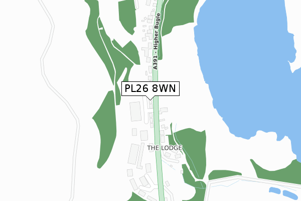
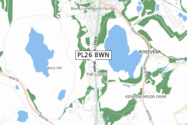
PL26 8WN is located in the Roche & Bugle electoral ward, within the unitary authority of Cornwall and the English Parliamentary constituency of St Austell and Newquay. The Sub Integrated Care Board (ICB) Location is NHS Cornwall and the Isles of Scilly ICB - 11N and the police force is Devon & Cornwall. This postcode has been in use since November 2019.


GetTheData
Source: OS Open Zoomstack (Ordnance Survey)
Licence: Open Government Licence (requires attribution)
Attribution: Contains OS data © Crown copyright and database right 2025
Source: Open Postcode Geo
Licence: Open Government Licence (requires attribution)
Attribution: Contains OS data © Crown copyright and database right 2025; Contains Royal Mail data © Royal Mail copyright and database right 2025; Source: Office for National Statistics licensed under the Open Government Licence v.3.0
| Easting | 201452 |
| Northing | 58039 |
| Latitude | 50.388620 |
| Longitude | -4.794520 |
GetTheData
Source: Open Postcode Geo
Licence: Open Government Licence
| Country | England |
| Postcode District | PL26 |
➜ See where PL26 is on a map | |
GetTheData
Source: Land Registry Price Paid Data
Licence: Open Government Licence
| Ward | Roche & Bugle |
| Constituency | St Austell And Newquay |
GetTheData
Source: ONS Postcode Database
Licence: Open Government Licence
| Silverton Parc (Higher Bugle) | Bugle | 116m |
| Silverton Parc (Higher Bugle) | Bugle | 127m |
| Carnsmerry (Fore Street) | Bugle | 483m |
| Carnsmerry (Higher Bugle) | Bugle | 487m |
| Caudledown Lane (Stannary Road) | Stenalees | 650m |
| Bugle Station | 1.3km |
| Luxulyan Station | 3.4km |
| Roche Station | 4.2km |
GetTheData
Source: NaPTAN
Licence: Open Government Licence
GetTheData
Source: ONS Postcode Database
Licence: Open Government Licence


➜ Get more ratings from the Food Standards Agency
GetTheData
Source: Food Standards Agency
Licence: FSA terms & conditions
| Last Collection | |||
|---|---|---|---|
| Location | Mon-Fri | Sat | Distance |
| Rosevear | 15:40 | 07:00 | 783m |
| Stenalees Post Office | 17:00 | 11:15 | 868m |
| Bugle Post Office | 17:00 | 11:10 | 949m |
GetTheData
Source: Dracos
Licence: Creative Commons Attribution-ShareAlike
The below table lists the International Territorial Level (ITL) codes (formerly Nomenclature of Territorial Units for Statistics (NUTS) codes) and Local Administrative Units (LAU) codes for PL26 8WN:
| ITL 1 Code | Name |
|---|---|
| TLK | South West (England) |
| ITL 2 Code | Name |
| TLK3 | Cornwall and Isles of Scilly |
| ITL 3 Code | Name |
| TLK30 | Cornwall and Isles of Scilly |
| LAU 1 Code | Name |
| E06000052 | Cornwall |
GetTheData
Source: ONS Postcode Directory
Licence: Open Government Licence
The below table lists the Census Output Area (OA), Lower Layer Super Output Area (LSOA), and Middle Layer Super Output Area (MSOA) for PL26 8WN:
| Code | Name | |
|---|---|---|
| OA | E00096392 | |
| LSOA | E01019076 | Cornwall 027F |
| MSOA | E02003957 | Cornwall 027 |
GetTheData
Source: ONS Postcode Directory
Licence: Open Government Licence
| PL26 8RQ | Silverton Parc | 114m |
| PL26 8PY | Higher Bugle | 117m |
| PL26 8SX | Stannary Road | 390m |
| PL26 8RD | Higher Bugle | 416m |
| PL26 8PZ | Higher Netley Cottages | 430m |
| PL26 8TH | Chynoweth | 456m |
| PL26 8GH | Higher Bugle | 460m |
| PL26 8PX | Carnsmerry | 486m |
| PL26 8SU | Stannary Road | 605m |
| PL26 8TG | Caudledown Lane | 617m |
GetTheData
Source: Open Postcode Geo; Land Registry Price Paid Data
Licence: Open Government Licence