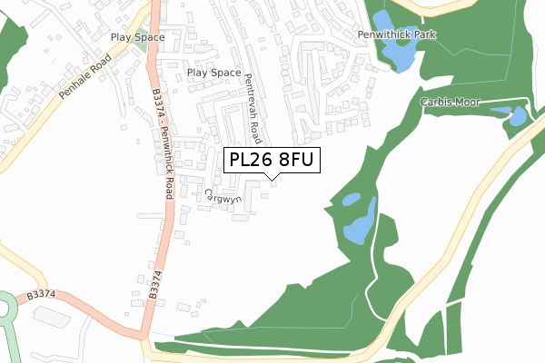
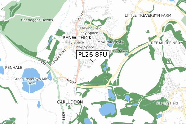
PL26 8FU is located in the Penwithick & Boscoppa electoral ward, within the unitary authority of Cornwall and the English Parliamentary constituency of St Austell and Newquay. The Sub Integrated Care Board (ICB) Location is NHS Cornwall and the Isles of Scilly ICB - 11N and the police force is Devon & Cornwall. This postcode has been in use since June 2019.


GetTheData
Source: OS Open Zoomstack (Ordnance Survey)
Licence: Open Government Licence (requires attribution)
Attribution: Contains OS data © Crown copyright and database right 2025
Source: Open Postcode Geo
Licence: Open Government Licence (requires attribution)
Attribution: Contains OS data © Crown copyright and database right 2025; Contains Royal Mail data © Royal Mail copyright and database right 2025; Source: Office for National Statistics licensed under the Open Government Licence v.3.0
| Easting | 202614 |
| Northing | 55971 |
| Latitude | 50.370435 |
| Longitude | -4.777108 |
GetTheData
Source: Open Postcode Geo
Licence: Open Government Licence
| Country | England |
| Postcode District | PL26 |
➜ See where PL26 is on a map ➜ Where is Penwithick? | |
GetTheData
Source: Land Registry Price Paid Data
Licence: Open Government Licence
| Ward | Penwithick & Boscoppa |
| Constituency | St Austell And Newquay |
GetTheData
Source: ONS Postcode Database
Licence: Open Government Licence
| Pengrowyn (Penwithick Road) | Penwithick | 199m |
| Pengrowyn (Penwithick Road) | Penwithick | 209m |
| Penwithick Road (Penwithhick Road) | Penwithick | 322m |
| Penwithick Road (Penwithhick Road) | Penwithick | 325m |
| Roundabout | Carluddon | 400m |
| Luxulyan Station | 3km |
| Bugle Station | 3.5km |
| St Austell Station | 3.6km |
GetTheData
Source: NaPTAN
Licence: Open Government Licence
| Percentage of properties with Next Generation Access | 100.0% |
| Percentage of properties with Superfast Broadband | 0.0% |
| Percentage of properties with Ultrafast Broadband | 0.0% |
| Percentage of properties with Full Fibre Broadband | 0.0% |
Superfast Broadband is between 30Mbps and 300Mbps
Ultrafast Broadband is > 300Mbps
| Percentage of properties unable to receive 2Mbps | 0.0% |
| Percentage of properties unable to receive 5Mbps | 0.0% |
| Percentage of properties unable to receive 10Mbps | 0.0% |
| Percentage of properties unable to receive 30Mbps | 100.0% |
GetTheData
Source: Ofcom
Licence: Ofcom Terms of Use (requires attribution)
GetTheData
Source: ONS Postcode Database
Licence: Open Government Licence


➜ Get more ratings from the Food Standards Agency
GetTheData
Source: Food Standards Agency
Licence: FSA terms & conditions
| Last Collection | |||
|---|---|---|---|
| Location | Mon-Fri | Sat | Distance |
| Penwithick Post Office | 16:00 | 10:30 | 352m |
| Penwithick Park | 16:00 | 09:30 | 378m |
| Carludden | 10:30 | 09:00 | 630m |
GetTheData
Source: Dracos
Licence: Creative Commons Attribution-ShareAlike
The below table lists the International Territorial Level (ITL) codes (formerly Nomenclature of Territorial Units for Statistics (NUTS) codes) and Local Administrative Units (LAU) codes for PL26 8FU:
| ITL 1 Code | Name |
|---|---|
| TLK | South West (England) |
| ITL 2 Code | Name |
| TLK3 | Cornwall and Isles of Scilly |
| ITL 3 Code | Name |
| TLK30 | Cornwall and Isles of Scilly |
| LAU 1 Code | Name |
| E06000052 | Cornwall |
GetTheData
Source: ONS Postcode Directory
Licence: Open Government Licence
The below table lists the Census Output Area (OA), Lower Layer Super Output Area (LSOA), and Middle Layer Super Output Area (MSOA) for PL26 8FU:
| Code | Name | |
|---|---|---|
| OA | E00096398 | |
| LSOA | E01019075 | Cornwall 027E |
| MSOA | E02003957 | Cornwall 027 |
GetTheData
Source: ONS Postcode Directory
Licence: Open Government Licence
| PL26 8TZ | Cargwyn | 99m |
| PL26 8TS | Rosina Way | 103m |
| PL26 8UA | Pentrevah Road | 124m |
| PL26 8UB | Ashley Close | 126m |
| PL26 8UG | Penwithick Road | 172m |
| PL26 8YX | Penwithick Park | 173m |
| PL26 8XZ | Penwithick Park | 179m |
| PL26 8TT | Helena Court | 205m |
| PL26 8UQ | Penwithick Road | 215m |
| PL26 8UN | Grose Hill Crescent | 298m |
GetTheData
Source: Open Postcode Geo; Land Registry Price Paid Data
Licence: Open Government Licence