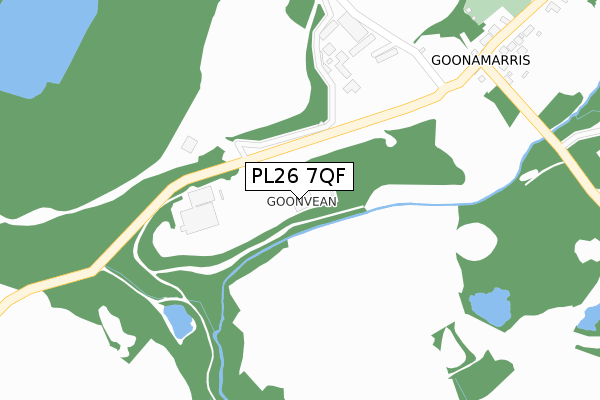
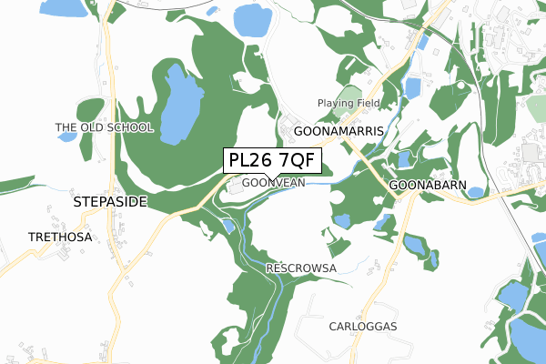
PL26 7QF is located in the St Stephen-in-Brannel electoral ward, within the unitary authority of Cornwall and the English Parliamentary constituency of St Austell and Newquay. The Sub Integrated Care Board (ICB) Location is NHS Cornwall and the Isles of Scilly ICB - 11N and the police force is Devon & Cornwall. This postcode has been in use since January 1980.


GetTheData
Source: OS Open Zoomstack (Ordnance Survey)
Licence: Open Government Licence (requires attribution)
Attribution: Contains OS data © Crown copyright and database right 2025
Source: Open Postcode Geo
Licence: Open Government Licence (requires attribution)
Attribution: Contains OS data © Crown copyright and database right 2025; Contains Royal Mail data © Royal Mail copyright and database right 2025; Source: Office for National Statistics licensed under the Open Government Licence v.3.0
| Easting | 195188 |
| Northing | 55012 |
| Latitude | 50.359283 |
| Longitude | -4.880877 |
GetTheData
Source: Open Postcode Geo
Licence: Open Government Licence
| Country | England |
| Postcode District | PL26 |
➜ See where PL26 is on a map | |
GetTheData
Source: Land Registry Price Paid Data
Licence: Open Government Licence
Elevation or altitude of PL26 7QF as distance above sea level:
| Metres | Feet | |
|---|---|---|
| Elevation | 140m | 459ft |
Elevation is measured from the approximate centre of the postcode, to the nearest point on an OS contour line from OS Terrain 50, which has contour spacing of ten vertical metres.
➜ How high above sea level am I? Find the elevation of your current position using your device's GPS.
GetTheData
Source: Open Postcode Elevation
Licence: Open Government Licence
| Ward | St Stephen-in-brannel |
| Constituency | St Austell And Newquay |
GetTheData
Source: ONS Postcode Database
Licence: Open Government Licence
| Trethosa Turn | Trethosa | 868m |
| Trethosa Turn | Trethosa | 878m |
| Garages | Trethosa | 962m |
| Garages | Trethosa | 972m |
| Kernick Dryers | Treviscoe | 1,097m |
| St Columb Road Station | 6.1km |
GetTheData
Source: NaPTAN
Licence: Open Government Licence
GetTheData
Source: ONS Postcode Database
Licence: Open Government Licence


➜ Get more ratings from the Food Standards Agency
GetTheData
Source: Food Standards Agency
Licence: FSA terms & conditions
| Last Collection | |||
|---|---|---|---|
| Location | Mon-Fri | Sat | Distance |
| Foxhole Post Office | 16:30 | 11:00 | 1,323m |
| Nanpean Post Office | 16:15 | 11:00 | 1,381m |
| Trethosa Road | 16:00 | 09:30 | 1,593m |
GetTheData
Source: Dracos
Licence: Creative Commons Attribution-ShareAlike
The below table lists the International Territorial Level (ITL) codes (formerly Nomenclature of Territorial Units for Statistics (NUTS) codes) and Local Administrative Units (LAU) codes for PL26 7QF:
| ITL 1 Code | Name |
|---|---|
| TLK | South West (England) |
| ITL 2 Code | Name |
| TLK3 | Cornwall and Isles of Scilly |
| ITL 3 Code | Name |
| TLK30 | Cornwall and Isles of Scilly |
| LAU 1 Code | Name |
| E06000052 | Cornwall |
GetTheData
Source: ONS Postcode Directory
Licence: Open Government Licence
The below table lists the Census Output Area (OA), Lower Layer Super Output Area (LSOA), and Middle Layer Super Output Area (MSOA) for PL26 7QF:
| Code | Name | |
|---|---|---|
| OA | E00096366 | |
| LSOA | E01019069 | Cornwall 030A |
| MSOA | E02003958 | Cornwall 030 |
GetTheData
Source: ONS Postcode Directory
Licence: Open Government Licence
| PL26 7QX | 284m | |
| PL26 7QY | 616m | |
| PL26 7YP | Fernleigh Terrace | 710m |
| PL26 7QZ | Goonabarn Cottages | 749m |
| PL26 7QJ | 814m | |
| PL26 7RA | 875m | |
| PL26 7QQ | 900m | |
| PL26 7RR | Stepaside Corner | 957m |
| PL26 7QG | 965m | |
| PL26 7QL | 965m |
GetTheData
Source: Open Postcode Geo; Land Registry Price Paid Data
Licence: Open Government Licence