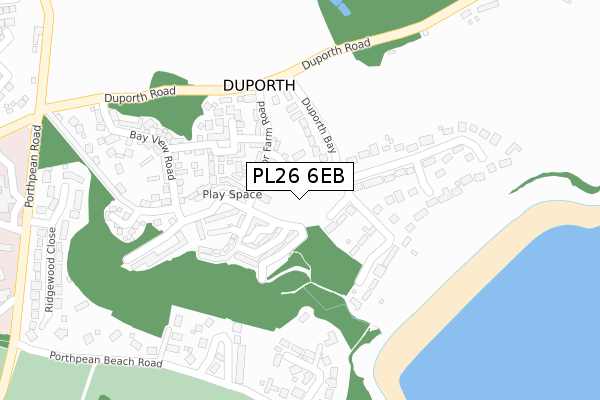
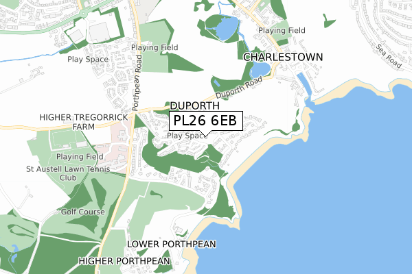
PL26 6EB is located in the Mevagissey & St Austell Bay electoral ward, within the unitary authority of Cornwall and the English Parliamentary constituency of St Austell and Newquay. The Sub Integrated Care Board (ICB) Location is NHS Cornwall and the Isles of Scilly ICB - 11N and the police force is Devon & Cornwall. This postcode has been in use since April 2019.


GetTheData
Source: OS Open Zoomstack (Ordnance Survey)
Licence: Open Government Licence (requires attribution)
Attribution: Contains OS data © Crown copyright and database right 2024
Source: Open Postcode Geo
Licence: Open Government Licence (requires attribution)
Attribution: Contains OS data © Crown copyright and database right 2024; Contains Royal Mail data © Royal Mail copyright and database right 2024; Source: Office for National Statistics licensed under the Open Government Licence v.3.0
| Easting | 203279 |
| Northing | 51288 |
| Latitude | 50.328591 |
| Longitude | -4.765323 |
GetTheData
Source: Open Postcode Geo
Licence: Open Government Licence
| Country | England |
| Postcode District | PL26 |
➜ See where PL26 is on a map ➜ Where is Duporth? | |
GetTheData
Source: Land Registry Price Paid Data
Licence: Open Government Licence
| Ward | Mevagissey & St Austell Bay |
| Constituency | St Austell And Newquay |
GetTheData
Source: ONS Postcode Database
Licence: Open Government Licence
| Duporth Two Coves | Charlestown | 115m |
| Duporth Two Coves | Charlestown | 126m |
| Duporth Bay (Duporth Road) | Charlestown | 207m |
| Duporth Bay (Duporth Road) | Charlestown | 214m |
| Duporth Turn (Porthpean Road) | St Austell | 441m |
| St Austell Station | 2.1km |
| Par Station | 5.2km |
GetTheData
Source: NaPTAN
Licence: Open Government Licence
GetTheData
Source: ONS Postcode Database
Licence: Open Government Licence


➜ Get more ratings from the Food Standards Agency
GetTheData
Source: Food Standards Agency
Licence: FSA terms & conditions
| Last Collection | |||
|---|---|---|---|
| Location | Mon-Fri | Sat | Distance |
| The Docks | 16:45 | 07:30 | 763m |
| Charlestown Road | 16:45 | 12:00 | 812m |
| Asda | 17:45 | 12:00 | 951m |
GetTheData
Source: Dracos
Licence: Creative Commons Attribution-ShareAlike
The below table lists the International Territorial Level (ITL) codes (formerly Nomenclature of Territorial Units for Statistics (NUTS) codes) and Local Administrative Units (LAU) codes for PL26 6EB:
| ITL 1 Code | Name |
|---|---|
| TLK | South West (England) |
| ITL 2 Code | Name |
| TLK3 | Cornwall and Isles of Scilly |
| ITL 3 Code | Name |
| TLK30 | Cornwall and Isles of Scilly |
| LAU 1 Code | Name |
| E06000052 | Cornwall |
GetTheData
Source: ONS Postcode Directory
Licence: Open Government Licence
The below table lists the Census Output Area (OA), Lower Layer Super Output Area (LSOA), and Middle Layer Super Output Area (MSOA) for PL26 6EB:
| Code | Name | |
|---|---|---|
| OA | E00096094 | |
| LSOA | E01019017 | Cornwall 036E |
| MSOA | E02003961 | Cornwall 036 |
GetTheData
Source: ONS Postcode Directory
Licence: Open Government Licence
| PL26 6DU | Clock Tower Court | 72m |
| PL26 6DW | Rashleigh Road | 83m |
| PL26 6BS | Garden Walk | 115m |
| PL26 6DH | Pavilion Rise | 116m |
| PL26 6AE | Duporth Bay | 117m |
| PL26 6AQ | Duporth Bay | 132m |
| PL26 6BD | Manor Farm Road | 136m |
| PL26 6BA | Orchard Way | 142m |
| PL26 6BW | Rope Walk | 147m |
| PL26 6AW | Pagoda Drive | 157m |
GetTheData
Source: Open Postcode Geo; Land Registry Price Paid Data
Licence: Open Government Licence