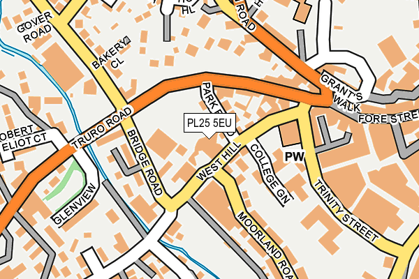
PL25 5EU is located in the St Austell Central & Gover electoral ward, within the unitary authority of Cornwall and the English Parliamentary constituency of St Austell and Newquay. The Sub Integrated Care Board (ICB) Location is NHS Cornwall and the Isles of Scilly ICB - 11N and the police force is Devon & Cornwall. This postcode has been in use since January 1980.


GetTheData
Source: OS OpenMap – Local (Ordnance Survey)
Source: OS VectorMap District (Ordnance Survey)
Licence: Open Government Licence (requires attribution)
| Easting | 201034 |
| Northing | 52399 |
| Latitude | 50.337829 |
| Longitude | -4.797370 |
GetTheData
Source: Open Postcode Geo
Licence: Open Government Licence
| Country | England |
| Postcode District | PL25 |
➜ See where PL25 is on a map ➜ Where is St Austell? | |
GetTheData
Source: Land Registry Price Paid Data
Licence: Open Government Licence
Elevation or altitude of PL25 5EU as distance above sea level:
| Metres | Feet | |
|---|---|---|
| Elevation | 40m | 131ft |
Elevation is measured from the approximate centre of the postcode, to the nearest point on an OS contour line from OS Terrain 50, which has contour spacing of ten vertical metres.
➜ How high above sea level am I? Find the elevation of your current position using your device's GPS.
GetTheData
Source: Open Postcode Elevation
Licence: Open Government Licence
| Ward | St Austell Central & Gover |
| Constituency | St Austell And Newquay |
GetTheData
Source: ONS Postcode Database
Licence: Open Government Licence
| Co-op (West Hill) | St Austell | 66m |
| Co-op (West Hill) | St Austell | 80m |
| Flats (Bridge Road) | St Austell | 100m |
| White River Cinema (Trinity Street) | St Austell | 142m |
| White River Cinema | St Austell | 159m |
| St Austell Station | 0.6km |
GetTheData
Source: NaPTAN
Licence: Open Government Licence
GetTheData
Source: ONS Postcode Database
Licence: Open Government Licence


➜ Get more ratings from the Food Standards Agency
GetTheData
Source: Food Standards Agency
Licence: FSA terms & conditions
| Last Collection | |||
|---|---|---|---|
| Location | Mon-Fri | Sat | Distance |
| Fore Street | 16:00 | 12:00 | 315m |
| Tregonney Hill | 11:15 | 10:30 | 330m |
| Tremena | 17:00 | 09:30 | 421m |
GetTheData
Source: Dracos
Licence: Creative Commons Attribution-ShareAlike
The below table lists the International Territorial Level (ITL) codes (formerly Nomenclature of Territorial Units for Statistics (NUTS) codes) and Local Administrative Units (LAU) codes for PL25 5EU:
| ITL 1 Code | Name |
|---|---|
| TLK | South West (England) |
| ITL 2 Code | Name |
| TLK3 | Cornwall and Isles of Scilly |
| ITL 3 Code | Name |
| TLK30 | Cornwall and Isles of Scilly |
| LAU 1 Code | Name |
| E06000052 | Cornwall |
GetTheData
Source: ONS Postcode Directory
Licence: Open Government Licence
The below table lists the Census Output Area (OA), Lower Layer Super Output Area (LSOA), and Middle Layer Super Output Area (MSOA) for PL25 5EU:
| Code | Name | |
|---|---|---|
| OA | E00096169 | |
| LSOA | E01019034 | Cornwall 038B |
| MSOA | E02003962 | Cornwall 038 |
GetTheData
Source: ONS Postcode Directory
Licence: Open Government Licence
| PL25 5EZ | Park Road | 49m |
| PL25 5HA | Grenville Court | 60m |
| PL25 5ET | West Hill | 77m |
| PL25 5HD | Bridge Road | 78m |
| PL25 5HE | Bridge Road | 121m |
| PL25 5JF | Truro Road | 128m |
| PL25 5EY | West Hill | 131m |
| PL25 5ES | College Green | 137m |
| PL25 5AT | Blowing House Lane | 177m |
| PL25 5AE | Bodmin Road | 177m |
GetTheData
Source: Open Postcode Geo; Land Registry Price Paid Data
Licence: Open Government Licence