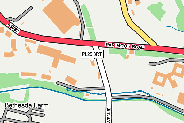
PL25 3RT is located in the Mevagissey & St Austell Bay electoral ward, within the unitary authority of Cornwall and the English Parliamentary constituency of St Austell and Newquay. The Sub Integrated Care Board (ICB) Location is NHS Cornwall and the Isles of Scilly ICB - 11N and the police force is Devon & Cornwall. This postcode has been in use since December 1997.


GetTheData
Source: OS OpenMap – Local (Ordnance Survey)
Source: OS VectorMap District (Ordnance Survey)
Licence: Open Government Licence (requires attribution)
| Easting | 205462 |
| Northing | 52851 |
| Latitude | 50.343369 |
| Longitude | -4.735454 |
GetTheData
Source: Open Postcode Geo
Licence: Open Government Licence
| Country | England |
| Postcode District | PL25 |
➜ See where PL25 is on a map ➜ Where is St Blazey? | |
GetTheData
Source: Land Registry Price Paid Data
Licence: Open Government Licence
Elevation or altitude of PL25 3RT as distance above sea level:
| Metres | Feet | |
|---|---|---|
| Elevation | 10m | 33ft |
Elevation is measured from the approximate centre of the postcode, to the nearest point on an OS contour line from OS Terrain 50, which has contour spacing of ten vertical metres.
➜ How high above sea level am I? Find the elevation of your current position using your device's GPS.
GetTheData
Source: Open Postcode Elevation
Licence: Open Government Licence
| Ward | Mevagissey & St Austell Bay |
| Constituency | St Austell And Newquay |
GetTheData
Source: ONS Postcode Database
Licence: Open Government Licence
| Par Market (Par Moor Road) | Carlyon Bay | 39m |
| Par Market (Par Moor Road) | Carlyon Bay | 42m |
| Cornish Market World | Tregrehan | 263m |
| Rear Cornish Market World | St Blazey Gate | 398m |
| Cornish Market World | Tregrehan | 415m |
| Par Station | 2.6km |
| St Austell Station | 3.9km |
GetTheData
Source: NaPTAN
Licence: Open Government Licence
GetTheData
Source: ONS Postcode Database
Licence: Open Government Licence


➜ Get more ratings from the Food Standards Agency
GetTheData
Source: Food Standards Agency
Licence: FSA terms & conditions
| Last Collection | |||
|---|---|---|---|
| Location | Mon-Fri | Sat | Distance |
| Carlyon Bay | 16:45 | 10:30 | 696m |
| The Docks | 16:45 | 07:30 | 1,982m |
| Charlestown Road | 16:45 | 12:00 | 2,083m |
GetTheData
Source: Dracos
Licence: Creative Commons Attribution-ShareAlike
The below table lists the International Territorial Level (ITL) codes (formerly Nomenclature of Territorial Units for Statistics (NUTS) codes) and Local Administrative Units (LAU) codes for PL25 3RT:
| ITL 1 Code | Name |
|---|---|
| TLK | South West (England) |
| ITL 2 Code | Name |
| TLK3 | Cornwall and Isles of Scilly |
| ITL 3 Code | Name |
| TLK30 | Cornwall and Isles of Scilly |
| LAU 1 Code | Name |
| E06000052 | Cornwall |
GetTheData
Source: ONS Postcode Directory
Licence: Open Government Licence
The below table lists the Census Output Area (OA), Lower Layer Super Output Area (LSOA), and Middle Layer Super Output Area (MSOA) for PL25 3RT:
| Code | Name | |
|---|---|---|
| OA | E00096089 | |
| LSOA | E01019017 | Cornwall 036E |
| MSOA | E02003961 | Cornwall 036 |
GetTheData
Source: ONS Postcode Directory
Licence: Open Government Licence
| PL24 2SH | Pennys Lane | 407m |
| PL24 2SL | St Austell Road | 428m |
| PL25 3SE | Crinnis Close | 535m |
| PL25 3SJ | Sea Road | 553m |
| PL25 3SD | Crinnis Close | 596m |
| PL24 2HW | Biscovey Road | 616m |
| PL25 3RH | 631m | |
| PL24 2SN | St Austell Road | 632m |
| PL24 2HA | St Marys Road | 664m |
| PL25 3SA | Beach Road | 669m |
GetTheData
Source: Open Postcode Geo; Land Registry Price Paid Data
Licence: Open Government Licence