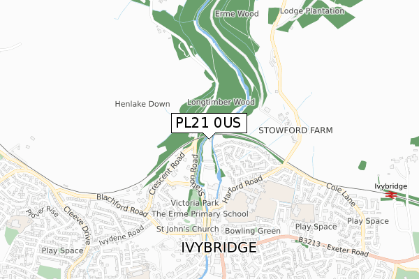
PL21 0US is located in the Ivybridge East electoral ward, within the local authority district of South Hams and the English Parliamentary constituency of South West Devon. The Sub Integrated Care Board (ICB) Location is NHS Devon ICB - 15N and the police force is Devon & Cornwall. This postcode has been in use since November 2019.


GetTheData
Source: OS Open Zoomstack (Ordnance Survey)
Licence: Open Government Licence (requires attribution)
Attribution: Contains OS data © Crown copyright and database right 2025
Source: Open Postcode Geo
Licence: Open Government Licence (requires attribution)
Attribution: Contains OS data © Crown copyright and database right 2025; Contains Royal Mail data © Royal Mail copyright and database right 2025; Source: Office for National Statistics licensed under the Open Government Licence v.3.0
| Easting | 263636 |
| Northing | 56914 |
| Latitude | 50.396231 |
| Longitude | -3.919946 |
GetTheData
Source: Open Postcode Geo
Licence: Open Government Licence
| Country | England |
| Postcode District | PL21 |
➜ See where PL21 is on a map ➜ Where is Ivybridge? | |
GetTheData
Source: Land Registry Price Paid Data
Licence: Open Government Licence
| Ward | Ivybridge East |
| Constituency | South West Devon |
GetTheData
Source: ONS Postcode Database
Licence: Open Government Licence
| Macandrew Walk (Cole Lane) | Ivybridge | 509m |
| Cole Lane Top (Cole Lane) | Ivybridge | 543m |
| Sportsmans Inn (Exeter Road) | Ivybridge | 662m |
| Sportsmans Inn (Exeter Road) | Ivybridge | 673m |
| Marshalls Field (Exeter Road) | Ivybridge | 718m |
| Ivybridge Station | 1.2km |
GetTheData
Source: NaPTAN
Licence: Open Government Licence
GetTheData
Source: ONS Postcode Database
Licence: Open Government Licence


➜ Get more ratings from the Food Standards Agency
GetTheData
Source: Food Standards Agency
Licence: FSA terms & conditions
| Last Collection | |||
|---|---|---|---|
| Location | Mon-Fri | Sat | Distance |
| Board School | 16:30 | 12:00 | 483m |
| Cole Lane | 16:15 | 12:00 | 485m |
| Fore Street | 18:15 | 12:45 | 832m |
GetTheData
Source: Dracos
Licence: Creative Commons Attribution-ShareAlike
The below table lists the International Territorial Level (ITL) codes (formerly Nomenclature of Territorial Units for Statistics (NUTS) codes) and Local Administrative Units (LAU) codes for PL21 0US:
| ITL 1 Code | Name |
|---|---|
| TLK | South West (England) |
| ITL 2 Code | Name |
| TLK4 | Devon |
| ITL 3 Code | Name |
| TLK43 | Devon CC |
| LAU 1 Code | Name |
| E07000044 | South Hams |
GetTheData
Source: ONS Postcode Directory
Licence: Open Government Licence
The below table lists the Census Output Area (OA), Lower Layer Super Output Area (LSOA), and Middle Layer Super Output Area (MSOA) for PL21 0US:
| Code | Name | |
|---|---|---|
| OA | E00102108 | |
| LSOA | E01020164 | South Hams 005D |
| MSOA | E02004193 | South Hams 005 |
GetTheData
Source: ONS Postcode Directory
Licence: Open Government Licence
| PL21 0RX | Carter Road | 175m |
| PL21 0AG | Station Cottages | 186m |
| PL21 0AH | Station Road | 200m |
| PL21 0PN | Cole Lane | 203m |
| PL21 0PW | Allans Road | 287m |
| PL21 0PP | Wood Park | 288m |
| PL21 0AR | Harford Road | 310m |
| PL21 0AQ | Beacon Road | 365m |
| PL21 0BS | Crescent Gardens | 423m |
| PL21 0AF | Brunel Way | 450m |
GetTheData
Source: Open Postcode Geo; Land Registry Price Paid Data
Licence: Open Government Licence