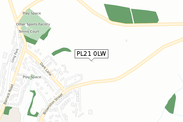
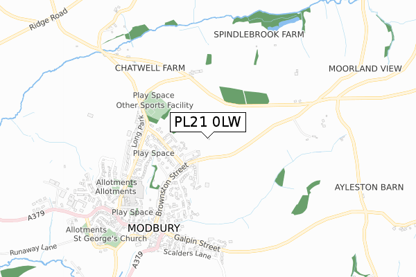
PL21 0LW is located in the Charterlands electoral ward, within the local authority district of South Hams and the English Parliamentary constituency of South West Devon. The Sub Integrated Care Board (ICB) Location is NHS Devon ICB - 15N and the police force is Devon & Cornwall. This postcode has been in use since October 2019.


GetTheData
Source: OS Open Zoomstack (Ordnance Survey)
Licence: Open Government Licence (requires attribution)
Attribution: Contains OS data © Crown copyright and database right 2025
Source: Open Postcode Geo
Licence: Open Government Licence (requires attribution)
Attribution: Contains OS data © Crown copyright and database right 2025; Contains Royal Mail data © Royal Mail copyright and database right 2025; Source: Office for National Statistics licensed under the Open Government Licence v.3.0
| Easting | 266178 |
| Northing | 52153 |
| Latitude | 50.354021 |
| Longitude | -3.882507 |
GetTheData
Source: Open Postcode Geo
Licence: Open Government Licence
| Country | England |
| Postcode District | PL21 |
➜ See where PL21 is on a map ➜ Where is Modbury? | |
GetTheData
Source: Land Registry Price Paid Data
Licence: Open Government Licence
| Ward | Charterlands |
| Constituency | South West Devon |
GetTheData
Source: ONS Postcode Database
Licence: Open Government Licence
HIGHER TRAINE BARN, MODBURY, IVYBRIDGE, PL21 0LW 2017 21 NOV £261,595 |
GetTheData
Source: HM Land Registry Price Paid Data
Licence: Contains HM Land Registry data © Crown copyright and database right 2025. This data is licensed under the Open Government Licence v3.0.
| Post Office (Broad Street) | Modbury | 623m |
| Post Office (Broad Street) | Modbury | 628m |
| Palm Cross (A379) | Modbury | 718m |
| Palm Cross | Modbury | 736m |
| Fancy Cross (A379) | Modbury | 1,408m |
| Ivybridge Station | 4.6km |
GetTheData
Source: NaPTAN
Licence: Open Government Licence
| Percentage of properties with Next Generation Access | 100.0% |
| Percentage of properties with Superfast Broadband | 100.0% |
| Percentage of properties with Ultrafast Broadband | 0.0% |
| Percentage of properties with Full Fibre Broadband | 0.0% |
Superfast Broadband is between 30Mbps and 300Mbps
Ultrafast Broadband is > 300Mbps
| Percentage of properties unable to receive 2Mbps | 0.0% |
| Percentage of properties unable to receive 5Mbps | 0.0% |
| Percentage of properties unable to receive 10Mbps | 0.0% |
| Percentage of properties unable to receive 30Mbps | 0.0% |
GetTheData
Source: Ofcom
Licence: Ofcom Terms of Use (requires attribution)
GetTheData
Source: ONS Postcode Database
Licence: Open Government Licence


➜ Get more ratings from the Food Standards Agency
GetTheData
Source: Food Standards Agency
Licence: FSA terms & conditions
| Last Collection | |||
|---|---|---|---|
| Location | Mon-Fri | Sat | Distance |
| Central Avenue | 18:30 | 09:15 | 4,667m |
| Fore Street | 18:15 | 12:45 | 4,791m |
| Board School | 16:30 | 12:00 | 5,002m |
GetTheData
Source: Dracos
Licence: Creative Commons Attribution-ShareAlike
The below table lists the International Territorial Level (ITL) codes (formerly Nomenclature of Territorial Units for Statistics (NUTS) codes) and Local Administrative Units (LAU) codes for PL21 0LW:
| ITL 1 Code | Name |
|---|---|
| TLK | South West (England) |
| ITL 2 Code | Name |
| TLK4 | Devon |
| ITL 3 Code | Name |
| TLK43 | Devon CC |
| LAU 1 Code | Name |
| E07000044 | South Hams |
GetTheData
Source: ONS Postcode Directory
Licence: Open Government Licence
The below table lists the Census Output Area (OA), Lower Layer Super Output Area (LSOA), and Middle Layer Super Output Area (MSOA) for PL21 0LW:
| Code | Name | |
|---|---|---|
| OA | E00102091 | |
| LSOA | E01020158 | South Hams 008B |
| MSOA | E02004196 | South Hams 008 |
GetTheData
Source: ONS Postcode Directory
Licence: Open Government Licence
| PL21 0RL | Traine Villas | 144m |
| PL21 0TE | Treveor Gardens | 181m |
| PL21 0RY | Oakwood Drive | 213m |
| PL21 0RJ | Silverwell Park | 264m |
| PL21 0RD | Dark Lane | 284m |
| PL21 0RS | Cromwell Park | 286m |
| PL21 0RN | 287m | |
| PL21 0RH | 308m | |
| PL21 0TY | Champernowne | 395m |
| PL21 0TX | Ayleston Park | 409m |
GetTheData
Source: Open Postcode Geo; Land Registry Price Paid Data
Licence: Open Government Licence