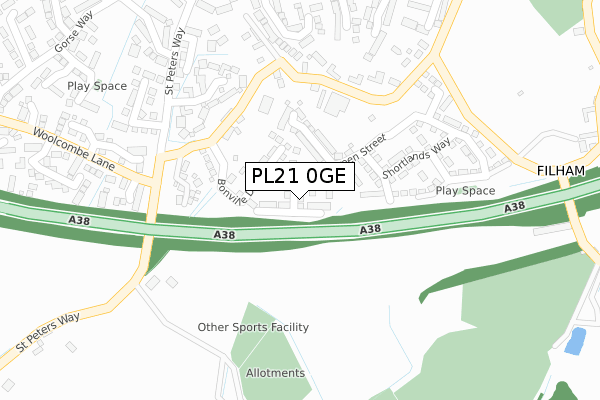
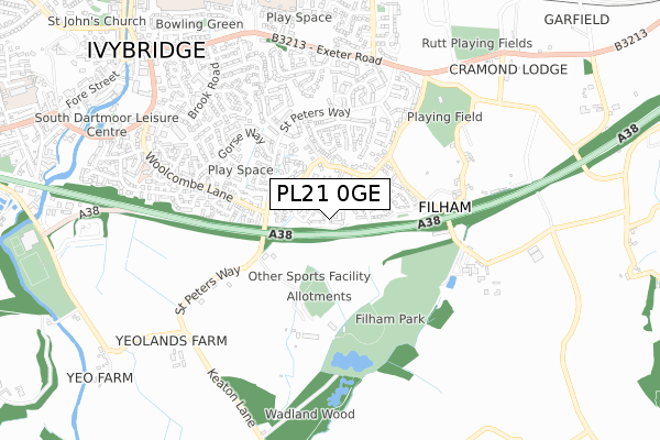
PL21 0GE is located in the Ivybridge East electoral ward, within the local authority district of South Hams and the English Parliamentary constituency of South West Devon. The Sub Integrated Care Board (ICB) Location is NHS Devon ICB - 15N and the police force is Devon & Cornwall. This postcode has been in use since September 2018.


GetTheData
Source: OS Open Zoomstack (Ordnance Survey)
Licence: Open Government Licence (requires attribution)
Attribution: Contains OS data © Crown copyright and database right 2025
Source: Open Postcode Geo
Licence: Open Government Licence (requires attribution)
Attribution: Contains OS data © Crown copyright and database right 2025; Contains Royal Mail data © Royal Mail copyright and database right 2025; Source: Office for National Statistics licensed under the Open Government Licence v.3.0
| Easting | 264380 |
| Northing | 55620 |
| Latitude | 50.384772 |
| Longitude | -3.909018 |
GetTheData
Source: Open Postcode Geo
Licence: Open Government Licence
| Country | England |
| Postcode District | PL21 |
➜ See where PL21 is on a map ➜ Where is Ivybridge? | |
GetTheData
Source: Land Registry Price Paid Data
Licence: Open Government Licence
| Ward | Ivybridge East |
| Constituency | South West Devon |
GetTheData
Source: ONS Postcode Database
Licence: Open Government Licence
2, BUTTON LANE, IVYBRIDGE, PL21 0GE 2018 6 SEP £349,995 |
GetTheData
Source: HM Land Registry Price Paid Data
Licence: Contains HM Land Registry data © Crown copyright and database right 2025. This data is licensed under the Open Government Licence v3.0.
| Filham Moor Close (St Peters Way) | Ivybridge | 266m |
| Filham Moor Close (St Peters Way) | Ivybridge | 274m |
| Waltham Way (Woolcombe Lane) | Ivybridge | 319m |
| Waltham Way (Woolcombe Lane) | Ivybridge | 375m |
| Waterslade Drive (St Peters Way) | Ivybridge | 406m |
| Ivybridge Station | 1km |
GetTheData
Source: NaPTAN
Licence: Open Government Licence
| Percentage of properties with Next Generation Access | 100.0% |
| Percentage of properties with Superfast Broadband | 100.0% |
| Percentage of properties with Ultrafast Broadband | 100.0% |
| Percentage of properties with Full Fibre Broadband | 100.0% |
Superfast Broadband is between 30Mbps and 300Mbps
Ultrafast Broadband is > 300Mbps
| Percentage of properties unable to receive 2Mbps | 0.0% |
| Percentage of properties unable to receive 5Mbps | 0.0% |
| Percentage of properties unable to receive 10Mbps | 0.0% |
| Percentage of properties unable to receive 30Mbps | 0.0% |
GetTheData
Source: Ofcom
Licence: Ofcom Terms of Use (requires attribution)
GetTheData
Source: ONS Postcode Database
Licence: Open Government Licence

➜ Get more ratings from the Food Standards Agency
GetTheData
Source: Food Standards Agency
Licence: FSA terms & conditions
| Last Collection | |||
|---|---|---|---|
| Location | Mon-Fri | Sat | Distance |
| Fore Street | 18:15 | 12:45 | 1,036m |
| Board School | 16:30 | 12:00 | 1,134m |
| Cole Lane | 16:15 | 12:00 | 1,171m |
GetTheData
Source: Dracos
Licence: Creative Commons Attribution-ShareAlike
The below table lists the International Territorial Level (ITL) codes (formerly Nomenclature of Territorial Units for Statistics (NUTS) codes) and Local Administrative Units (LAU) codes for PL21 0GE:
| ITL 1 Code | Name |
|---|---|
| TLK | South West (England) |
| ITL 2 Code | Name |
| TLK4 | Devon |
| ITL 3 Code | Name |
| TLK43 | Devon CC |
| LAU 1 Code | Name |
| E07000044 | South Hams |
GetTheData
Source: ONS Postcode Directory
Licence: Open Government Licence
The below table lists the Census Output Area (OA), Lower Layer Super Output Area (LSOA), and Middle Layer Super Output Area (MSOA) for PL21 0GE:
| Code | Name | |
|---|---|---|
| OA | E00102099 | |
| LSOA | E01020160 | South Hams 002C |
| MSOA | E02004190 | South Hams 002 |
GetTheData
Source: ONS Postcode Directory
Licence: Open Government Licence
| PL21 0LT | Godwell Lane | 198m |
| PL21 0FT | Torrhill Gardens | 242m |
| PL21 0WF | Charles Hankin Close | 244m |
| PL21 0LE | Godwell Lane | 280m |
| PL21 0YF | Waltham Way | 296m |
| PL21 0YG | Canterbury Close | 299m |
| PL21 0FE | Wellstones Close | 312m |
| PL21 0FH | Langlands Meadow | 312m |
| PL21 0WE | Tom Maddock Gardens | 317m |
| PL21 0FB | Woodfield Crescent | 318m |
GetTheData
Source: Open Postcode Geo; Land Registry Price Paid Data
Licence: Open Government Licence