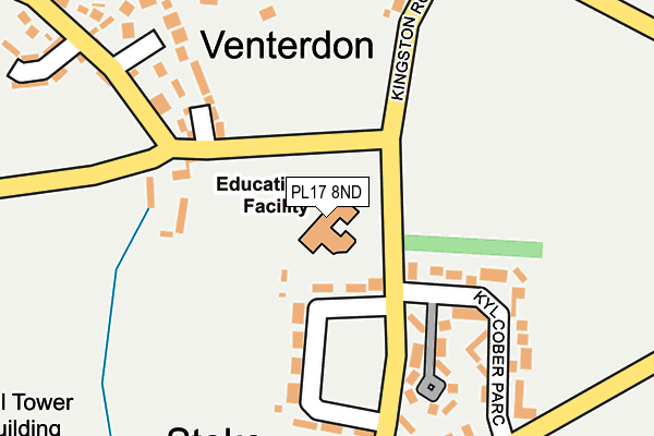
PL17 8ND is located in the Altarnun & Stoke Climsland electoral ward, within the unitary authority of Cornwall and the English Parliamentary constituency of North Cornwall. The Sub Integrated Care Board (ICB) Location is NHS Cornwall and the Isles of Scilly ICB - 11N and the police force is Devon & Cornwall. This postcode has been in use since December 1995.


GetTheData
Source: OS OpenMap – Local (Ordnance Survey)
Source: OS VectorMap District (Ordnance Survey)
Licence: Open Government Licence (requires attribution)
| Easting | 235964 |
| Northing | 74669 |
| Latitude | 50.548713 |
| Longitude | -4.316732 |
GetTheData
Source: Open Postcode Geo
Licence: Open Government Licence
| Country | England |
| Postcode District | PL17 |
➜ See where PL17 is on a map ➜ Where is Stoke Climsland? | |
GetTheData
Source: Land Registry Price Paid Data
Licence: Open Government Licence
Elevation or altitude of PL17 8ND as distance above sea level:
| Metres | Feet | |
|---|---|---|
| Elevation | 140m | 459ft |
Elevation is measured from the approximate centre of the postcode, to the nearest point on an OS contour line from OS Terrain 50, which has contour spacing of ten vertical metres.
➜ How high above sea level am I? Find the elevation of your current position using your device's GPS.
GetTheData
Source: Open Postcode Elevation
Licence: Open Government Licence
| Ward | Altarnun & Stoke Climsland |
| Constituency | North Cornwall |
GetTheData
Source: ONS Postcode Database
Licence: Open Government Licence
| Recreation Ground (Kingston Road) | Stoke Climsland | 174m |
| Duck Pond (Venterdon) | Stoke Climsland | 184m |
| Recreation Ground (Kingston Road) | Stoke Climsland | 217m |
| Dingle Close | Venterdon | 234m |
| Duchy College (Stoke Road) | Stoke Climsland | 300m |
GetTheData
Source: NaPTAN
Licence: Open Government Licence
GetTheData
Source: ONS Postcode Database
Licence: Open Government Licence


➜ Get more ratings from the Food Standards Agency
GetTheData
Source: Food Standards Agency
Licence: FSA terms & conditions
| Last Collection | |||
|---|---|---|---|
| Location | Mon-Fri | Sat | Distance |
| Bowling Green | 16:30 | 10:00 | 2,003m |
| Bray Shop | 15:15 | 10:00 | 2,982m |
| Horsebridge | 10:00 | 10:00 | 4,117m |
GetTheData
Source: Dracos
Licence: Creative Commons Attribution-ShareAlike
The below table lists the International Territorial Level (ITL) codes (formerly Nomenclature of Territorial Units for Statistics (NUTS) codes) and Local Administrative Units (LAU) codes for PL17 8ND:
| ITL 1 Code | Name |
|---|---|
| TLK | South West (England) |
| ITL 2 Code | Name |
| TLK3 | Cornwall and Isles of Scilly |
| ITL 3 Code | Name |
| TLK30 | Cornwall and Isles of Scilly |
| LAU 1 Code | Name |
| E06000052 | Cornwall |
GetTheData
Source: ONS Postcode Directory
Licence: Open Government Licence
The below table lists the Census Output Area (OA), Lower Layer Super Output Area (LSOA), and Middle Layer Super Output Area (MSOA) for PL17 8ND:
| Code | Name | |
|---|---|---|
| OA | E00095787 | |
| LSOA | E01018967 | Cornwall 006E |
| MSOA | E02003936 | Cornwall 006 |
GetTheData
Source: ONS Postcode Directory
Licence: Open Government Licence
| PL17 8PA | Duchy Cottages | 131m |
| PL17 8PJ | Anvil Court | 158m |
| PL17 8PH | Kyl Cober Parc | 178m |
| PL17 8PL | Dingle Close | 234m |
| PL17 8PD | 240m | |
| PL17 8NY | 259m | |
| PL17 8PF | Trevendon | 315m |
| PL17 8NX | 320m | |
| PL17 8PG | 321m | |
| PL17 8NZ | 398m |
GetTheData
Source: Open Postcode Geo; Land Registry Price Paid Data
Licence: Open Government Licence