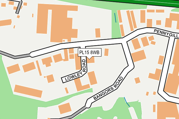
PL15 8WB is located in the Altarnun & Stoke Climsland electoral ward, within the unitary authority of Cornwall and the English Parliamentary constituency of North Cornwall. The Sub Integrated Care Board (ICB) Location is NHS Cornwall and the Isles of Scilly ICB - 11N and the police force is Devon & Cornwall. This postcode has been in use since December 2001.


GetTheData
Source: OS OpenMap – Local (Ordnance Survey)
Source: OS VectorMap District (Ordnance Survey)
Licence: Open Government Licence (requires attribution)
| Easting | 231780 |
| Northing | 83558 |
| Latitude | 50.627392 |
| Longitude | -4.379761 |
GetTheData
Source: Open Postcode Geo
Licence: Open Government Licence
| Country | England |
| Postcode District | PL15 |
➜ See where PL15 is on a map ➜ Where is Launceston? | |
GetTheData
Source: Land Registry Price Paid Data
Licence: Open Government Licence
Elevation or altitude of PL15 8WB as distance above sea level:
| Metres | Feet | |
|---|---|---|
| Elevation | 140m | 459ft |
Elevation is measured from the approximate centre of the postcode, to the nearest point on an OS contour line from OS Terrain 50, which has contour spacing of ten vertical metres.
➜ How high above sea level am I? Find the elevation of your current position using your device's GPS.
GetTheData
Source: Open Postcode Elevation
Licence: Open Government Licence
| Ward | Altarnun & Stoke Climsland |
| Constituency | North Cornwall |
GetTheData
Source: ONS Postcode Database
Licence: Open Government Licence
| Guinness Trust (George Fox Close) | Launceston | 548m |
| Guinness Trust (George Fox Close) | Launceston | 557m |
| Pennygillam (Western Road) | Launceston | 702m |
| Tregaller Lane (B3254) | Daws House | 712m |
| Pennygillam | Launceston | 721m |
GetTheData
Source: NaPTAN
Licence: Open Government Licence
GetTheData
Source: ONS Postcode Database
Licence: Open Government Licence


➜ Get more ratings from the Food Standards Agency
GetTheData
Source: Food Standards Agency
Licence: FSA terms & conditions
| Last Collection | |||
|---|---|---|---|
| Location | Mon-Fri | Sat | Distance |
| Kennards House | 10:30 | 10:30 | 2,982m |
| Lanstephan | 17:15 | 10:15 | 3,962m |
GetTheData
Source: Dracos
Licence: Creative Commons Attribution-ShareAlike
The below table lists the International Territorial Level (ITL) codes (formerly Nomenclature of Territorial Units for Statistics (NUTS) codes) and Local Administrative Units (LAU) codes for PL15 8WB:
| ITL 1 Code | Name |
|---|---|
| TLK | South West (England) |
| ITL 2 Code | Name |
| TLK3 | Cornwall and Isles of Scilly |
| ITL 3 Code | Name |
| TLK30 | Cornwall and Isles of Scilly |
| LAU 1 Code | Name |
| E06000052 | Cornwall |
GetTheData
Source: ONS Postcode Directory
Licence: Open Government Licence
The below table lists the Census Output Area (OA), Lower Layer Super Output Area (LSOA), and Middle Layer Super Output Area (MSOA) for PL15 8WB:
| Code | Name | |
|---|---|---|
| OA | E00095782 | |
| LSOA | E01018965 | Cornwall 006C |
| MSOA | E02003936 | Cornwall 006 |
GetTheData
Source: ONS Postcode Directory
Licence: Open Government Licence
| PL15 7PY | Lowley Road | 42m |
| PL15 7ED | Pennygillam Way | 59m |
| PL15 7PH | Bangors Road | 168m |
| PL15 7EF | Hawks Tor | 324m |
| PL15 7EP | 363m | |
| PL15 7DN | Moorland Road | 574m |
| PL15 7JG | 605m | |
| PL15 7JS | Higher Daws Lane | 606m |
| PL15 7JQ | Tregaller Close | 616m |
| PL15 7DW | Upper Chapel | 622m |
GetTheData
Source: Open Postcode Geo; Land Registry Price Paid Data
Licence: Open Government Licence