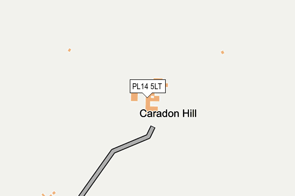
PL14 5LT is located in the Lynher electoral ward, within the unitary authority of Cornwall and the English Parliamentary constituency of South East Cornwall. The Sub Integrated Care Board (ICB) Location is NHS Cornwall and the Isles of Scilly ICB - 11N and the police force is Devon & Cornwall. This postcode has been in use since January 1980.


GetTheData
Source: OS OpenMap – Local (Ordnance Survey)
Source: OS VectorMap District (Ordnance Survey)
Licence: Open Government Licence (requires attribution)
| Easting | 227338 |
| Northing | 70784 |
| Latitude | 50.511322 |
| Longitude | -4.436574 |
GetTheData
Source: Open Postcode Geo
Licence: Open Government Licence
| Country | England |
| Postcode District | PL14 |
➜ See where PL14 is on a map | |
GetTheData
Source: Land Registry Price Paid Data
Licence: Open Government Licence
Elevation or altitude of PL14 5LT as distance above sea level:
| Metres | Feet | |
|---|---|---|
| Elevation | 360m | 1,181ft |
Elevation is measured from the approximate centre of the postcode, to the nearest point on an OS contour line from OS Terrain 50, which has contour spacing of ten vertical metres.
➜ How high above sea level am I? Find the elevation of your current position using your device's GPS.
GetTheData
Source: Open Postcode Elevation
Licence: Open Government Licence
| Ward | Lynher |
| Constituency | South East Cornwall |
GetTheData
Source: ONS Postcode Database
Licence: Open Government Licence
| Methodist Chapel | Minions | 1,240m |
| Post Office | Minions | 1,251m |
| Tokenbury Corner (B3254) | Pensilva | 1,252m |
| Tokenbury Corner | Pensilva | 1,259m |
| Cheesewring Hotel | Minions | 1,281m |
GetTheData
Source: NaPTAN
Licence: Open Government Licence
GetTheData
Source: ONS Postcode Database
Licence: Open Government Licence


➜ Get more ratings from the Food Standards Agency
GetTheData
Source: Food Standards Agency
Licence: FSA terms & conditions
| Last Collection | |||
|---|---|---|---|
| Location | Mon-Fri | Sat | Distance |
| Minions Post Office | 15:45 | 11:00 | 1,254m |
| Crows Nest | 15:30 | 11:00 | 1,751m |
| Polyphant | 16:30 | 07:45 | 2,675m |
GetTheData
Source: Dracos
Licence: Creative Commons Attribution-ShareAlike
The below table lists the International Territorial Level (ITL) codes (formerly Nomenclature of Territorial Units for Statistics (NUTS) codes) and Local Administrative Units (LAU) codes for PL14 5LT:
| ITL 1 Code | Name |
|---|---|
| TLK | South West (England) |
| ITL 2 Code | Name |
| TLK3 | Cornwall and Isles of Scilly |
| ITL 3 Code | Name |
| TLK30 | Cornwall and Isles of Scilly |
| LAU 1 Code | Name |
| E06000052 | Cornwall |
GetTheData
Source: ONS Postcode Directory
Licence: Open Government Licence
The below table lists the Census Output Area (OA), Lower Layer Super Output Area (LSOA), and Middle Layer Super Output Area (MSOA) for PL14 5LT:
| Code | Name | |
|---|---|---|
| OA | E00094788 | |
| LSOA | E01018777 | Cornwall 012A |
| MSOA | E02003893 | Cornwall 012 |
GetTheData
Source: ONS Postcode Directory
Licence: Open Government Licence
| PL14 5AJ | 799m | |
| PL14 5BL | 958m | |
| PL14 5LS | Duchy Terrace | 1059m |
| PL14 5LQ | 1112m | |
| PL14 5AA | 1139m | |
| PL14 5PJ | 1158m | |
| PL14 5LF | 1181m | |
| PL14 5LR | Midmoor Cottages | 1185m |
| PL14 5AY | 1197m | |
| PL14 5LE | 1219m |
GetTheData
Source: Open Postcode Geo; Land Registry Price Paid Data
Licence: Open Government Licence