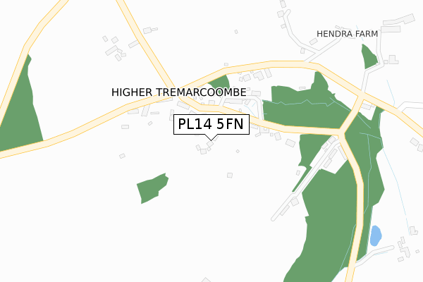
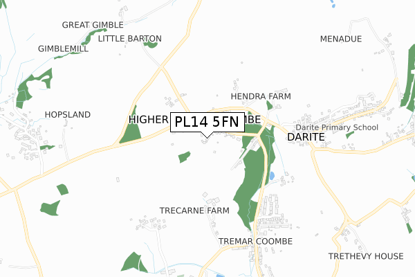
PL14 5FN is located in the St Cleer & Menheniot electoral ward, within the unitary authority of Cornwall and the English Parliamentary constituency of South East Cornwall. The Sub Integrated Care Board (ICB) Location is NHS Cornwall and the Isles of Scilly ICB - 11N and the police force is Devon & Cornwall. This postcode has been in use since February 2019.


GetTheData
Source: OS Open Zoomstack (Ordnance Survey)
Licence: Open Government Licence (requires attribution)
Attribution: Contains OS data © Crown copyright and database right 2024
Source: Open Postcode Geo
Licence: Open Government Licence (requires attribution)
Attribution: Contains OS data © Crown copyright and database right 2024; Contains Royal Mail data © Royal Mail copyright and database right 2024; Source: Office for National Statistics licensed under the Open Government Licence v.3.0
| Easting | 225131 |
| Northing | 69309 |
| Latitude | 50.497403 |
| Longitude | -4.467015 |
GetTheData
Source: Open Postcode Geo
Licence: Open Government Licence
| Country | England |
| Postcode District | PL14 |
➜ See where PL14 is on a map | |
GetTheData
Source: Land Registry Price Paid Data
Licence: Open Government Licence
| Ward | St Cleer & Menheniot |
| Constituency | South East Cornwall |
GetTheData
Source: ONS Postcode Database
Licence: Open Government Licence
| Ply Cottages | Higher Tremarcoombe | 140m |
| Ply Cottages | Higher Tremarcoombe | 158m |
| Hendra Farm | Darite | 377m |
| Hendra Farm | Darite | 377m |
| Telephone Box | Darite | 587m |
GetTheData
Source: NaPTAN
Licence: Open Government Licence
| Percentage of properties with Next Generation Access | 100.0% |
| Percentage of properties with Superfast Broadband | 100.0% |
| Percentage of properties with Ultrafast Broadband | 0.0% |
| Percentage of properties with Full Fibre Broadband | 0.0% |
Superfast Broadband is between 30Mbps and 300Mbps
Ultrafast Broadband is > 300Mbps
| Percentage of properties unable to receive 2Mbps | 0.0% |
| Percentage of properties unable to receive 5Mbps | 0.0% |
| Percentage of properties unable to receive 10Mbps | 0.0% |
| Percentage of properties unable to receive 30Mbps | 0.0% |
GetTheData
Source: Ofcom
Licence: Ofcom Terms of Use (requires attribution)
GetTheData
Source: ONS Postcode Database
Licence: Open Government Licence


➜ Get more ratings from the Food Standards Agency
GetTheData
Source: Food Standards Agency
Licence: FSA terms & conditions
| Last Collection | |||
|---|---|---|---|
| Location | Mon-Fri | Sat | Distance |
| Gwelmenneth Park | 09:00 | 08:00 | 994m |
| Commonmoor | 15:30 | 11:15 | 1,026m |
| Crows Nest | 15:30 | 11:00 | 1,226m |
GetTheData
Source: Dracos
Licence: Creative Commons Attribution-ShareAlike
The below table lists the International Territorial Level (ITL) codes (formerly Nomenclature of Territorial Units for Statistics (NUTS) codes) and Local Administrative Units (LAU) codes for PL14 5FN:
| ITL 1 Code | Name |
|---|---|
| TLK | South West (England) |
| ITL 2 Code | Name |
| TLK3 | Cornwall and Isles of Scilly |
| ITL 3 Code | Name |
| TLK30 | Cornwall and Isles of Scilly |
| LAU 1 Code | Name |
| E06000052 | Cornwall |
GetTheData
Source: ONS Postcode Directory
Licence: Open Government Licence
The below table lists the Census Output Area (OA), Lower Layer Super Output Area (LSOA), and Middle Layer Super Output Area (MSOA) for PL14 5FN:
| Code | Name | |
|---|---|---|
| OA | E00094824 | |
| LSOA | E01018782 | Cornwall 012B |
| MSOA | E02003893 | Cornwall 012 |
GetTheData
Source: ONS Postcode Directory
Licence: Open Government Licence
| PL14 5HP | 66m | |
| PL14 5HW | Hawksland Cottages | 141m |
| PL14 5HS | 160m | |
| PL14 5HN | Higher Tremar Cottages | 163m |
| PL14 5HB | Sun Cottages | 236m |
| PL14 5HR | Jaysland | 300m |
| PL14 5HJ | 345m | |
| PL14 5EE | 500m | |
| PL14 5EZ | Polwrath Terrace | 532m |
| PL14 5FE | Hendra Close | 547m |
GetTheData
Source: Open Postcode Geo; Land Registry Price Paid Data
Licence: Open Government Licence