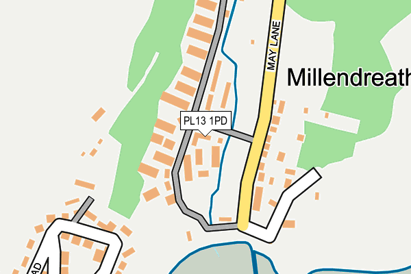
PL13 1PD lies on Valley Bungalows in Millendreath, Looe. PL13 1PD is located in the Looe East & Deviock electoral ward, within the unitary authority of Cornwall and the English Parliamentary constituency of South East Cornwall. The Sub Integrated Care Board (ICB) Location is NHS Cornwall and the Isles of Scilly ICB - 11N and the police force is Devon & Cornwall. This postcode has been in use since August 2004.


GetTheData
Source: OS OpenMap – Local (Ordnance Survey)
Source: OS VectorMap District (Ordnance Survey)
Licence: Open Government Licence (requires attribution)
| Easting | 226810 |
| Northing | 54242 |
| Latitude | 50.362523 |
| Longitude | -4.436402 |
GetTheData
Source: Open Postcode Geo
Licence: Open Government Licence
| Street | Valley Bungalows |
| Locality | Millendreath |
| Town/City | Looe |
| Country | England |
| Postcode District | PL13 |
➜ See where PL13 is on a map ➜ Where is Looe? | |
GetTheData
Source: Land Registry Price Paid Data
Licence: Open Government Licence
Elevation or altitude of PL13 1PD as distance above sea level:
| Metres | Feet | |
|---|---|---|
| Elevation | 10m | 33ft |
Elevation is measured from the approximate centre of the postcode, to the nearest point on an OS contour line from OS Terrain 50, which has contour spacing of ten vertical metres.
➜ How high above sea level am I? Find the elevation of your current position using your device's GPS.
GetTheData
Source: Open Postcode Elevation
Licence: Open Government Licence
| Ward | Looe East & Deviock |
| Constituency | South East Cornwall |
GetTheData
Source: ONS Postcode Database
Licence: Open Government Licence
15, VALLEY BUNGALOWS, MILLENDREATH, LOOE, PL13 1PD 2002 3 MAY £14,000 |
GetTheData
Source: HM Land Registry Price Paid Data
Licence: Contains HM Land Registry data © Crown copyright and database right 2025. This data is licensed under the Open Government Licence v3.0.
| New Barbican Farm (Barbican Road) | Looe | 865m |
| Barbican Road | Looe | 870m |
| Barbican Road | Looe | 887m |
| Looe School (Barbican Road) | Looe | 902m |
| Top Of Sunrise Estate (Sunrising Estate) | Looe | 927m |
| Looe Station | 1.5km |
| Sandplace Station | 3.4km |
| Causeland Station | 5.3km |
GetTheData
Source: NaPTAN
Licence: Open Government Licence
GetTheData
Source: ONS Postcode Database
Licence: Open Government Licence


➜ Get more ratings from the Food Standards Agency
GetTheData
Source: Food Standards Agency
Licence: FSA terms & conditions
| Last Collection | |||
|---|---|---|---|
| Location | Mon-Fri | Sat | Distance |
| Quarry | 11:00 | 10:45 | 1,393m |
| Looe Post Office | 17:15 | 12:00 | 1,568m |
| Market Street | 16:45 | 11:45 | 1,601m |
GetTheData
Source: Dracos
Licence: Creative Commons Attribution-ShareAlike
| Risk of PL13 1PD flooding from rivers and sea | High |
| ➜ PL13 1PD flood map | |
GetTheData
Source: Open Flood Risk by Postcode
Licence: Open Government Licence
The below table lists the International Territorial Level (ITL) codes (formerly Nomenclature of Territorial Units for Statistics (NUTS) codes) and Local Administrative Units (LAU) codes for PL13 1PD:
| ITL 1 Code | Name |
|---|---|
| TLK | South West (England) |
| ITL 2 Code | Name |
| TLK3 | Cornwall and Isles of Scilly |
| ITL 3 Code | Name |
| TLK30 | Cornwall and Isles of Scilly |
| LAU 1 Code | Name |
| E06000052 | Cornwall |
GetTheData
Source: ONS Postcode Directory
Licence: Open Government Licence
The below table lists the Census Output Area (OA), Lower Layer Super Output Area (LSOA), and Middle Layer Super Output Area (MSOA) for PL13 1PD:
| Code | Name | |
|---|---|---|
| OA | E00094785 | |
| LSOA | E01018774 | Cornwall 028E |
| MSOA | E02003901 | Cornwall 028 |
GetTheData
Source: ONS Postcode Directory
Licence: Open Government Licence
| PL13 1PE | Hillside Villas | 62m |
| PL13 1NY | 182m | |
| PL13 1PF | Hillside Villas | 222m |
| PL13 1LE | 241m | |
| PL13 1LF | 514m | |
| PL13 1LG | Plaidy Park Road | 552m |
| PL13 1AB | Plaidy Park Road | 583m |
| PL13 1DR | Rame View | 710m |
| PL13 1LH | Chantry Lane | 721m |
| PL13 1PG | Barbican Farm Lane | 732m |
GetTheData
Source: Open Postcode Geo; Land Registry Price Paid Data
Licence: Open Government Licence