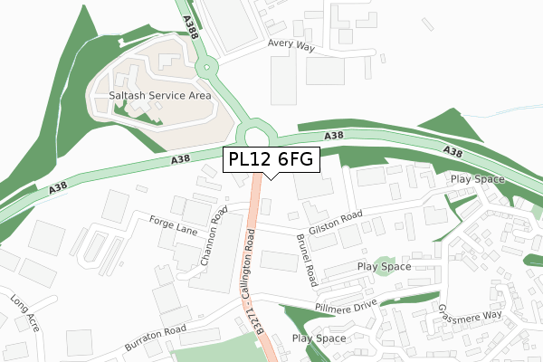
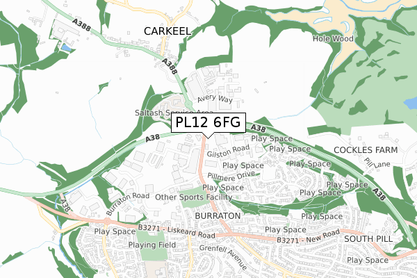
PL12 6FG is located in the Saltash Tamar electoral ward, within the unitary authority of Cornwall and the English Parliamentary constituency of South East Cornwall. The Sub Integrated Care Board (ICB) Location is NHS Cornwall and the Isles of Scilly ICB - 11N and the police force is Devon & Cornwall. This postcode has been in use since March 2019.


GetTheData
Source: OS Open Zoomstack (Ordnance Survey)
Licence: Open Government Licence (requires attribution)
Attribution: Contains OS data © Crown copyright and database right 2025
Source: Open Postcode Geo
Licence: Open Government Licence (requires attribution)
Attribution: Contains OS data © Crown copyright and database right 2025; Contains Royal Mail data © Royal Mail copyright and database right 2025; Source: Office for National Statistics licensed under the Open Government Licence v.3.0
| Easting | 241464 |
| Northing | 60002 |
| Latitude | 50.418417 |
| Longitude | -4.232971 |
GetTheData
Source: Open Postcode Geo
Licence: Open Government Licence
| Country | England |
| Postcode District | PL12 |
➜ See where PL12 is on a map ➜ Where is Saltash? | |
GetTheData
Source: Land Registry Price Paid Data
Licence: Open Government Licence
| Ward | Saltash Tamar |
| Constituency | South East Cornwall |
GetTheData
Source: ONS Postcode Database
Licence: Open Government Licence
UNIT C, CARKEEL GATEWAY, CARKEEL, SALTASH, PL12 6FG 1999 1 JUL £569,250 |
GetTheData
Source: HM Land Registry Price Paid Data
Licence: Contains HM Land Registry data © Crown copyright and database right 2025. This data is licensed under the Open Government Licence v3.0.
| Gilston Road Junction | Burraton | 162m |
| Gilston Road Junction (Callington Road) | Burraton | 183m |
| Waitrose | Carkeel | 206m |
| Pillmere Drive | Burraton | 254m |
| Burraton Road | Burraton | 359m |
| Saltash Station | 2.1km |
| St Budeaux Victoria Road Station | 3.7km |
| St Budeaux Ferry Road Station | 3.8km |
GetTheData
Source: NaPTAN
Licence: Open Government Licence
GetTheData
Source: ONS Postcode Database
Licence: Open Government Licence


➜ Get more ratings from the Food Standards Agency
GetTheData
Source: Food Standards Agency
Licence: FSA terms & conditions
| Last Collection | |||
|---|---|---|---|
| Location | Mon-Fri | Sat | Distance |
| Tamar View Industrial Estate | 18:45 | 295m | |
| Homer Park | 17:00 | 11:45 | 748m |
| Alamein Road | 17:15 | 11:30 | 1,231m |
GetTheData
Source: Dracos
Licence: Creative Commons Attribution-ShareAlike
The below table lists the International Territorial Level (ITL) codes (formerly Nomenclature of Territorial Units for Statistics (NUTS) codes) and Local Administrative Units (LAU) codes for PL12 6FG:
| ITL 1 Code | Name |
|---|---|
| TLK | South West (England) |
| ITL 2 Code | Name |
| TLK3 | Cornwall and Isles of Scilly |
| ITL 3 Code | Name |
| TLK30 | Cornwall and Isles of Scilly |
| LAU 1 Code | Name |
| E06000052 | Cornwall |
GetTheData
Source: ONS Postcode Directory
Licence: Open Government Licence
The below table lists the Census Output Area (OA), Lower Layer Super Output Area (LSOA), and Middle Layer Super Output Area (MSOA) for PL12 6FG:
| Code | Name | |
|---|---|---|
| OA | E00172823 | |
| LSOA | E01018787 | Cornwall 022B |
| MSOA | E02003897 | Cornwall 022 |
GetTheData
Source: ONS Postcode Directory
Licence: Open Government Licence
| PL12 6LF | Saltash Parkway Industrial Estate | 91m |
| PL12 6TW | Gilston Road | 144m |
| PL12 6XA | Paddock Close | 218m |
| PL12 6XB | Pillmere Drive | 242m |
| PL12 6XX | Lyndon Court | 242m |
| PL12 6XL | Harebell Close | 286m |
| PL12 6LW | Callington Road | 295m |
| PL12 6XD | Grassmere Way | 298m |
| PL12 6XH | Bluebell Close | 314m |
| PL12 6YX | Leat Walk | 330m |
GetTheData
Source: Open Postcode Geo; Land Registry Price Paid Data
Licence: Open Government Licence