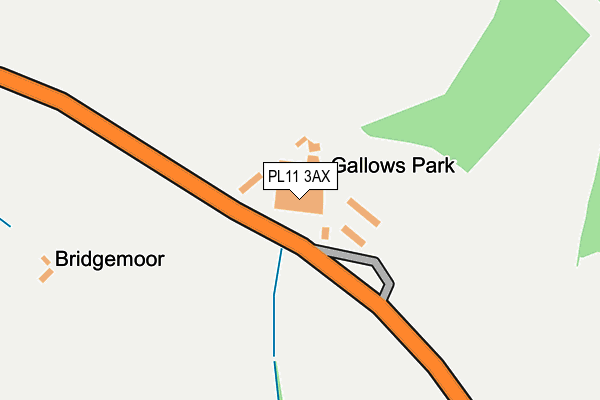
PL11 3AX is located in the Rame Peninsula & St Germans electoral ward, within the unitary authority of Cornwall and the English Parliamentary constituency of South East Cornwall. The Sub Integrated Care Board (ICB) Location is NHS Cornwall and the Isles of Scilly ICB - 11N and the police force is Devon & Cornwall. This postcode has been in use since December 1994.


GetTheData
Source: OS OpenMap – Local (Ordnance Survey)
Source: OS VectorMap District (Ordnance Survey)
Licence: Open Government Licence (requires attribution)
| Easting | 241188 |
| Northing | 52734 |
| Latitude | 50.353043 |
| Longitude | -4.233750 |
GetTheData
Source: Open Postcode Geo
Licence: Open Government Licence
| Country | England |
| Postcode District | PL11 |
➜ See where PL11 is on a map | |
GetTheData
Source: Land Registry Price Paid Data
Licence: Open Government Licence
Elevation or altitude of PL11 3AX as distance above sea level:
| Metres | Feet | |
|---|---|---|
| Elevation | 90m | 295ft |
Elevation is measured from the approximate centre of the postcode, to the nearest point on an OS contour line from OS Terrain 50, which has contour spacing of ten vertical metres.
➜ How high above sea level am I? Find the elevation of your current position using your device's GPS.
GetTheData
Source: Open Postcode Elevation
Licence: Open Government Licence
| Ward | Rame Peninsula & St Germans |
| Constituency | South East Cornwall |
GetTheData
Source: ONS Postcode Database
Licence: Open Government Licence
| Gallows Park Industrial Estate (B3247) | St John | 47m |
| St John Turning (B3247) | St John | 499m |
| St John Turning (B3247) | St John | 500m |
| Hounster Farm (St Andrews Street) | Millbrook | 866m |
| St Johns Inn (Church Lane) | St John | 929m |
| Dockyard (Plymouth) Station | 5.2km |
| Devonport Station | 5.3km |
| Keyham Station | 5.6km |
GetTheData
Source: NaPTAN
Licence: Open Government Licence
GetTheData
Source: ONS Postcode Database
Licence: Open Government Licence


➜ Get more ratings from the Food Standards Agency
GetTheData
Source: Food Standards Agency
Licence: FSA terms & conditions
| Last Collection | |||
|---|---|---|---|
| Location | Mon-Fri | Sat | Distance |
| Hounster Drive | 15:45 | 10:00 | 949m |
| Anderton (Millbrook) | 16:00 | 10:00 | 1,267m |
| Millbrook Post Office | 16:00 | 10:00 | 1,296m |
GetTheData
Source: Dracos
Licence: Creative Commons Attribution-ShareAlike
The below table lists the International Territorial Level (ITL) codes (formerly Nomenclature of Territorial Units for Statistics (NUTS) codes) and Local Administrative Units (LAU) codes for PL11 3AX:
| ITL 1 Code | Name |
|---|---|
| TLK | South West (England) |
| ITL 2 Code | Name |
| TLK3 | Cornwall and Isles of Scilly |
| ITL 3 Code | Name |
| TLK30 | Cornwall and Isles of Scilly |
| LAU 1 Code | Name |
| E06000052 | Cornwall |
GetTheData
Source: ONS Postcode Directory
Licence: Open Government Licence
The below table lists the Census Output Area (OA), Lower Layer Super Output Area (LSOA), and Middle Layer Super Output Area (MSOA) for PL11 3AX:
| Code | Name | |
|---|---|---|
| OA | E00094805 | |
| LSOA | E01018780 | Cornwall 034A |
| MSOA | E02003903 | Cornwall 034 |
GetTheData
Source: ONS Postcode Directory
Licence: Open Government Licence
| PL11 3AU | 689m | |
| PL11 3AT | 759m | |
| PL11 3AS | Mowhay Meadow | 798m |
| PL11 3DE | Pathfields | 803m |
| PL11 3AP | Church Lane | 928m |
| PL10 1AJ | Hounster Hill | 932m |
| PL11 3AR | 934m | |
| PL11 3AW | 947m | |
| PL10 1BZ | Hounster Drive | 1020m |
| PL10 1JJ | 1033m |
GetTheData
Source: Open Postcode Geo; Land Registry Price Paid Data
Licence: Open Government Licence