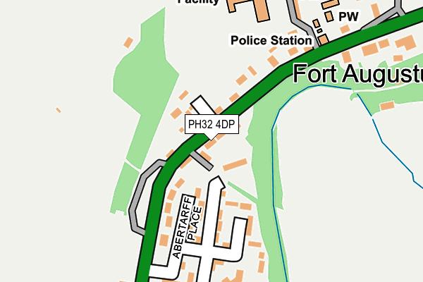
PH32 4DP is located in the Aird and Loch Ness electoral ward, within the council area of Highland and the Scottish Parliamentary constituency of Inverness, Nairn, Badenoch and Strathspey. The Community Health Partnership is Highland Health and Social Care Partnership and the police force is Scotland. This postcode has been in use since January 1980.


GetTheData
Source: OS OpenMap – Local (Ordnance Survey)
Source: OS VectorMap District (Ordnance Survey)
Licence: Open Government Licence (requires attribution)
| Easting | 237554 |
| Northing | 808847 |
| Latitude | 57.141699 |
| Longitude | -4.686272 |
GetTheData
Source: Open Postcode Geo
Licence: Open Government Licence
| Country | Scotland |
| Postcode District | PH32 |
➜ See where PH32 is on a map ➜ Where is Fort Augustus? | |
GetTheData
Source: Land Registry Price Paid Data
Licence: Open Government Licence
| Ward | Aird And Loch Ness |
| Constituency | Inverness, Nairn, Badenoch And Strathspey |
GetTheData
Source: ONS Postcode Database
Licence: Open Government Licence
| Abertarff Place (A82) | Fort Augustus | 187m |
| Camp Site (A82) | Fort Augustus | 470m |
| Tourist Information (A82) | Fort Augustus | 587m |
| Inchnacardoch Hotel (A82) | Fort Augustus | 1,434m |
| Inchnacardoch Hotel (A82) | Fort Augustus | 1,450m |
GetTheData
Source: NaPTAN
Licence: Open Government Licence
| Median download speed | 39.9Mbps |
| Average download speed | 47.6Mbps |
| Maximum download speed | 80.00Mbps |
| Median upload speed | 10.0Mbps |
| Average upload speed | 11.0Mbps |
| Maximum upload speed | 20.00Mbps |
GetTheData
Source: Ofcom
Licence: Ofcom Terms of Use (requires attribution)
Estimated total energy consumption in PH32 4DP by fuel type, 2015.
| Consumption (kWh) | 63,106 |
|---|---|
| Meter count | 8 |
| Mean (kWh/meter) | 7,888 |
| Median (kWh/meter) | 7,398 |
GetTheData
Source: Postcode level gas estimates: 2015 (experimental)
Source: Postcode level electricity estimates: 2015 (experimental)
Licence: Open Government Licence
GetTheData
Source: ONS Postcode Database
Licence: Open Government Licence


➜ Get more ratings from the Food Standards Agency
GetTheData
Source: Food Standards Agency
Licence: FSA terms & conditions
| Last Collection | |||
|---|---|---|---|
| Location | Mon-Fri | Sat | Distance |
| Westend | 16:45 | 08:30 | 37m |
| Fort Augustus Post Office | 16:45 | 11:45 | 464m |
| Tourist Centre | 17:00 | 09:30 | 588m |
GetTheData
Source: Dracos
Licence: Creative Commons Attribution-ShareAlike
The below table lists the International Territorial Level (ITL) codes (formerly Nomenclature of Territorial Units for Statistics (NUTS) codes) and Local Administrative Units (LAU) codes for PH32 4DP:
| ITL 1 Code | Name |
|---|---|
| TLM | Scotland |
| ITL 2 Code | Name |
| TLM6 | Highlands and Islands |
| ITL 3 Code | Name |
| TLM62 | Inverness and Nairn, Moray, and Badenoch and Strathspey |
| LAU 1 Code | Name |
| S30000030 | Inverness and Nairn |
GetTheData
Source: ONS Postcode Directory
Licence: Open Government Licence
The below table lists the Census Output Area (OA), Lower Layer Super Output Area (LSOA), and Middle Layer Super Output Area (MSOA) for PH32 4DP:
| Code | Name | |
|---|---|---|
| OA | S00118220 | |
| LSOA | S01010668 | Loch Ness - 05 |
| MSOA | S02002006 | Loch Ness |
GetTheData
Source: ONS Postcode Directory
Licence: Open Government Licence