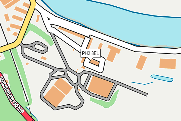
PH2 8EL is located in the Perth City Centre electoral ward, within the council area of Perth and Kinross and the Scottish Parliamentary constituency of Perth and North Perthshire. The Community Health Partnership is Perth & Kinross Community Health Partnership and the police force is Scotland. This postcode has been in use since February 2010.


GetTheData
Source: OS OpenMap – Local (Ordnance Survey)
Source: OS VectorMap District (Ordnance Survey)
Licence: Open Government Licence (requires attribution)
| Easting | 312094 |
| Northing | 721378 |
| Latitude | 56.376485 |
| Longitude | -3.424954 |
GetTheData
Source: Open Postcode Geo
Licence: Open Government Licence
| Country | Scotland |
| Postcode District | PH2 |
➜ See where PH2 is on a map ➜ Where is Perth? | |
GetTheData
Source: Land Registry Price Paid Data
Licence: Open Government Licence
| Ward | Perth City Centre |
| Constituency | Perth And North Perthshire |
GetTheData
Source: ONS Postcode Database
Licence: Open Government Licence
| Craigclowan School (Edinburgh Road) | Scoonieburn | 358m |
| Friarton Road (Edinburgh Road) | Friarton | 395m |
| Friarton Road (Edinburgh Road) | Friarton | 396m |
| Craigclowan School (Edinburgh Road) | Scoonieburn | 436m |
| Drummond Crescent (Edinburgh Road) | Friarton | 548m |
| Perth Station | 2km |
GetTheData
Source: NaPTAN
Licence: Open Government Licence
GetTheData
Source: ONS Postcode Database
Licence: Open Government Licence


➜ Get more ratings from the Food Standards Agency
GetTheData
Source: Food Standards Agency
Licence: FSA terms & conditions
| Last Collection | |||
|---|---|---|---|
| Location | Mon-Fri | Sat | Distance |
| Scoonieburn | 17:15 | 10:15 | 422m |
| Hm Prison | 17:00 | 11:30 | 988m |
| Shore Rosd | 18:30 | 11:30 | 1,330m |
GetTheData
Source: Dracos
Licence: Creative Commons Attribution-ShareAlike
The below table lists the International Territorial Level (ITL) codes (formerly Nomenclature of Territorial Units for Statistics (NUTS) codes) and Local Administrative Units (LAU) codes for PH2 8EL:
| ITL 1 Code | Name |
|---|---|
| TLM | Scotland |
| ITL 2 Code | Name |
| TLM7 | Eastern Scotland |
| ITL 3 Code | Name |
| TLM77 | Perth and Kinross, and Stirling |
| LAU 1 Code | Name |
| S30000043 | Perth and Kinross |
GetTheData
Source: ONS Postcode Directory
Licence: Open Government Licence
The below table lists the Census Output Area (OA), Lower Layer Super Output Area (LSOA), and Middle Layer Super Output Area (MSOA) for PH2 8EL:
| Code | Name | |
|---|---|---|
| OA | S00126693 | |
| LSOA | S01011878 | Glenfarg, Dunning and Rhynd - 03 |
| MSOA | S02002228 | Glenfarg, Dunning and Rhynd |
GetTheData
Source: ONS Postcode Directory
Licence: Open Government Licence