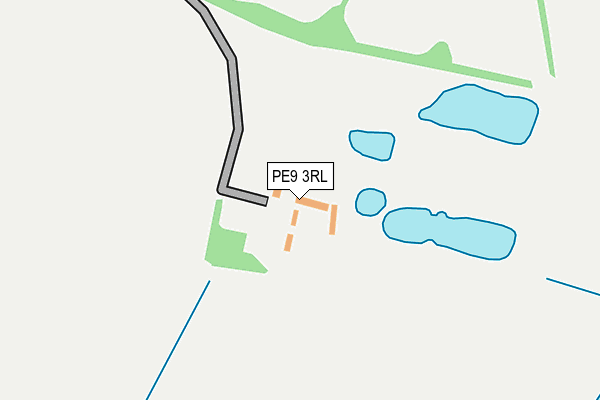
PE9 3RL lies on Barrowden Road in Ketton, Stamford. PE9 3RL is located in the Ketton electoral ward, within the unitary authority of Rutland and the English Parliamentary constituency of Rutland and Melton. The Sub Integrated Care Board (ICB) Location is NHS Leicester, Leicestershire and Rutland ICB - 03W and the police force is Leicestershire. This postcode has been in use since January 1980.


GetTheData
Source: OS OpenMap – Local (Ordnance Survey)
Source: OS VectorMap District (Ordnance Survey)
Licence: Open Government Licence (requires attribution)
| Easting | 498546 |
| Northing | 303343 |
| Latitude | 52.618923 |
| Longitude | -0.545803 |
GetTheData
Source: Open Postcode Geo
Licence: Open Government Licence
| Street | Barrowden Road |
| Locality | Ketton |
| Town/City | Stamford |
| Country | England |
| Postcode District | PE9 |
➜ See where PE9 is on a map ➜ Where is Ketton? | |
GetTheData
Source: Land Registry Price Paid Data
Licence: Open Government Licence
Elevation or altitude of PE9 3RL as distance above sea level:
| Metres | Feet | |
|---|---|---|
| Elevation | 40m | 131ft |
Elevation is measured from the approximate centre of the postcode, to the nearest point on an OS contour line from OS Terrain 50, which has contour spacing of ten vertical metres.
➜ How high above sea level am I? Find the elevation of your current position using your device's GPS.
GetTheData
Source: Open Postcode Elevation
Licence: Open Government Licence
| Ward | Ketton |
| Constituency | Rutland And Melton |
GetTheData
Source: ONS Postcode Database
Licence: Open Government Licence
2022 21 APR £1,800,000 |
2010 10 SEP £1,600,000 |
GetTheData
Source: HM Land Registry Price Paid Data
Licence: Contains HM Land Registry data © Crown copyright and database right 2025. This data is licensed under the Open Government Licence v3.0.
| Church Road (Station Road) | Aldgate | 938m |
| Church Road (Luffenham Road) | Ketton | 1,078m |
| Stock's Hill (High Street) | Ketton | 1,127m |
| Spinney Road (Northwick Road) | Ketton | 1,202m |
| The Collyweston Slater Ph (Main Road) | Collyweston | 1,233m |
| Stamford Station | 5.5km |
GetTheData
Source: NaPTAN
Licence: Open Government Licence
GetTheData
Source: ONS Postcode Database
Licence: Open Government Licence


➜ Get more ratings from the Food Standards Agency
GetTheData
Source: Food Standards Agency
Licence: FSA terms & conditions
| Last Collection | |||
|---|---|---|---|
| Location | Mon-Fri | Sat | Distance |
| Ketton Railway Station | 16:45 | 09:45 | 752m |
| Ketton Aldgate | 16:45 | 09:30 | 1,050m |
| The Fountain | 16:30 | 10:15 | 1,128m |
GetTheData
Source: Dracos
Licence: Creative Commons Attribution-ShareAlike
The below table lists the International Territorial Level (ITL) codes (formerly Nomenclature of Territorial Units for Statistics (NUTS) codes) and Local Administrative Units (LAU) codes for PE9 3RL:
| ITL 1 Code | Name |
|---|---|
| TLF | East Midlands (England) |
| ITL 2 Code | Name |
| TLF2 | Leicestershire, Rutland and Northamptonshire |
| ITL 3 Code | Name |
| TLF22 | Leicestershire CC and Rutland |
| LAU 1 Code | Name |
| E06000017 | Rutland |
GetTheData
Source: ONS Postcode Directory
Licence: Open Government Licence
The below table lists the Census Output Area (OA), Lower Layer Super Output Area (LSOA), and Middle Layer Super Output Area (MSOA) for PE9 3RL:
| Code | Name | |
|---|---|---|
| OA | E00069572 | |
| LSOA | E01013792 | Rutland 004B |
| MSOA | E02002866 | Rutland 004 |
GetTheData
Source: ONS Postcode Directory
Licence: Open Government Licence
| PE9 3RS | Kelthorpe Close | 458m |
| PE9 3RJ | Barrowden Road | 503m |
| PE9 3YB | Holmes Drive | 713m |
| PE9 3RH | Geeston | 731m |
| PE9 3AY | Aldgate Court | 772m |
| PE9 3RQ | Station Road | 809m |
| PE9 3TH | Edmunds Drive | 882m |
| PE9 3PJ | Back Lane | 935m |
| PE9 3PS | Ketton Road | 1002m |
| PE9 3RD | Church Road | 1003m |
GetTheData
Source: Open Postcode Geo; Land Registry Price Paid Data
Licence: Open Government Licence