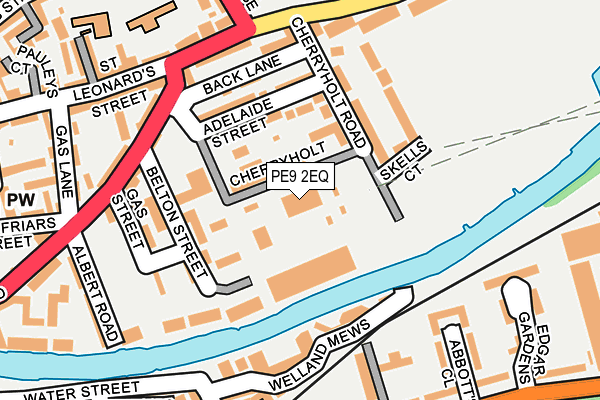
PE9 2EQ is located in the Stamford St Mary's electoral ward, within the local authority district of South Kesteven and the English Parliamentary constituency of Grantham and Stamford. The Sub Integrated Care Board (ICB) Location is NHS Lincolnshire ICB - 71E and the police force is Lincolnshire. This postcode has been in use since December 2001.


GetTheData
Source: OS OpenMap – Local (Ordnance Survey)
Source: OS VectorMap District (Ordnance Survey)
Licence: Open Government Licence (requires attribution)
| Easting | 503485 |
| Northing | 307119 |
| Latitude | 52.651957 |
| Longitude | -0.471683 |
GetTheData
Source: Open Postcode Geo
Licence: Open Government Licence
| Country | England |
| Postcode District | PE9 |
➜ See where PE9 is on a map ➜ Where is Stamford? | |
GetTheData
Source: Land Registry Price Paid Data
Licence: Open Government Licence
Elevation or altitude of PE9 2EQ as distance above sea level:
| Metres | Feet | |
|---|---|---|
| Elevation | 20m | 66ft |
Elevation is measured from the approximate centre of the postcode, to the nearest point on an OS contour line from OS Terrain 50, which has contour spacing of ten vertical metres.
➜ How high above sea level am I? Find the elevation of your current position using your device's GPS.
GetTheData
Source: Open Postcode Elevation
Licence: Open Government Licence
| Ward | Stamford St Mary's |
| Constituency | Grantham And Stamford |
GetTheData
Source: ONS Postcode Database
Licence: Open Government Licence
| Site Of Brazenose College (Brazenose Lane) | Stamford | 211m |
| Phillips Court (Water Street) | Stamford | 263m |
| Phillips Court (Water Street) | Stamford | 267m |
| Abbot's Close (Barnack Road) | Stamford | 282m |
| Abbot's Close (Barnack Road) | Stamford | 293m |
| Stamford Station | 0.7km |
GetTheData
Source: NaPTAN
Licence: Open Government Licence
GetTheData
Source: ONS Postcode Database
Licence: Open Government Licence


➜ Get more ratings from the Food Standards Agency
GetTheData
Source: Food Standards Agency
Licence: FSA terms & conditions
| Last Collection | |||
|---|---|---|---|
| Location | Mon-Fri | Sat | Distance |
| Wharf Road | 17:30 | 11:15 | 167m |
| Priory Road | 17:30 | 11:15 | 171m |
| Newtown | 17:30 | 11:30 | 225m |
GetTheData
Source: Dracos
Licence: Creative Commons Attribution-ShareAlike
The below table lists the International Territorial Level (ITL) codes (formerly Nomenclature of Territorial Units for Statistics (NUTS) codes) and Local Administrative Units (LAU) codes for PE9 2EQ:
| ITL 1 Code | Name |
|---|---|
| TLF | East Midlands (England) |
| ITL 2 Code | Name |
| TLF3 | Lincolnshire |
| ITL 3 Code | Name |
| TLF30 | Lincolnshire CC |
| LAU 1 Code | Name |
| E07000141 | South Kesteven |
GetTheData
Source: ONS Postcode Directory
Licence: Open Government Licence
The below table lists the Census Output Area (OA), Lower Layer Super Output Area (LSOA), and Middle Layer Super Output Area (MSOA) for PE9 2EQ:
| Code | Name | |
|---|---|---|
| OA | E00133852 | |
| LSOA | E01026350 | South Kesteven 016B |
| MSOA | E02005491 | South Kesteven 016 |
GetTheData
Source: ONS Postcode Directory
Licence: Open Government Licence
| PE9 2EP | Cherry Holt Road | 72m |
| PE9 2EN | Adelaide Street | 76m |
| PE9 2FH | Back Lane | 92m |
| PE9 2WX | Belton Gardens | 93m |
| PE9 2EH | Brownlow Terrace | 117m |
| PE9 2EF | Belton Street | 123m |
| PE9 2AN | Gas Street | 130m |
| PE9 2JZ | The Croft | 137m |
| PE9 2EB | Wharf Road | 148m |
| PE9 2AS | Bowman Mews | 148m |
GetTheData
Source: Open Postcode Geo; Land Registry Price Paid Data
Licence: Open Government Licence